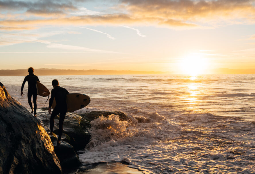

From beach to mountain, pines to palm, San Diego has nearly 120 hiking trails sure to please everyone. With landscape diversity that gives the best hikes in Colorado a run for their money — as well as more trails, parks, public land, coastlines, and national forests than almost any county in the U.S.— you haven’t seen S.D. until you’ve seen it on foot. As a professional hiker who’s walked around the world, I think San Diego is one of the best cities to visit and live in if you’re an outdoor lover.
The trick to San Diego is to do like the locals and skip the traffic and theme parks. Stroll, hike, trail run, bike, or horseback ride on thousands of miles of hiking trails in and around San Diego. The metro county has so much to see that no matter what season you visit, you’re sure to find hiking tours to suit your level of fitness and sense of adventure. Bonus: after the hike, you can look forward to some of the best beers, tacos, and burritos in the world!
Whether you’re just starting out, hiking with kids, looking for an urban adventure, or ready to tackle a strenuous, full-day outing, we’ve got a trail for you.
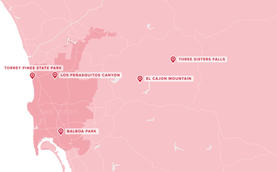
The Five Best Places to Hike in or Near San Diego
Before we break down the best day hikes, here are the best places to hike in San Diego:
Easy Day Hikes in San Diego:
- Los Peñasquitos Canyon and Waterfall – 6.2 miles, best for Bringing Your Dog Along
Moderate Day Hikes in San Diego:
- Balboa Park: Urban Park Loop – 5 miles, best for Hitting the Urban Trails
- Torrey Pines State Park Loop – 5 miles, best for a Moderate Hiking Experience
Strenuous Day Hikes in San Diego:
- El Cajon – 10.4 miles, best for Rigorous Mountain Climbing
- Three Sisters Falls – 4.5 miles, best for the Advanced Hiking Experience
Here is the map showing the best day hikes in San Diego below!
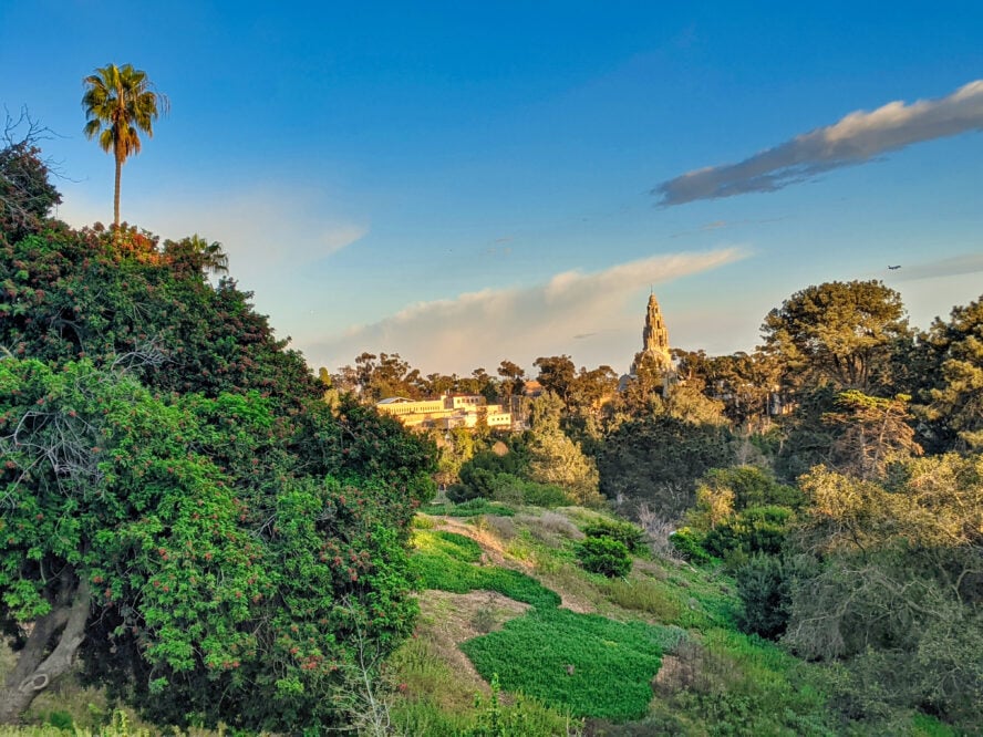
1. Balboa Park: Urban Park Loop
Considered one of the premier destinations in San Diego, Balboa Park is one of the most visited places in the city. Given its expansiveness, it’s a great urban hiking destination. The trail through the park visits fountains, world-class architecture, botanic gardens, and more—some of which are free to enter and all of which are among the most photographed places in the city.
The Central Park of San Diego, 65 miles of trail connects 17 museums, the famous San Diego Zoo, and numerous gardens and fountains. While many folks drive up and choose one destination, this five-mile urban hike takes you past the architectural, botanical, historical, and cultural landmarks of the city. While Balboa Park is known for its human-made attractions, its natural areas and hiking trails add to the uniqueness of what Balboa Park has to offer.
The Five Gateways to Balboa Park
Balboa Park has five hiking trailhead gateways: Morley Field, Park Blvd., Sixth and Upas, Golden Hill, and Marston Point. Each gateway has a kiosk with a large map of the hiking trails in the area. Most trails are marked with colored and numbered markers. While these markers aren’t at every intersection, major trails are visible on Google Maps, and you’ll always have cell reception in the park, so navigating back to your car shouldn’t be an issue.
Each trail is also rated by difficulty, taking into account elevation gain and the terrain it covers. Most numbered hiking trails are on a combination of dirt, sidewalks, and paved paths, so plan to bring shoes with good traction and enough cushioning for soft and harder surfaces. If there’s been rain, some dirt trails can be muddy for a few days after, so you may opt for a hiking route that utilizes more paved surfaces and sidewalks.
Balboa Park Has Great Hikes for Families or People Strapped for Time
With 65 miles of trails and numerous attractions, locals and visitors alike have their own opinions on which is the best of the numbered trails to hike. Still, for those visiting San Diego for the first time (and otherwise weren’t planning to visit Balboa Park separately), I advise a combination of Route #43 and #44.
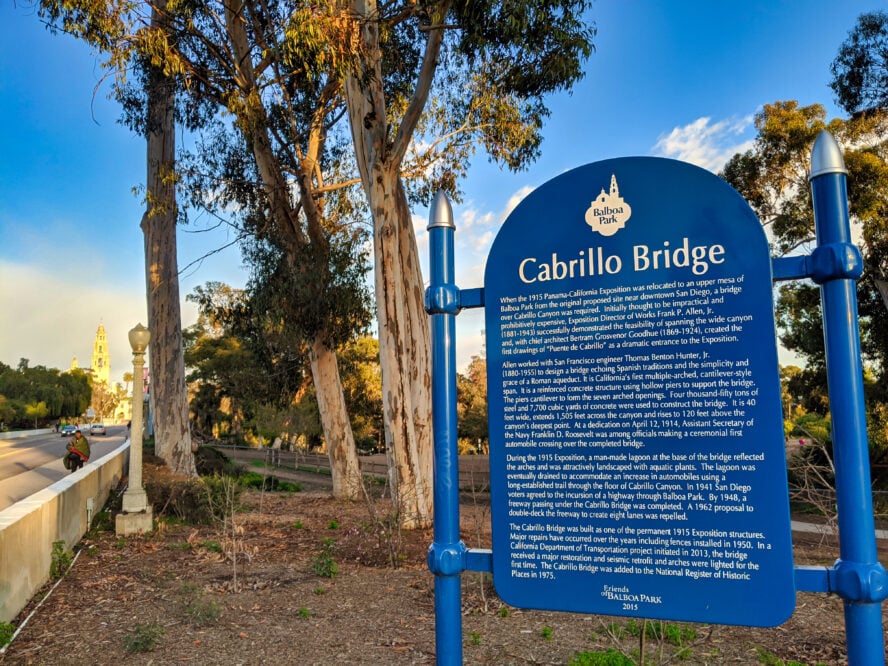
This nearly five-mile loop touches on highlights that make the park one of the finest in the U.S., including the 1915 1915 Panama-California Exposition grounds, views from the West Mesa, the architectural beauty of the Cabrillo bridge, and gardens that showcase native trees and botany of San Diego.
Before you go, check the weather and predicted temperature for the day. Although there are trees and shade in some parts of the park, during summer, it’s better to get your hiking done during the morning and save the afternoons for air-conditioned museums.
While the park is well-trafficked by tourists and locals alike during the day, the park closes at dusk. San Diego, like most West Coast cities, has a population of houseless people who camp in parks at night.
This urban adventure takes hikers longer than they expect because it’s designed for exploration. I recommend taking the time to visit the free botanic garden or art museums, play in fountains, listen to live music, and take lots of photos.
Forested Views and Native Plants in Balboa Park
Start at the Cypress Grove Picnic area, heading south on the paved trail towards Cabrillo Bridge. You’ll pass gnarled trees, a medicinal plants garden, and forested picnic areas—most with informational placards. Admire Cypress Point and Redwood Circle, which both have expansive views east over the forested Cabrillo canyon towards the California Tower. Its ornate dome is one of the most recognizable landmarks in San Diego.
Walk behind the Bowling Green, where enthusiastic players can be seen almost every afternoon. Then, you’ll find yourself on Cabrillo Bridge, a pedestrian and car bridge that connects Uptown to El Prado Complex, the former grounds of the 1915 Panama-California Exposition.
The Walk Across Cabrillo Bridge
The 450-foot long Cabrillo Bridge spans 150 feet above the forested Cabrillo Canyon. Built for the 1915 Panama Exposition, the bridge is designed after the Alcantara Bridge in Toledo, Spain. It was the first multiple arched cantilever bridge in California. When it was dedicated in 1914, Franklin D. Roosevelt gave the opening speech and was a passenger in the first car crossing.
Nowadays, cars are still allowed on the bridge, but it’s mainly used by pedestrians. Crossing the bridge is a fun experience for pedestrians. It’s incredible to look down at the floor of the valley while suspended so high above, and the panorama rivals the best Grand Canyon hikes. The Cabrillo Bridge was nominated for the National Historic Register of Places in the 1970s.
El Prado (1915 Panama Exposition Grounds)
Whether you are a hiker or not, I think the El Prado is the #1 must-see attraction in San Diego. A historic district, the pedestrian-friendly complex was designed by famed architects Bertram Goodhue and Carleton Winslow. The next mile or so of your hike visits an area also on the National Register of Historic Places.
From the California Quadrangle and California Tower, explore the El Prado Arcade, an arched covered walkway. In summer, I’ve walked through it instead of in the plaza for shade. Pass numerous fountains, including the reflecting pool in front of the Botanical Building. One of the largest lath structures in the world, the garden building, and pool in front are considered the most photographed spot in San Diego. I’m fond of watching the koi and red-eared slider turtles swim in the pond nearby.
A pedestrian pathway takes you to Spanish Village, a complex of art galleries. Elephant topiaries announce you’re approaching the entrance of the San Diego Zoo. While this is another must-see in San Diego, you’ll want to dedicate a full day to the experience, so I wouldn’t advise taking the zoo detour while on this hike.
Head towards the Historic Carousel and Miniature Train until you pass the giant Moreton Bay Fig Tree. It’s the largest Ficus macrophylla in the park with a trunk girth of 486 inches and numerous aerial roots. I’m a big fan of the giant fig trees throughout the park, but this one takes the cake on size alone.
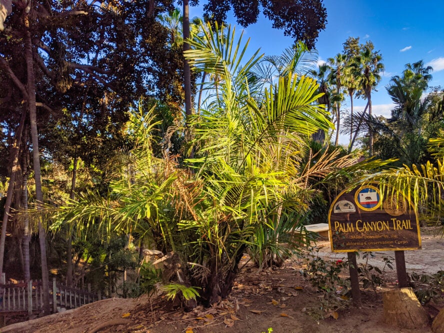
Don’t miss Palm Canyon
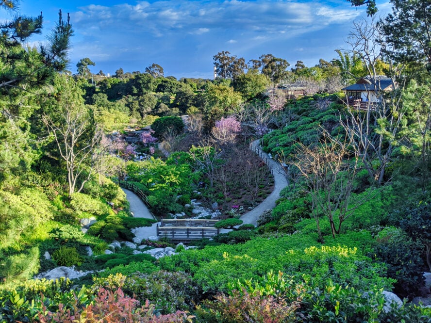
After visiting the fountain by the Natural History Museum, return through the plaza before taking a detour to the left. You’ll pass above the Japanese Garden on your way to the Spreckels Organ Pavilion, the world’s largest pipe organ in a fully outdoor venue.
Descend the dirt trail to Palm Canyon, the most natural and serene part of this hike. This shaded forested area is a palm oasis similar to what you’d find in the eastern part of the county. Like an oasis in a wild area, it is home to many birds. Climb wooden stairs up to Alcazar Garden before recrossing the Cabrillo Bridge.
Here, if I still have the energy and daylight, I like to turn left after Nate’s Point dog park to visit the West Mesa. After crossing Pine Grove Picnic Area, you’ll reach Marston Point. I like this part of Balboa Park because it is forested and feels more peaceful and quiet than other parts of the park. It’s a nice reprieve from the busy museum district. There are expansive views south towards downtown.
From here, follow the lightly trafficked road back to your car.
While Balboa Park is known for its human-made attractions, its natural areas and hiking trails add to the uniqueness of what Balboa Park has to offer.
By Liz Thomas — urban hiker


Balboa Park: Urban Park Loop - Good to Know
Moderate (for length)
5 miles
From 6th Ave. and Upas St., take Balboa Drive to the Cypress Parking Area.
2.5 to 6+ hours, depending on side-trips to museums
Year-round
17 museums. Live music from street performers and at the Spreckels Organ Pavilion.
There’s free admission to the Botanic Gardens or Timken Art Museum. Parking can get crowded, especially on weekends and during events. Check the Traffic Alerts page prior to your visit for real time updates.
Getting there
Balboa Park is close to downtown San Diego and the San Diego Airport. It’s accessible by walking, biking, public transit, and car. Most people fly into San Diego Airport and rent a car to get around the city. There are numerous free parking spots in the park and in surrounding neighborhoods. However, parking can be a pain on weekends, holidays, and during events. Bus Route 120 (Fashion Valley), Route 7 (City College), and Rapid 215 all go through the park. It’s also easy to use rideshare services in the city to get dropped off at the trailhead.
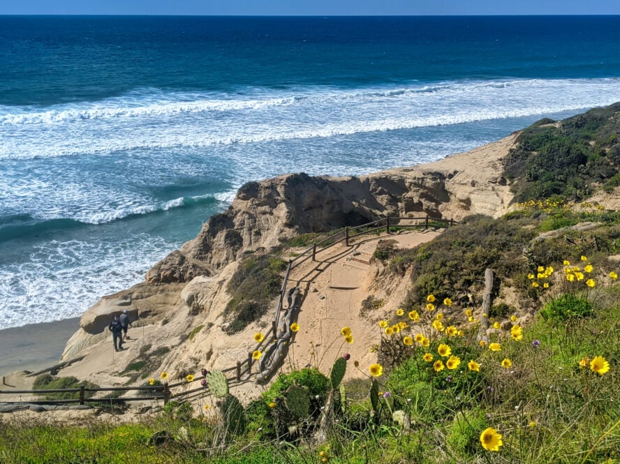
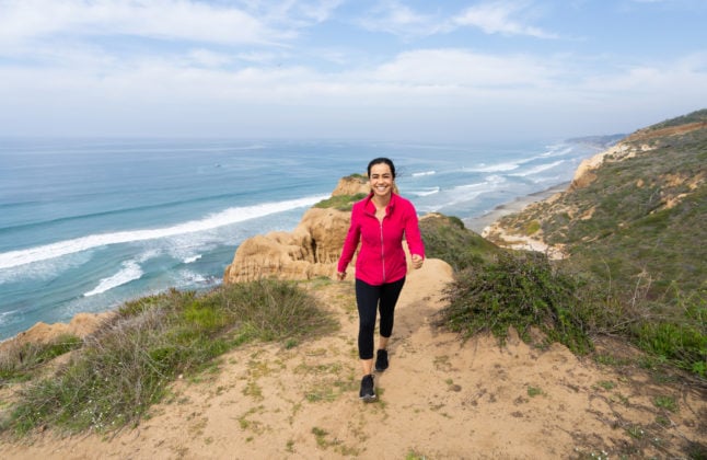
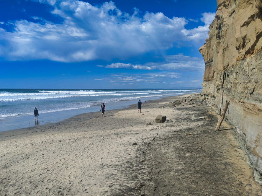
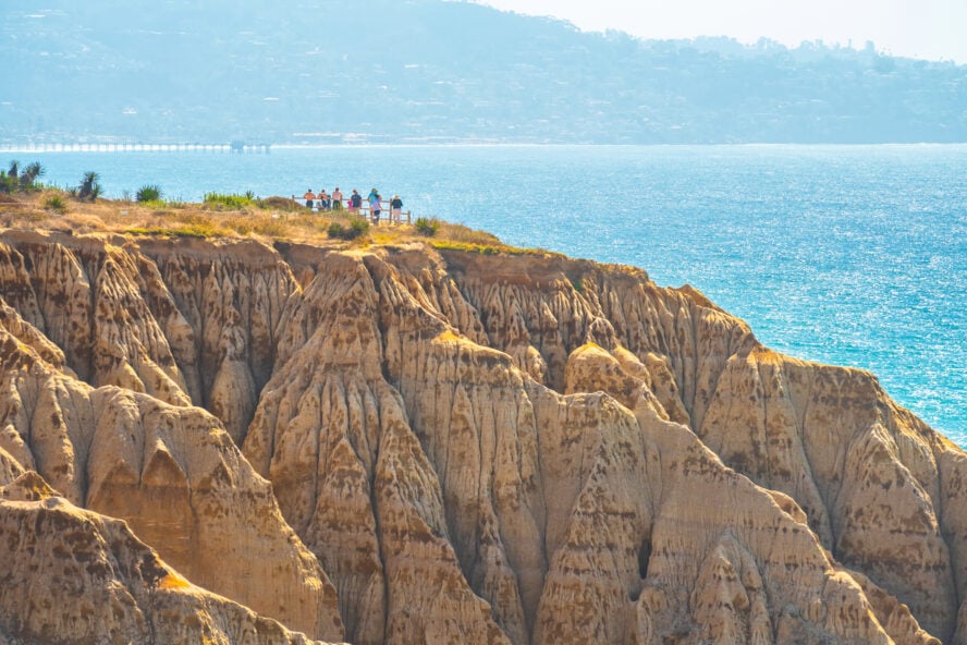
2. Torrey Pines State Park Loop
For one of the most iconic beach hikes in and around the San Diego area, check out Torrey Pines State Park. Named after the Torrey Pine (Pinus torreyana), one of the most endangered pine trees in the world, this reserve is home to over half of the world’s population of 6,000 trees. The whiplash-inducing transition from forest to shrub to beach reminds one of the best hikes in Olympic National Park but in a more compact package.
This loop trail hits highlight viewpoints from Razor Point to Yucca Point past the Big Basin down the Beach Trail to Flat Rock and up Broken Hill back to the West Overlook. For beginner hikers, this is a great option for a guided hiking tour in San Diego.
How Long Is the Torrey Pines Hike?
Torrey Pines is best hiked as a five-mile loop, although there are trails that are ⅔ of a mile (Guy Fleming Trail), ½ mile (Parry Grove Trail), and the High Point Trail (100 yards). It’s common to see locals running along the loop I describe because it’s so scenic and well-defined. The State Reserve does an excellent job of marking trails and delineating where they are. They even have cables along the edges of many trails to serve as “bumper lanes” that prevent hikers from confusing animal paths for the real trail.
Starting at the West Overlook
Start at the West Overlook, where there is parking, toilets, and a viewpoint. Be sure to fill up your water bottles here as this is the last spot on this hike with any water. An information board, trail signs, and take-with-you paper map all help point the way.
Follow the Razor Point Trail to a red, rocky outcropping. This is the spot to take epic photos because it is so prominent against the coastal bluffs and has great views of the ocean behind. From this viewpoint, descend towards Razor Point. After half a mile, you’ll be at an overlook right over the ocean.
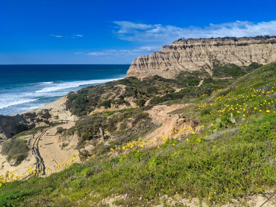
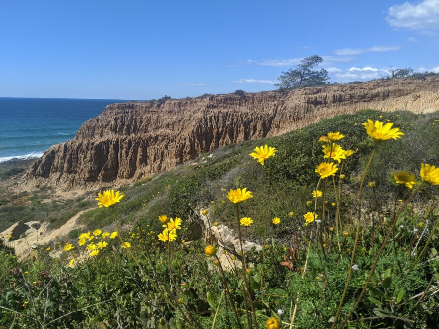
From Razor Point, ascend back to an intersection that takes you towards Yucca Point via the Beach Trail. You’ll circumnavigate around Big Basin, famous for its “badlands” like erosion. Approximately 160,000 years ago, rivers deposited silt and sand that eroded to form steep slopes, canyons, hoodoos, gullies, buttes, and mesas. In the spring, I like coming here to see abundant wildflowers like the bright yellow sea dahlia, blue wild hyacinth, and purple wild lupine.
Continue On to the Torrey Pines Beach
A highlight of this hike is the maze-like narrow canyons of rock that take you on the last descent towards the beach. You’ll swirl around a small cave before walking on the thin edge of a cliff. Descend stairs, and you’ll reach a secluded cove. Check the tides before you leave the Torrey Pines visitor center. During high tide, the beach is underwater.
From here, you can see the crowded Torrey Pines Beach to your right. More sandy coves, cliffs, and bluffs are to your left. Adventurous locals will run from Torrey Pines State Beach all the way to Black’s Beach, sometimes holding onto the cliffside to get around bluffs. Enjoy some of the most scenic seaside views you’ll find on the West Coast, as good as those along the legendary backpacking trails in Big Sur.
After the beauty of the beach, I can’t help but feel bittersweet turning around and heading back up the stairs. But returning to the car on the Broken Hill Trail lets you see a part of the park that is a little less crowded. With chaparral, sagebrush, and just a few trees, there’s plenty of scenic views to be had.
Towards the end of the hike, you’ll see the backside of the Torrey Pines Golf Course. I always enjoy comparing the natural area that I’ve been hiking in with the manicured grass on the other side of the reserve boundary.
You top out on a road closed to motor vehicles (but open to bikes). From here, walk the flat, Torrey-pine lined ridge. Below you is Peñasquitos Lagoon, where freshwater streams reach the tidal saltwater creating a shallow, coastal lagoon. In the distance are the high granite mountains of San Diego.
These mountains were created millions of years ago from a chain of volcanoes formed by the collision of tectonic plates, a process also responsible for the best hikes in Washington. The volcanos eroded, and the granite was lifted and carved into mountains by rivers. As is the case with the top Oahu hikes, these volcanic mountains make up some of the best hiking areas in the county.
Return to your car having viewed or hiked through many of the major ecosystems in San Diego County. As you descend more than 500 feet (and have to climb back up), budget some extra time for this hike.
Torrey Pines State Reserve deserves the hype. Between the beach, ocean views, wildflowers, bluffs, and badlands, this Reserve packs in a lot of nature in one hike.
By Liz Thomas — urban hiker


Torrey Pines State Park Loop - Good to Know
Moderate
5-mile loop, about 500 feet total on the return
There’s numerous hotels in La Jolla and RV-style campgrounds in Del Mar, both of which are pricier neighborhoods in the area. I suggest staying farther out and driving in for the day.
Day Use fee is $12-$25 per vehicle (demand-based pricing) or a valid annual California State Parks Vehicle Day Use Pass. Day use passes from other California State Parks won’t work at Torrey Pines State Reserve.
2 to 4 hours
Year-round. Wildflowers bloom from February to May
The park is busiest from 10 AM to 1 PM, especially during summer and holidays. The South Lot and free parking along North Torrey Pines Road are the first to fill. Plan your trip around those times and consider parking at the North Beach Lot.
Getting there
From downtown San Diego, take I-5 north for about 17 miles to the Torrey Pines State Beach South Parking or North Parking Area. There’s convenient bus stops to get to-and-from the beach, as well. If you’re driving, most folks park on the left (west) side of North Torrey Pines Road at the South Beach parking lot. The North Beach parking lot is on the right (east) side. A lucky few can snab a free spot along the road, but don’t count on it, even on weekdays. You can avoid paying the day use fee by taking the bus and walking up. Otherwise, you can take a ride-share and get picked up/dropped off just outside the gate near the bus stop in the free parking area. You’ll have to walk 0.9 mile uphill to reach the trailhead. Locals do it just for the extra exercise.
3. Los Peñasquitos Canyon and Waterfall
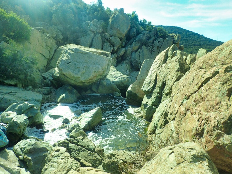
A local favorite—especially among dog owners—Los Peñasquitos Canyon is a nature preserve in the middle of the northern San Diego suburbs. Los Peñasquitos means “little cliffs” in Spanish, referring to the series of big volcanic boulders that the small waterfall tumbles down. At 4,000 acres and over seven miles long, Los Peñasquitos Canyon is one of the largest urban parks in the world. This shady, multi-use trail is open to hikers, bikers, and horse riders.
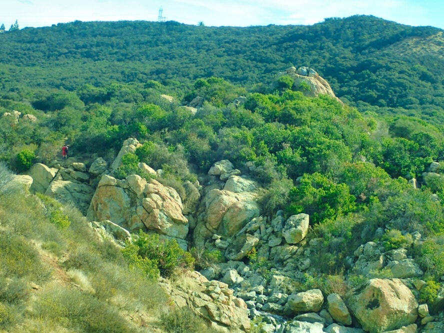
Pass Through a Canyon Rich in Plants and Wildlife
From the Los Peñasquitos Canyon trailhead, fill up your water bottles and head west on the dirt road. You’ll pass through a forest of giant California Live Oaks. The preserve is also home to over 500 plant species and 170 different species of birds. Native American history in the canyon goes back 7,000 years. Side trails lead to historic sites like an adobe ranch house, a museum, and a community garden.
Even when other trails feel too hot to hike, I like visiting this trail because it is shaded and relatively flat. It’s part of the Trans San Diego County Trail. This 140-mile long-distance hiking route goes from the eastern edge of the county at the Salton Sea, across Anza Borrego Desert State Park, over the Cuyamaca Mountains and Pacific Crest Trail, and down to the Pacific Ocean.
A Great Trail for Hiking With Friends
The trail is wide enough to walk side-by-side with other hikers in your party, which also makes it one of the more dog-friendly hikes in San Diego. In this peaceful wooded area, it’s easy to get caught up in conversation with your trail buddies. Signs along the waypoint to side-trails. Mile markers make it easy to track your progress.
After about three miles, you’ll see a signed intersection for the waterfall. Head right towards some stone stairs to the top of the bouldery falls. The trail continues across the water, so bring sturdy shoes and get ready to get wet. You can keep going. But, for a moderate hike, this is a good place to turn around and return to your car.
At 4,000 acres and over 7 miles long, Los Peñasquitos Canyon is one of the largest urban parks in the world.
By Liz Thomas — urban hiker


Los Peñasquitos Canyon and Waterfall - Good to Know
Beginner to moderate (because of length)
6.2 miles out-and-back, 200 feet of gain
Nearby Sorrento Valley and Mira Mar neighborhoods have numerous hotels. Unfortunately, this is a locals’ trail, so there aren’t great camping options neary.
Drinking fountain, outhouse, horse staging area
3-4 hours
Wait until late afternoon/early evening for cooler temperatures. Be sure to bring your headlamp just in case.
This hike is good year-round if done early in the morning, but winter, spring and fall have the best weather and winter and spring are the best for viewing the waterfall.
Getting there
Start at the Los Peñasquitos Canyon trailhead on Black Mountain Road. The waterfall is also accessible from a northern entrance near Peñasquitos Creek Park at the intersection of Park Village Road and Camino Del Sur in Rancho Peñasquitos. See this park map to see where the access points are to the preserve.
4. El Cajon aka El Capitan Mountain aka El Cap
El Cajon Mountain, known locally as “El Capitan,” or sometimes just “El Cap,” is one of those hikes that makes you feel like you’ve made it as a hiker. Even if it’s among the smaller southern California mountains, it hosts some of the hardest hiking you’ll find in San Diego County. Summiting it via the rugged, steep, and exposed trail is an essential part of the infamous San Diego Six-Pack of Peaks hiking challenge. Locals also use this as a training hike for Mt. Whitney and other Sierra peaks and a good friend trained for a Pacific Crest Trail thru-hike on this mountain.
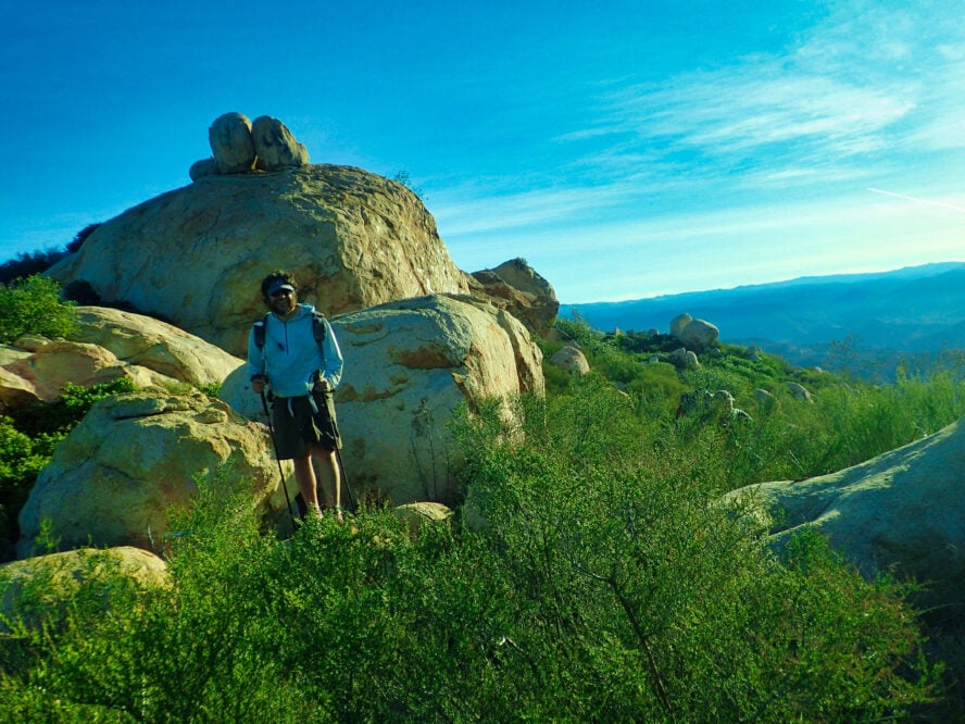
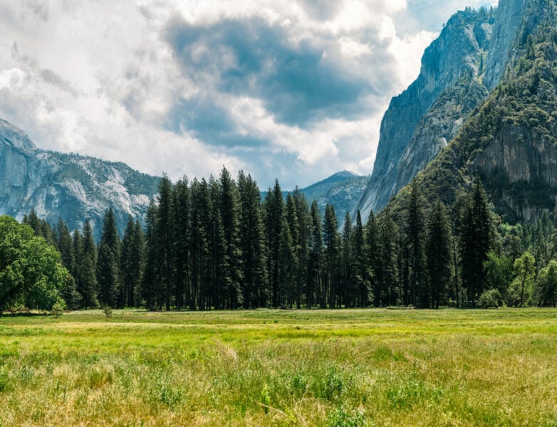
El Cajon Peak has a prominence of 1,955 feet—meaning you can see it against the skyline for a long distance and there’s no easy way up. Part of the Cuyamaca Mountains, El Cap is a high peak in eastern San Diego with a wilderness-like feel and granite boulders that remind some people of the hikes in Yosemite National Park (hence the nickname).
A Steep Trail Worthy of a Workout Takes You to El Cajon Peak
For the fit and adventurous, the steep route up El Cajon Peak travels 11 miles and 4,000 feet of gain to a wild summit filled with granite boulders. Start early and bring plenty of sunscreen—this trail has very little shade and no water along the way.
While technically open to leashed dogs, I think it’s best to leave your pets at home for this one. This is one intense hike that gets incredibly hot, is very long, and ridiculously steep, so it’s really only accessible for the most hardcore of four-legged (and two-legged) friends.


I’ve heard hikers call El Cajon “uphill both ways,” and that seems accurate given the roller-coaster-like up-and-down profile of this hike. The trail follows a steep old mining road, making even the descent to be a tricky affair. I’d advise bringing trekking poles to help on the way up and down. I usually don’t carry trekking poles, but was incredibly happy to have them last time I descended this peak.
I’d also recommend good hiking shoes or boots with excellent traction, stability, and support. The trail is quite rocky towards the top and twisting an ankle is not something you’d want to do in this remote place.
I’d advise carrying at least 3 liters of water and tackling this hike in the winter only. It’s so exposed that I’ve been hot hiking downhill at 10 am in January. The hike gets so hot that the San Diego County Parks department closes it down completely in August.
How to Hike El Cajon Peak
The first half mile takes you up a mix of paved and gravel roads to the “official” trailhead — your last opportunity to use an outhouse. As you ascend the trail (really, a wide, old road), you’ll see thick chaparral on either side and your first views of granite boulders. It’s easy to navigate the trail, but the loose dirt can make ascending it tricky.
With this kind of terrain, I’d advise wearing shoes with excellent traction and timing your hike for a day or two after a rainstorm (the extra moisture makes it easier for feet to stick to the soil).
The trail isn’t a direct five miles up to the summit. At times, it flattens before ascending some very steep hills. Sometimes, it goes downhill for a while, which I find a bit upsetting after all the effort required to climb. The closer you get to the summit, the rockier and more eroded the trail becomes.
On the plus side, navigation is easy on this hike. The trail is marked with signs showing the mileage and maps showing where you are relative to the elevation gain you have ahead.
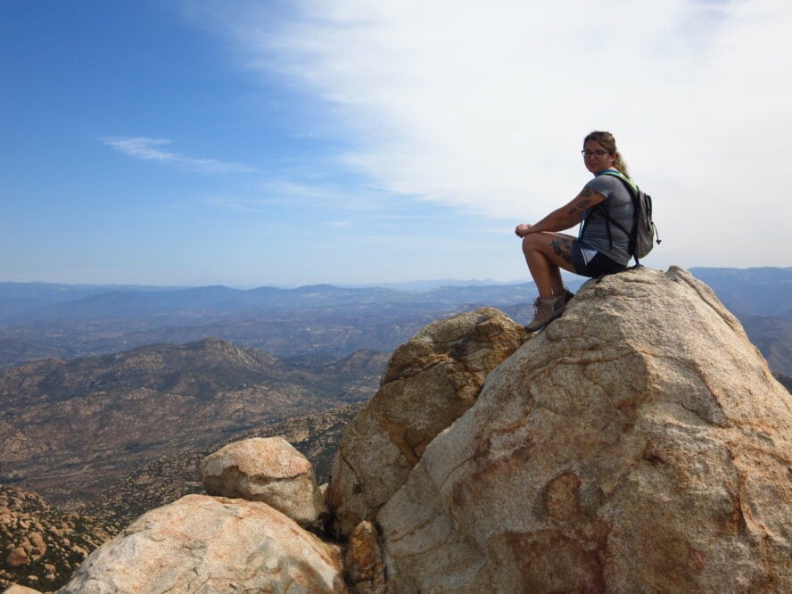
As the trail gets rockier and the ascent more unrelenting, I like to remind fellow hikers that it is ok to take plenty of breaks. You’re in one of the most beautiful places in the county, and the views are incredible. Don’t be ashamed to take a breather and a photo. There’s even a metal bench at an overlook halfway up specifically for this purpose.
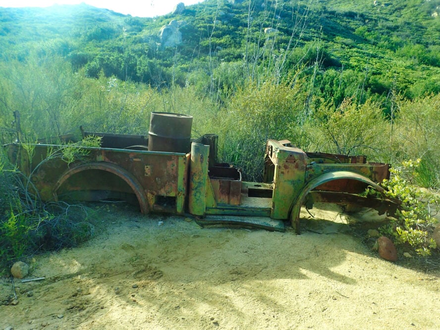
A few miles in, there’s a side trail to a mine shaft. Otherwise, continue to the summit, passing a rusted-out old truck that looks like it dates back to the mining days. The summit is nearby, just past the five-mile post. One last bit of rocky scramble leads to a boulder-filled summit. It feels like you’re in a distant land quite different from everything else in the county.
One of the hardest hikes in San Diego County, summiting El Cajon via the rugged, steep, and exposed trail is proof that you are a hardcore hiker.
By Liz Thomas — urban hiker


El Cajon aka El Capitan Mountain aka El Cap - Good to Know
Strenuous
10.4 miles and 4000 feet
The area around Lake Jennings has several private campgrounds. The nearby town of El Cajon has the best options for hotels.
None required for day hiking
6+ hours
Winter
Start early to snag a spot at the parking lot and avoid the heat. Bring trekking poles, good shoes, and 4 liters of water.
Getting there
The trail is located in the eastern section of San Diego, in the El Capitan County Preserve. Heading out from the city, take Highway 52 east towards Lakeside. Exit on Highway 67 north, turn right into Mapleview, and take the next left onto Ashwood Street, a.k.a. Blue Sky Ranch Road. You should see a large parking area across from Oak Oasis county park. Summer parking hours are 7-7, 7-5 in the winter months.
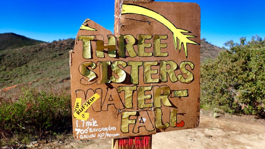
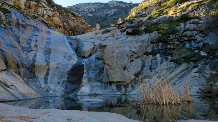
5. Three Sisters Falls
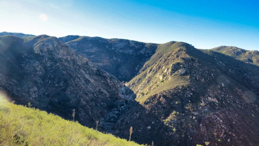
Visit one of San Diego County’s biggest waterfalls on one of its most popular waterfall hikes. On a winter morning after a storm, there’s nothing quite like the view of this giant three-tiered waterfall, as epic as the ones along the Mt. Rainier hikes, springing from a dry-looking mountainside.
Hiking the Three Sisters Falls and the nearby Cedar Creek Falls is a bucket-list ordeal for many San Diego hikers. But while Cedar Creek requires hikers to get a permit ahead of time, Three Sisters is still open to anyone who shows up. During wildflower season, expect to see poppies and wild mustard to add to the waterfall scenery.
Consider Leaving Your Pets at Home Before the Three Sisters Falls Hike
While technically open to dogs on leash, the Three Sisters Trail (like the nearby Cedar Creek Falls) has become notorious for taking the lives of innocent pets dragged on hikes by their owners. Even on cooler days, the surface temperature near the ground can be 20F degrees warmer than what a human may feel while hiking. I would highly recommend saving your dog hikes for something more gentle on your pet.
For the Three Sisters Falls Trail, Water Is Essentials
I’ve visited this trail several times and am always astounded by how warm it gets, even in the morning in January. The Forest Service recommends bringing a gallon of water per person, and I’d throw in some electrolytes and plenty of sun protection. A reverse hike (like the Grand Canyon), you’ll be dropping down to this waterfall.
All the climbing is on the return—after legs are already tired from walking half the trip. As a result, this is one of those San Diego hikes where rescues are common. I’d advise checking the Forest Service Palomar Ranger District on warm days. The rangers will often close the trail down for extreme heat when temps reach 95F degrees or more.
The Best Trails to Get To the Three Sisters Waterfall
From the large parking area, take the wide, flat dirt trail (an old ranch road) for half a mile to a wooden post. This marks the intersection with the Eagle Peak Trail. Make a sharp left to get your first views of the top of Three Sisters Falls. Sometimes, the junction sign is missing, so I always look for the distinctive V-shaped notch across the valley to make sure I’m headed in the right direction.
The trail descends along the dry creek bed of Boulder Creek through oaks and ferns. Soon, you’ll reach the new section of the trail that bypasses what was formerly a steep, almost canyoneering-esque route to the waterfall.
Now, the well-designed path skirts around the hillside. After a few short switchbacks, you reach the smooth granite slab right below Middle Sister Falls. The last 50 feet across the slab can feel tricky and exposed, especially when wet. If you feel comfortable crossing it, you’ll be at the pool below Middle Sister. The water tumbles 50 feet to a pool, and you can see Lower Sister Falls below.
Don’t underestimate this hike. Despite its length of four miles, I’ve always found it a lot more physically demanding than it appears on paper. Take your time on the return and remember to drink plenty of water!
Three Sisters Falls and the nearby Cedar Creek Falls have become bucket-list hikes for many San Diego hikers. But while Cedar Creek requires hikers to get a permit ahead of time, Three Sisters is still open to anyone who shows up.
By Liz Thomas — urban hiker


Three Sisters Falls - Good to Know
Strenuous
4.5 miles round trip
1,400 feet elevation gain on the return
The nearby towns of Julian or Lake Cuyamaca offer campgrounds and hotels
3 to 5 hours
Winter. The Forest Service closes the trail on days of 95F degrees.
Get to the trail early (like dawn). The parking lot can fill up and the hike is a lot easier when temperatures are cooler.
Getting there
The trailhead is accessible via a dirt road that is good enough for most 2WD cars (at least if the roads are dry). From Julian, head west on CA 79, Turn left on Pine Hills, following signs for the YMCA and Girl Scout Camps. Turn right on Eagle Peak Road and left on Boulder Creek Road, which you’ll take for 13 miles through the Inaja Indian Reservation. The trailhead and parking lot is at a sharp bend in the road. This area is very remote and doesn’t have cell reception, so consider printing out directions and downloading it to your phone beforehand. While it is possible to reach the trailhead from the town of Descansos (and sometimes Google Maps or car GPS may direct you that way), I’ve found the water crossings on that route to be a bit much for 2 WD vehicles.
Honorable Mentions
La Jolla Trail
The La Jolla beach trail is a short-but-sweet 2.5-mile hike connecting the La Jolla Shores Beach and La Jolla cove. It’s one of the mildest and most relaxing trails in SoCal, with plenty of great views of the oceanfront. The hike itself has two access points: the Cave Store to the north, and a gorgeous secluded beach called the Children’s Pool from the south.
The trail is full-on family-friendly, it’s very popular among joggers and bird-watchers, and has one of the denser wildflower populations in the area. If you’re lucky, you might even catch a glimpse of a harbor seal. Keep in mind that it can get very crowded on the weekends, especially during the summer season, and that pets aren’t allowed on the trail’s seal lookout bridge.
Cowles Mountain
Cowles Mountain is a moderate 5-mile trail in Mission Trails Regional Park, and one of the most popular mountain hikes in San Diego county. Its biggest highlight is that it takes you to the highest point in San Diego at 1,593 ft, with views spanning from the OC to Mexico. While the main trail usually sees the biggest crowds, those in the know prefer the less-crowded and more scenic backway accessible from Big Rock Trailhead.
The hike follows a steady incline until you get to the summit, when it gets a little steeper and more rocky. However, the great panoramas are there to push you forward, and the trail never gets unmanageable. The biggest downside to this hike has to be the crowds. Hiking early in the morning or late in the afternoon is a must here. Also, some sections of the trail have even been eroded by the constant traffic, so watch your step!
Sunset Cliffs
Spanning through a natural park with the same name, the Sunset Cliffs Trail is an easy 3-mile coastal hike with some great vistas. The park is well-known for its abundance of caves, cool rock formations evocative of the hikes in Southern Utah, and cliffs jutting out into the Pacific. Although there’s a set trail, there’s also plenty of “off-the-beaten-path” options, most of which start from a very cool-looking tree tunnel like the ones you’ll find hiking in Northern California. If you’re a first-time hiker in it for the postcard-worthy sunsets and weird-looking rock formations, this one’s for you. But don’t forget to check some hiking tips for beginners.
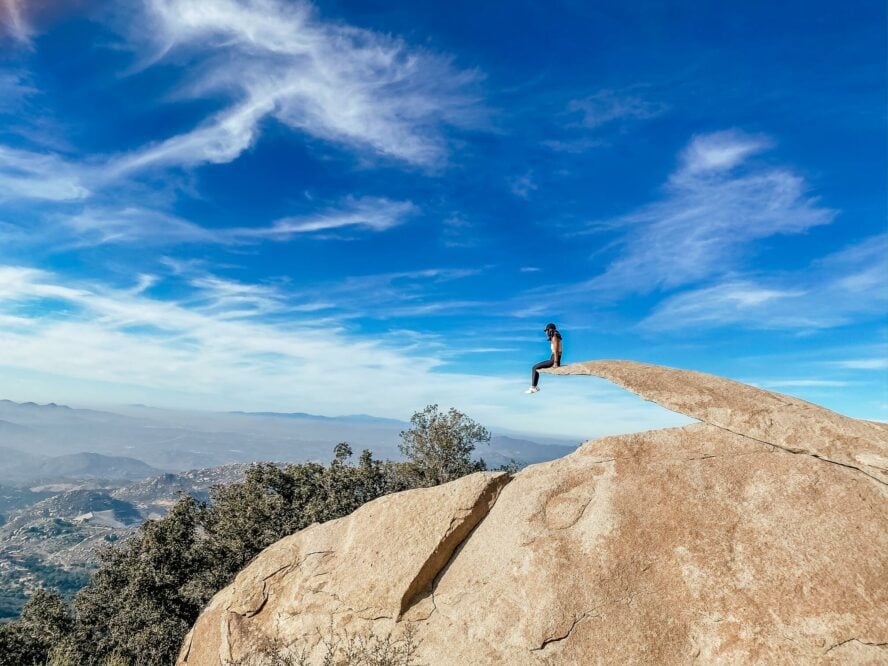
Potato Chip Rock
Potato Chip Rock is probably the most iconic rock formation in San Diego county. The hike up to the rock is a challenging one, with a steep, narrow, but well-marked uphill. The trailhead is 30 minutes north of San Diego. There’s no shade here, so starting early and bringing lots of water is the right move. When you finally reach the summit, you can stay and take in the panoramic views, or just take a picture hanging off the rock for your Instagram. Just an FYI, it’s a 40-foot drop, so be smart.
What You Need to Know for Hiking in San Diego
Whether you’re planning a vacation or a local looking for a good day hike, here’s some important info you need to know for hiking in San Diego, from when to visit, to where to stay to some gear essentials you don’t want to forget.
What Makes San Diego Hiking So Great?
San Diego is known for its beaches, but its canyons, woodlands, deserts, palm oases, and mountains (they even get snow!), which means that there’s an adventure for everyone. The county is home to 1.4 million people. It’s also home to numerous state, city, and county parks and national forests. Almost a quarter of the county is public land that’s open for anyone to explore.
San Diego is considered by many to be the second most botanically diverse county in the country. The endangered Torrey Pine, for which Torrey Pines State Park is named, is one of the rarest pines in the world.
Because of the diversity in elevation in the county (sea level to 6,535 feet), it’s home to six climate zones: Coastal, Coastal Inland, Upland Central, Transition, Mountain, and Desert. For hikers in San Diego, you can walk through a lot of ecosystems and experience many different types of hikes—all with trailheads less than an hour from one another!
Hikers looking to explore all the county has to offer are best suited by renting a car, though there are plenty of bike trails and trailheads accessible by public transit.
When Is the Best Time to Visit San Diego for Hiking?
Hiking in San Diego is a winter hiker’s paradise. Where other hiking destinations may be trapped under snow for months, San Diego’s desert, foothills, canyons, and even mountains are all pleasant temperatures.
The county is known for having among the most sun anywhere in the country. For hikers, campers, and backpackers aching to get some miles in from December through February, San Diego has become the place to soak up Vitamin D and get in some nature time.
Although winters are pleasant and a great time for backcountry skiing in California, the spring brings a new dimension to the desert. As is the case with the famed Joshua Tree hikes, spring wildflowers attract photographers and Instagrammers from around the world. In late February through early April—especially in years after a big rain—poppies, cacti flowers, and rare California natives bloom to form a colorful carpet over the otherwise sandy landscape. It’s a must-do event worth seeing at least once in your life.
If you want to see flowers but would rather not battle the crowds, coastal wildflowers bloom in April, and mountain wildflowers bloom from April to May.
Should You Hire a Guide to Hike in San Diego?
Experienced hikers will find their way around San Diego trails with no problem. Beginner hikers can do the same with a little planning. However, a local hiking guide can show you the highlights of the area and take care of all the planning and logistics for you—a great option if you have a little time and want to make the most out of your day of hiking.
Stay Cautious in the Summer
As great as winter and spring are for hikers, San Diego is really a year-round destination. It’s easy to find trails with comfortable temperatures whenever you visit. Cooling ocean breezes maintain mild temps along the beaches and bluffs, even when the summer sun brings the Anza Borrego Desert up to 120°F. Keep in mind that the inland temps can be 15 to 20°F warmer than on the coast. If you’re planning a summer trek, especially if it’s a hardcore one like the Tahoe Rim Trail thru-hike, pay special attention to the weather report.
While many people enjoy summer trekking and mountain biking in California, it’s smart to avoid hiking the desert during the summer and to exercise extreme caution when visiting some mountain destinations as well. Ditto for your pup. If you’re hiking with a dog, check temperatures and pick your trails not just based on whether they allow dogs, but whether there’s enough shade and water to keep your dog cool.
I’m local, so have the freedom to hike each of San Diego’s distinct areas during their prime seasons. But if you’re visiting from afar and want to get the best hike possible, plan your San Diego trip around the types of ecosystems you want to see.
Be Prepared for Varying Temperatures and Conditions
As you may have guessed, a county with beaches, deserts, mountains, and woodlands has a lot of variation in temperatures and conditions. San Diego’s elevations go from sea level to Hot Springs Mountain (6,535’), and from desert and beach to mountains that get snow.
Temperatures depend a lot on where you are. As in most hiking destinations, conditions vary by elevation and season. For example, the Anza Borrego Desert is mild in January but gets to 120F regularly in summer. As anyone who trekked the hikes in Arizona would tell you, you don’t want to find yourself in the desert when it hits the hundreds. Torrey Pines State Park right on the beach stays a consistent 60-80F year-round. Cuyamaca Peak, meanwhile, can get below freezing in winter but can be in the 90s in summer.
Pack the Essentials: Water and Sun Protection
Regardless of when or where you hike, San Diego’s constant sunshine means you don’t have to exert much effort to start warming up—even in January. If you’ve ever gone hiking in Austin, you know what I’m talking about — the dry air and lack of shade on many trails means your body will need more water than you think. Pack some electrolytes, too.
One trick I often use when hiking in San Diego is to start around sunrise because it takes a few hours for marine layers to burn off or temperatures to otherwise rise. I avoid a lot of the crowds that way, too, and if you try combining it with the less-popular trails, you’ll feel as solo as if you were hiking in Alaska.
I love the sun in San Diego but that also means sun protection—including sunglasses, a sun hat, and sunblock—is essential year-round. Some San Diego trails, like Cedar Creek Falls and nearby Three Sister Falls, claim lives every year and rescues are common due to overheating and dehydration.
While dogs aren’t prohibited on most San Diego trails, some trails are too hot and exposed for most breeds to handle, especially in late spring, summer, and early fall. Be prepared and check weather and conditions before setting out on any of these hikes at any time of year — and be prepared to leave four-legged friends at home.
What Are Some Good Backpacking Trails in San Diego?
If you’re looking to spend more than a day on the trail, there are plenty of backpacking options in San Diego.
The Secret Canyon Trail, an intermediate 15-mile point-to-point waterfall hike, is popular both among hikers and horseback riders. You’ll find plenty of waterfalls, livestock, green meadows, and even a historic stone shrine in the northern section of the trail. It also has plenty of free-flowing streams, great dispersed camping options, and, if you’re looking to cool off, a large swimming hole like the ones you’d find hiking in Austin (but don’t drink the water!).
Part of the iconic Pacific Crest Trail, the dog-friendly Agua Caliente Creek Trail is a 10 mile, moderately trafficked trail that’s usually doable year-round. As the name suggests, the trail follows a small creek through an oak-dotted field, through a densely-forested valley, and to a striking granite canyon, with a makeshift campsite right in the middle. The hiking isn’t too challenging, and the trail is great for wildflower spotting.
What’s the Five Peaks Challenge?
The Five Peaks Challenge is a great way to test your hiking skills right in San Diego’s backyard. The goal was to challenge hikers to summit all five peaks in Mission Trails Regional Park—Cowles Mountain, Pyles Peak, Kwaay Paay, South Fortuna, and North Fortuna. This was done to divert attention from Cowles Mountain and to better distribute trail traffic.
The only rules are that you’re only allowed to hike on established trails and that you have to take a selfie at the summit of each of the five peaks (preferably with the summit marker in view). Most people take two or more days to finish the challenge, but some extreme hiking fanatics manage to do it in one.
Since over 15,000 people have completed the challenge to date, the organizers are no longer giving out certificates and logo pins. Despise that, the Five Peaks Challenge is still a great way to experience Mission Trails Regional Park and take in some great panoramic views of the San Diego area.
What are some other things to do in San Diego?
If you’re looking to take a break from the trails, why not try the rocks? Rock climbing in San Diego is a big deal, and there are plenty of great beginner-friendly routes to get you used to SoCal’s top-quality granite. El Cajon, more specifically the Buffalo Bill and Meteor routes, is one of the best places for beginner-friendly rock climbing in California, but make sure to gear up properly and bring a guide, especially if you’re a first-timer.
And when you’re ready to take it to the next level, Joshua Tree climbing and Sierra Nevada climbing are classic, and relatively close-by, options. If you’re looking to dip your toe into the world of alpinism, a Mount Shasta climbing trip is, as far as I’m concerned, the best way to do it in the States. With a guide, of course.
To fuel up for the adventures ahead, why not pay a visit to San Diego’s great food spots? Hodad’s in Ocean Beach and downtown San Diego is the best-rated fast-food dive in town. The prices are low and the portions are massive — what more could you ask for?
Visiting SoCal and not dropping by a Mexican restaurant should be a crime. El Indio in Mission Springs is famous for its taquitos (which some claim they invented), and Cafe Coyote in Old Town is the best place to down a big Margarita with an even bigger plate of burritos, tacos, or other quintessential Mexican snacks.
Plan Your Stay Ahead of Time
If you’re visiting San Diego specifically for hiking, many of the world-famous hiking destinations are in the eastern or northern part of the county away from the city center. If you’re interested in desert or mountain trails, you may want to look for hotels near the towns of Julian, Alpine, or even Poway (which may be less expensive). Julian is famous for pies, apples, and cider. Even when I don’t stay in town, I always get a slice.
If you’re visiting during wildflower season—especially for Anza Borrego Desert State Park—I recommend making reservations for hotels and campgrounds before your trip. I’ve always had luck finding free or low-cost campsites in the desert from October through January, but it can get quite busy when the flowers are blooming, especially on weekends.
If you are visiting San Diego during summer or are more interested in city, beach, bluff, and lagoon hikes, you’ve got options. Torrey Pines, Del Mar, and La Jolla have beautiful accommodations and are closer to Torrey Pines State Park. The downside is you may need to book early and these areas tend to be pricier than other parts of the county. Unless you’re into golf, you may want to avoid visiting during the U.S. Open at Torrey Pines.
Many folks will prefer to stick to Old Town or City Center, where it’s easy to walk to restaurants and easily catch public transit or ride-shares to popular trailheads. You’ll also have access to bike trails and the easy-to-use bike sharing system that not only gives you access to different neighborhoods to eat and visit, but also some of the more popular urban trailheads.
Are you ready to head out hiking in San Diego but want a little help from a professional guide with extensive knowledge of the area? Check out our guided San Diego hikes and join a group tour or head out with a private guide hiking in Torrey Pines or Cowles Mountain.