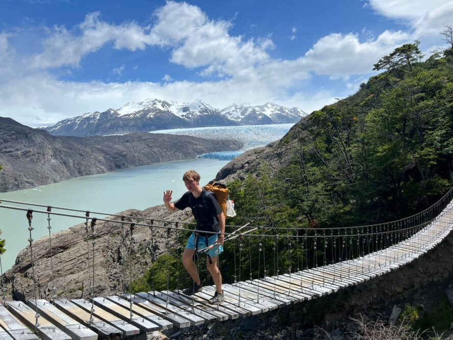
It was the last day and the emotions were flooding in.
“I am capable of completing this, all I need to do is finish these 16 miles,” I repeat to myself, delaying my departure. Looking forlornly at breakfast, I add: “Then I will stuff an entire pizza into my belly.”
Oatmeal was getting old, but my options were a bar or a strawberries and cream packet; I had eaten everything else. “I am capable of completing this too,” I bemuse. Fantasies of toppings and melted cheese running through my head, I tossed my pack over my shoulder and started walking down the trail for Tahoe City.
Pros and Cons of Hiking the Tahoe Rim Trail
The Idea for a Tahoe Rim Trail Thru-Hike
Growing up in a small town outside the city limits on the north shore of the lake, my family spent every opportunity skiing, hiking, swimming, and mountain biking around the blue waters. However, my parents were never keen on sleeping in tents, so backpacking was an activity I fell in love with during my time in college. When I returned home the summer after graduating and told my parents that I was going to thru-hike the 165 mile Tahoe Rim Trail, alone—to collect my thoughts before diving into a career—they rolled their eyes.
My mom has always been a worrier and she started firing questions. Traditionally, I am not a planner, but this time I was ready—to her surprise—and her arsenal of questions were deflected:
“Where do you plan to park?,” she asked. There’s a trailhead lot in Tahoe City.
“How long do you think you’ll be gone?” Most take 10-14 days, but I want to test myself and try to finish in seven.
“What are you going to eat?” I already went to the store, so two packets of oatmeal for breakfast, two bars and trail mix for lunch, and pesto-couscous for dinner. I’ll also bring a couple of protein powders just in case.
“Have you gotten permits to sleep?” Except for Desolation Wilderness, you don’t need a permit, as long as you follow Leave No Trace best practices.
As the questions continued, her worries dissipated. I had done my research.
A Bit of Background About the Tahoe Rim Trail
During the planning, I discovered more about the area than I had ever known growing up because my dedication and desire to play a sport in college prevented me from going on several weekend trips with friends. Now, my collegiate career was over and my time to explore was surfacing. I found there were many paths used by the Indigious people of Lake Tahoe, known as the Washoe tribe, but a maintained loop around the rim wasn’t established until 2001.
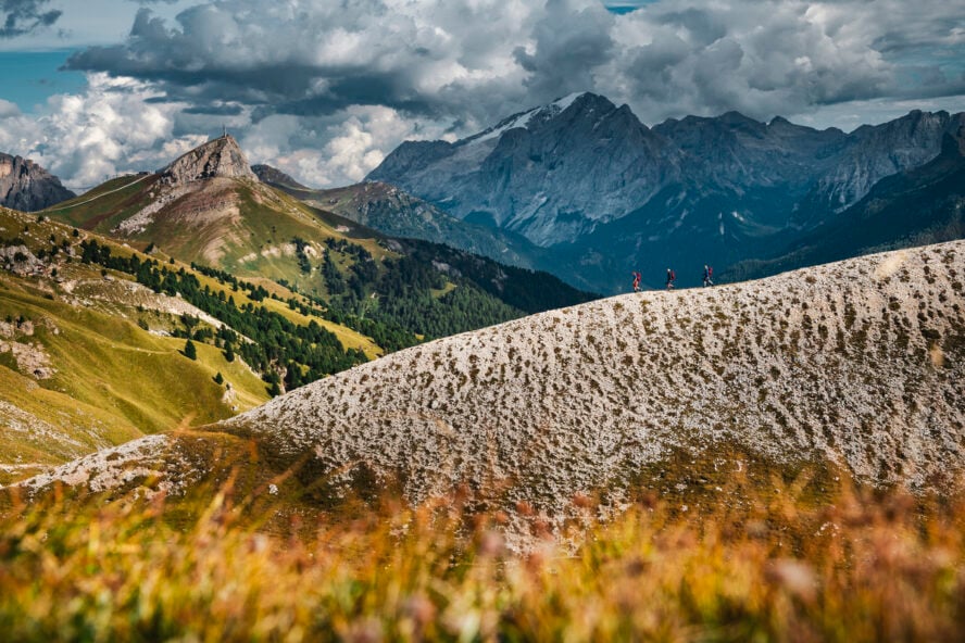
The concept for the Tahoe Rim Trail was proposed by Glen Hampton back in 1978 and after three years of fundraising it broke ground. A massive endeavor—linking hiking paths, Pony Express routes, and game trails throughout the ridges of the Carson and Emerald range, 165 miles and 31,000 feet of vertical gain in total—took 17 years. It’s a rough patchwork of terrain as I’d come to find.
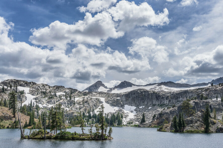
Regarding the terrain, the east side of the lake is dry, steep, and home to Mount Rose and Mount Freel. In other words, your thighs will be burning and your water bottles will be empty here. Storms often come into the Tahoe basin from the west, so much of the moisture is initially dumped on the western slope—which helps produce one of the country’s most reliable snowpacks and gives Tahoe excellent backcountry skiing—but leaves the Carson Range thirsty. Meanwhile the Emerald range, on the west side of the lake, is heavily covered with trees, filled with creeks and streams, but doesn’t have many high points. While on the trail, you’ll notice a stark difference between the ranges.
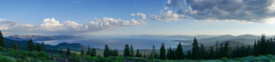
The Lake Tahoe area, due to its unprecedented natural beauty, is the area where some of the best hikes in northern California call home.
As I continued down rabbit holes, there came a point where I knew I needed to pack my bag and go, so that’s what I did.
What I Packed: My Gear List for the Tahoe Rim Trail
My preparations were almost done, my parents’ worries subdued, and now all I needed to do was pack my bag. This isn’t like day hiking in San Diego — serious prep work is required. Since I wanted to move quickly, I didn’t want to resupply, even though there are common places like Brockway Summit, Tramway Market, and Alpenglow Sport along the way.
Opting for a 70L pack, my gear list included:
- 3-season tent (I was going in summer)
- 20 degree sleeping bag
- MSR whisperlite (I wanted to make couscous)
- One pot
- 3 liters of water (the third was only filled during the dry section on east side of the lake)
- Two pairs of shorts
- Two shirts
- Two pairs of socks
- One puffy jacket
- One rain jacket
- A med kit (minus the ibuprofen)
- Bear canister (bear proofing is required while overnight camping in Tahoe)
Exploring My Home Range: On The Tahoe Rim Trail Thru-Hike
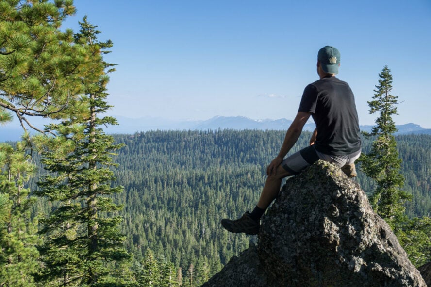
Starting in high spirits
Do I go clockwise or counterclockwise? The difference is negligible, but I chose clockwise and headed north, across the bridge and up my first hill. As the parking lot faded behind the trees and the dirt trail became my path to follow, I started to feel the weight of my pack. Warding off thoughts of skepticism, I looked around at the blooming flowers, it looks like I timed this hike perfectly! Between July and early August, the wildflowers blossom, depending on the snow pack, making summer the best time to backpack the Tahoe Rim Trail.
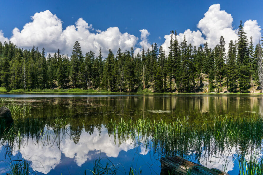
Even though I got an afternoon start on the day, my progress was quick. There are eight sections to the trail, averaging 20 miles in length per leg, and I was already 1.5 sections in as I set up camp on my first night. Camping near a lake, I was able to refill my bottles, eat some food, and crawl into my sleeping bag for a good night’s rest.
Feeling good, for now
Waking up ready to crank out miles, my goal was to push for 35 miles. After some oatmeal I left the lake and headed towards Mount Rose. Passing others along the trail as they enjoyed their morning cup of coffee and eggs over the stove, I was a bit jealous.
I crunched over snow patches, twigs, pine cones, and more. The sky was clear and the sun beat down on as hard as on the best Joshua Tree hikes. Drinking water and keeping up my pace, the only distraction I allowed was to stop and snap a few photographs.
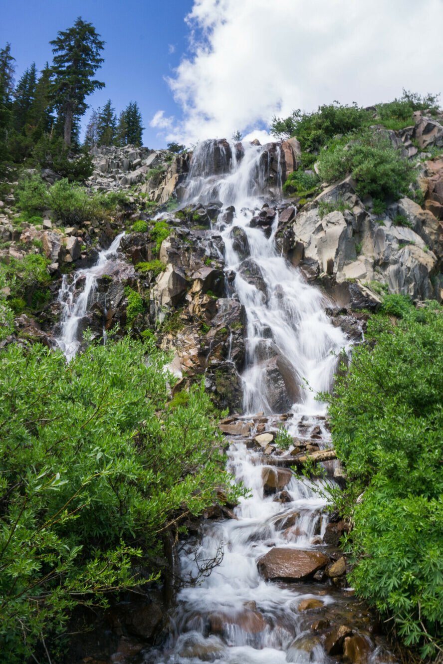
One stop, a waterfall along the Tahoe Rim Trail not far from Mount Rose summit fork, came at the perfect timing. I was low on water, hungry, and ready for an excuse to drop my pack. Feeling as though the weight of the world had dropped off my shoulders, I walked around with my camera, snapping images left and right, the cascading water spraying me. Grateful for the cooldown, I enjoyed my snack, pounded some water—for this might be my only refill for 20 miles—and got on my way.
Passing a large group, near the Mount Rose trailhead, I asked what they were doing. They were day hiking with the Tahoe Rim Trail Association guides, they said, and explained there were three options for guided trips. First, if you’re a beginner hiker looking for tips on how to get started, you could day hike in sections, the guides organizing the logistics. Second, you could section hike, each could be done over a weekend. Lastly, you could do the whole Tahoe Rim Trail thru hike with the help of guides. The best part, the community—laughing, telling jokes, and having a jolly time!
Entering a fairytale
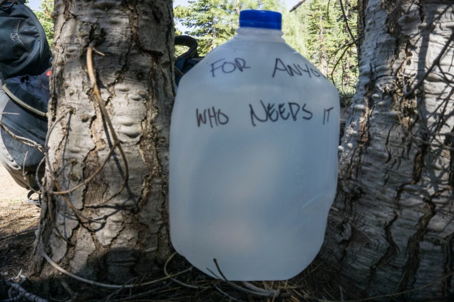
The following day, day three, would be roughly the same distance, but no water. From the Carson range to the Kingsbury Section Connector there is no water. Often, trail fairies leave a gallon, or two, for thru hikers, but don’t count on this. If you don’t plan in advance, you might have to detour two miles to a store down the road.
To help you prepare, you can find water sources from the Tahoe Rim Trail Association.
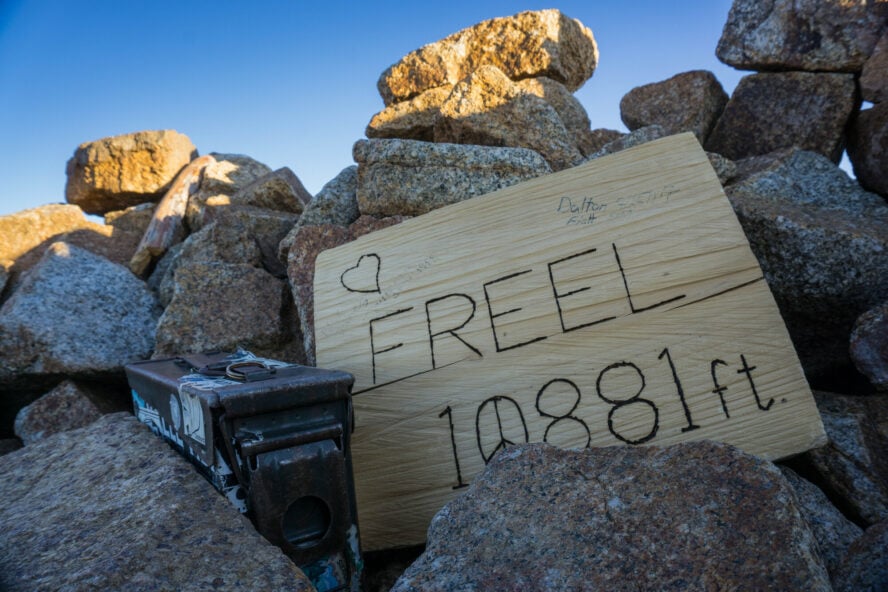
Towards the end of the day, I had reached my goal. Since I had made good time on this section, I decided to make the side trip to the summit of Mount Freel to watch the sunset. I figured it wouldn’t be an issue to add the extra mileage. Dropping my pack at the cairns marking the split, I worked my way up the sandy slope, reaching the summit in time to watch the last light fade into darkness.
The crawl
Day five, I was beat up, everything hurt, and my body wasn’t ready for this. In the back of my head, I continually recalled an early fascination I had about ultra-runners using the full length of the Tahoe Rim Trail, 165 miles and 31,000 feet of vertical gain, as a training ground. I drooled over the Fastest Known Times thinking to myself, “How is that even possible?”
There is no doubt in my mind that I had underestimated the difficulty of the Tahoe Rim Trail. For some reason, I thought it was going to be as easy as backpacking in Big Sur. This hike is serious! My left knee was swollen, my back was in pain, and I really didn’t know if I could continue. Breaking down the tent and packing my bag was difficult. I started down the trail, looking for a stick so I would have a hiking pole. I found two.
The irony is that today was supposed to be my biggest day, roughly 50 miles, through the most beautiful section, Desolation Wilderness. It felt like I was crawling.
With 20 years of high-level sports under my belt, I felt driven by my competitive nature. But in reality, I didn’t know much else. Everything I did was a competition with myself.
In many ways, when I told my parents that I wanted to “collect my thoughts before entering my career,” these were the thoughts I wanted to address.
Entering the Wilderness area, even with a bummed knee and lower back, I opted out of the free wilderness permits for overnight camping in the area. I was committed to trekking the 32 miles, even though it was already 10am.
Before pushing on, I stopped in at Echo Chalet, a grocery store near Echo Lake and the entrance to the wilderness, for a sandwich, a bag of chips, and some ice-cream. I am not sure if I have ever had a meal that tasted so good.
Pulling myself together, I started up the rocky slope.
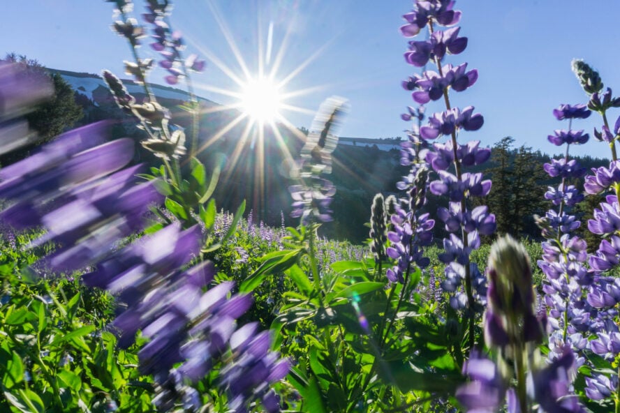
The trail was gorgeous, a bit rocky, but led towards some grand views, something anyone who ever did the best Grand Canyon hikes can relate to. The lupines were in bloom and the Lake Aloha area hands down has the best views along the Tahoe Rim Trail.
To myself, I muttered, “be smart, stop here for a night, or two, to enjoy this,” but my ego wouldn’t allow it. Conflicted inside, I battle with myself. I came out here to look inside myself, relive those missed opportunities during my childhood, and yet I put myself in a position to where I also didn’t want to disappoint myself by not meeting the standard I had set.
My schedule was tight, my body feeling dilapidated, but I felt compelled to dip in Lake Aloha. Swimming, journaling, and simply being on the banks was a welcomed reprieve. I knew I needed to move on, but I didn’t want to. I considered staying put, but I was afraid of the consequences… of letting myself down.
Putting my pack on, I murmured, “You should have gotten a permit.”
Going up and over Dick’s pass was brutal. My knee was in excruciating pain, I was moving slowly, and I just needed a savior. Luckily, out of no-where, a day hiker came romping down the pass, whistling a tune, and started a conversation. After some time, I asked if they had a wrap for my knee, but they didn’t. Instead they did have some ibuprofen, something I forgot to pack in my medkit. Gulping them down and saying good-bye, I laid on my back, staring up at the pass, wondering if I would ever finish with the trail. It didn’t seem like it.
Soon I was cresting the pass and started down the slope. Pulling over on the side of the trail, I made dinner by headlamp, knowing I had many more miles to walk, in the dark. Just outside the wilderness boundary, a few hours later, I had made my goal.
I looked around for a place to pop my tent and saw a random trail marker glowing. Confused, I wandered towards the reflector until it moved, revealing two eyes staring at me. A mountain lion. Doing everything I could do not to freak out, I walked backwards keeping an eye on the cat, picked up my bag, and kept walking.
The good news, I no longer felt any pain in my knee, or back!
Two more hours of hiking. Ready to collapse. I set up my tent. Bed. I hoped I would wake up the next morning.
16 miles to freedom—and pizza
The morning light warmed my face, and I was grateful to be alive.
Today was going to be my last day. The emotions were flooding in. “I am capable of completing the Tahoe Rim Trail thru hike. All I need to do is finish these final 16 miles. Then I will stuff an entire large pizza into my belly,” I repeated to myself.
Originally, I set out to make this trip for myself, to grow, connect with my home, and learn about myself. I was naive. The Tahoe Rim Trail became another competition instead of a soul search. There were 16 more miles, but, in many ways, I had an undetermined amount of time ahead of me. These were my first steps outside of competition and goals. Unlearning was going to take more than miles, more than fatigue, more than time alone. If I wanted to untether myself, I would need to learn to accept who I am, potentially disappointing those I love and those who’ve invested in my future.
I started down the trail knowing these 16 miles were just the beginning.
Good to Know Information About Thru-Hiking the Tahoe Lake Rim Trail
Can I bring my dog on the Tahoe Rim Trail?
The trails are dog-friendly, though they should be kept leashed around other trail users, at trailheads, and on steep or slippery terrain. Take note of the differing regulations as you pass from land managed from one agency to another, and be respectful of fellow hikers (not everyone is comfortable around dogs). You can read more about dogs on the trail from the Tahoe Rim Trail Association.
Do I need a permit to hike the Tahoe Rim Trail?
You only need a permit for the Desolation Wilderness, or if you plan on using a camp stove. You can read more about the regulations from the Tahoe Rim Trail Association.
Maps for the Tahoe Rim Trail
The Tahoe Rim Trail Association has an excellent interactive map to help you prepare for your trip, along with maps that show water sources and current conditions. You can download the maps or print them out for reference on the trail.
When the Boot Hits the Finish Line a New Chapter Is Just About to Begin
Sitting on a picnic table bench, looking out at Lake Tahoe, half a pizza in my belly and the other half waiting to be devoured, my dad asked, “So, what was it like?” Not really knowing what to say, I picked up another slice of pizza and started to recall the memories, trying to decide where to start.