
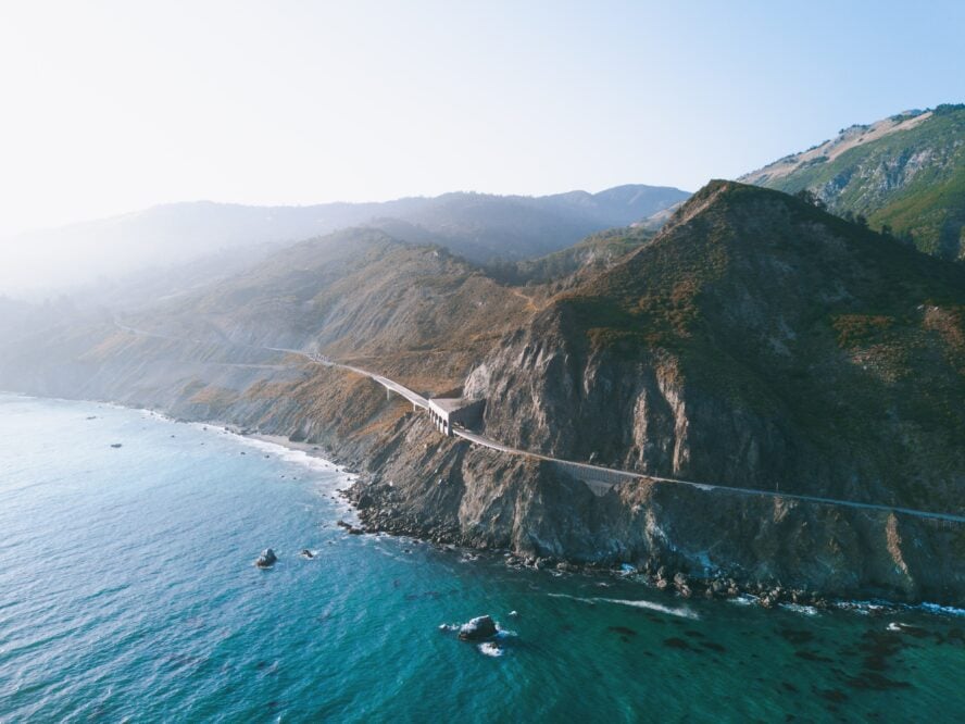
Big Sur should win an Oscar for visual effects.
Here you’ll find redwood groves sprouting within sight of ocean coves, and mountains rising from the Pacific with an abruptness that rivals the prominence of the east face of Mt. Whitney. Even though the area is a 5-hour drive from Hollywood, Big Sur’s flair for the dramatic may as well be cut from a movie script.
While the area sees upwards of 4 million visitors a year, most only enjoy a short hike or a drink by the ocean before leaving. To each their own, however, that is a bit like watching a movie trailer and assuming you’ve understood the whole plot. To fully enjoy this story, though, you need to spend at least a night here. Or better yet, a few: backpacking in Big Sur is the way to go.
A Brief Overview of Big Sur
Between the year-round pleasantness of San Diego’s hiking trails and the old-growth pathways of Redwood National Park sits Big Sur’s seemingly untouched wilderness.
While locals might have their own definitions, Big Sur has no clear boundaries. When I use the name, I usually refer to a 71-mile segment of the California State Route 1, between the coastal Malpasso Creek in the north and San Carpoforo Creek in the south. Whatever the boundaries, it has been described as “one of the most beautiful coastlines anywhere in the world.”
Surprisingly, the area sees about as many yearly visitors as Yellowstone, yet houses just under 2,000 permanent residents (and with much less infrastructure). That’s because the land is protected under the 1976 California Coastal Act and the 1981 Big Sur Coastal Plan, whose guiding ideas are that Big Sur should be preserved for its open space, visual access, and unique ecology. Since its founding, land stewardship has been a defining feature.
As a result, Big Sur is home to seven state parks and two state preserves. Many of the greatest camping spots can be found in the mountainous portions of the region, including the Ventana Wilderness and Silver Peak Wilderness of Los Padres National Forest, as well as non-wilderness sections.
What’s hiding under the “Rain shadow”? Big Sur’s boundless biodiversity
The overall climate could be described as Mediterranean, however, Big Sur enjoys a whole host of microclimates that get more pronounced the further inland you go. This is mostly due to a phenomenon called “rain shadow”.
In regions where a mountainous range sits right by a shoreline, the passage of wet and warm maritime air is blocked by the higher elevations. This leads to the coast-oriented side absorbing the rain and moisture, while the side facing away from the water stays dry.
Because of the stark climate diversity there is a wide range of flora and fauna. For example, the moisture trapped by the mountains creates a prime environment for coast redwood, usually found near creeks or in canyons. On the other, drier side, you’ll find yucca and dusty chaparral flourishing along the trail.
Big Sur hosts many more unique plant species, including the Monterey pine, California bay laurel, and the rare Santa Lucia fir, found only on the steep slopes of its range.
My Favorite Backpacking and Hiking Trails in Big Sur
Sparsely populated, mostly uninhabited, and about as rugged as it was centuries ago, the best hikes in Big Sur pass through rarefied terrain. To see this dramatic landscape, I recommend hitting the trails.
Typically, hikers and backpackers congregate in two main areas: the Ventana Wilderness towards the central area of the region and Silver Peak to the south.
A third area, the Pine Ridge Trail from Big Sur Station to Sykes Hot Springs, used to be the most popular one. Unfortunately, a wildfire in 2016, followed by subsequent landslides, caused enough damage that the Forest Service closed it.
Hiking in the Ventana Wilderness
The Ventana Wilderness is a federally-designated 98,000-acre area of land that straddles the Santa Lucia range just south of the Monterrey Peninsula.
The area is popular among travelers for its sheer and rugged montane landscapes: creeks falling from steep crested ridges, craggy peaks descending into V-shaped valleys, deep pools, and hot springs lying secluded under brushy covers.
The Wilderness hosts nearly 200 miles of trails starting from 9 trailheads, the most popular of which is the 24-mile Pine Ridge Trail. Backpackers of all skill levels are mostly drawn to the trails around Kirk Creek in the south and Little Sur River in the north, as they provide access to the best campsites.
Hiking in the Silver Peak Wilderness
Rising sharply from the Willow Creek and Salmon Creek drainages to nearly 4,000 feet (1,220 m), the Silver Peak Wilderness is another highly-trafficked backpacking spot.
Known for its spectacular views of the shoreline, the area also hosts the southernmost redwood grove in the world and tons of vibrant flora around the creeks. It’s best visited in the springtime as that’s when the waterfalls come to life, and you’re more likely to spot a deer, squirrel, rabbit, or wild turkey.
Due to how steep Silver Peak is, the trails there are more physically demanding. The most popular trek is a mild one leading to Salmon Creek Falls, but there are plenty of other, more adventurous, hikes climbing north across the area.
Map of Day Hikes and Backpacking Trails in Big Sur
From loops to one-ways, shoreline traipses to peak bagging, there are plenty of options when backpacking in Big Sur. Below, each marker indicates a backpacking area I’ll be chatting about.
Your Guide for the Best Day Hikes and Backpacking Trails in Big Sur
To help you find your footing in Big Sur, I’ve compiled a list of 8 must-do day hikes and backpacking trips in the area. For convenience’s sake, most of these adventures will take place in or near Ventana and Silver Peak, and I’ve selected a wide array of treks for visitors of all skill levels.
No matter how fit you are or how much time you have, you’ll find something to do here.
Easy Day Hikes in Big Sur:
-
- Pfeiffer Falls Trail – 1.3 miles (2 km), best for a family hike
- Buzzard’s Roost Trail – 2.6 miles (4.1 km), best for birdwatchers and botany enthusiasts
- Partington Cove Trail – 1.1 miles (1.7 km), best for oceanside hikes
Moderate Day Hikes in Big Sur:
-
- Creamery Meadow, Panorama, Bluffs, and Ridge Trail Loop – 8 miles (12.8 km), best for landscape variety
Moderate Backpacking Trips in Big Sur:
-
- Kirk Creek Trail to Stone Ridge Trail, Ventana – 13.2 miles (21.2 km), best for seeing a bit of everything
- Salmon Creek Trail, Silver Peak – 16 miles (25.7 km), best for off-season hikes
Challenging Backpacking Trips in Big Sur:
-
- Cone Peak Trail via Kirk Creek Trail, Ventana – 24 miles (38.6 km), best for great views
- Buckeye Trail to Alder Creek Camp, Silver Peak – 15.2 miles (24.4 km), best for advanced hikers
My Recommended Backpacking Trails in Big Sur
1. Kirk Creek Trail to Stone Ridge Trail, Ventana Wilderness
If you want a little taste of everything Big Sur has to offer, the Stone Ridge Trail is a strenuous backpacking trip you won’t want to miss. You’ll enjoy wild coastal views and old-growth redwoods characteristic of hiking in Northern California, moss-covered oak forests, meadows, and crystal clear streams. Set up a short car shuttle to do it as a 13.2-mile one-way hike or make it an out-and-back trip.

How to backpack the Stone Ridge Trail
Start at Highway 1 near the Kirk Creek Campground. Take the Kirk Creek Trail (often called the Vicente Flat Trail) up above the ocean for an unobscured view of the Pacific (unless it’s foggy, of course). You have the option of camping at Espinoza Camp or Vicente Flat Camp. I prefer the latter, as it has more reliable water and flat spots among old-growth redwoods.
Cross the stream and climb from spooky moss-covered oaks to open high meadows. Descend on the steep and sometimes slippery Twitchell Elevator Use Trail through Limekiln State Park back to Highway 1. Along the way you’ll get views of grassy hillsides, with Cone Peak above, and the Pacific Ocean below. Note that you’ll come out on Highway 1 about 2 miles from the Kirk Creek Campground.
To avoid the knee-busting descent, turn the trip into an out-and-back after reaching the grassy meadow.
A loop trail that gives you a taste of Big Sur’s many ecosystems with several campsite options.


Kirk Creek Trail to Stone Ridge Trail, Ventana Wilderness - Good to Know
Challenging
13.2 miles (21.2 km)
+ 3,542 ft, – 4,215 ft (+ 1,079 m, – 1,285 m)
Rocky, bushy, sometimes eroded
Yes, leashed
The access road for the trail, Cone Peak Road, is sometimes closed at the intersection with Nacimiento-Fergusson Road, and the only other way around is a 4-mile hike.
2 days
Spring through fall
Starting at the Kirk Creek Car Campground on Highway 1, follow the Kirk Creek Trail.
2. Salmon Creek Trail to Three Peaks Camp, Silver Peak Wilderness

Salmon Creek Falls offers a great spot to cool off on a hot day.This Big Sur backpacking trip has one of the best beginnings of any trip: a double waterfall! Most hikers you’ll see will be going only as far as Salmon Creek Falls. With an especially impressive flow after a rainstorm, it’ll remind you of waterfalls on the western slope of the Sierra, like you see on the hikes in Yosemite.
Getting to Three Peaks Camp
From a signed intersection, climb switchbacks far into the interior of the Santa Lucia Mountains. At Spruce Creek Camp, you’ll reach a confluence of perennial springs and a place to overnight with reliable water. If you’re visiting after rain, know that Spruce Creek can rise 4 feet after an inch of rain. Backpackers have been trapped on the wrong side of the creek, so plan accordingly and always check the weather before you go.
Further up the trail is Estrella Camp, which has numerous spots to sprawl out. For those of you headed to the peaks, this will likely be your last water source. Camp here and fill up. Once you reach the dirt South Coast Ridge Road, the walking gets easier with great views as you bop along the ridge towards Three Peaks Camp.
It’s open to cars during certain months of the year, but you’re unlikely to see traffic as it barely looks passable to any kind of motorized vehicle. Take the gated (but not signed) Three Peaks Campground Road to a primitive campground below Three Peaks that has a perennial spring.
You can also access Three Peaks Camp by taking Spruce Creek Trail via Dutra Flat, though I think the camps and trail conditions along the route as described are nicer and in better condition. It’s 16 miles roundtrip with 4,700 feet of elevation gain to Three Peaks Camp as described.
Climb past one of Big Sur’s most beautiful double waterfalls to a campground high in the Santa Lucia mountains.


Salmon Creek Trail to Three Peaks Camp, Silver Peak Wilderness - Good to Know
Intermediate
16 miles (25.7 km)
2,110 ft (643 m)
Rough and often slippery, decently shaded
Yes, leashed
Bring extra water and your best hiking shoes. The terrain is tricky, especially at the start, and there’s a lack of reliable water sources near the Three Peaks.
2 days
Spring to fall
At the bend in Cabrillo Highway you’ll find parking for the Salmon Creek Trail.
3. Cone Peak Trail via Kirk Creek Trail, Ventana Wilderness
Climb the highest peak in Big Sur—in fact, with an elevation of 5,155 feet, Cone Peak is the tallest coastal mountain in the contiguous U.S.! Just three miles from the ocean, this should give you an idea of how steep of a climb it is.
(If you know your geography, Mount Olympus, one of the most impressive hikes in Olympic National Park, is 7,980 feet tall, but much further inland).
Earn a feather in your cap on this cone
I once backpacked this as a New Year’s trip and was surprised at how warm the summit was, even in winter. But when I visited again most recently this past February, there was snow on top; the mix of hot and cold, snow and sun give it almost a Cascades feel, like you get among the hikes of Mt. Rainier.
Summit photos on a snowy Cone Peak are considered a feather in the cap for many California hikers.

How to backpack the Cone Peak Trail
Start at the Kirk Creek Trail on Highway 1 (aka Vicente Flat Trail, aka Vincente Flat Trail; signs may indicate either spelling). After a night at Vicente Flat Camp, take the Vicente Flat Trail north towards Cone Peak Road. Here, you’ll head west on a closed, wide dirt road along the ridgeline, with views of the hidden interior of the Big Sur mountains.
Turn left onto the narrow and sometimes brushy Cone Peak Trail to the Summit Trail. There’s a fire lookout at the top. From the peak, there are one-of-a-kind 360° views of the Pacific Ocean and the ridges and peaks of the Santa Lucia Range.
Climb the highest peak in Big Sur—in fact, the tallest coastal mountain in the contiguous U.S.


Cone Peak Trail via Kirk Creek Trail, Ventana Wilderness - Good to Know
Moderate to Challenging
24 miles (38.6 km)
6,230 ft (1,899 m)
Steep, rocky
Yes, leashed
Bugs and bees are common along the trail. Bring bug spray and some longer layers just in case.
2 days
Spring through fall
Take the Kirk Creek Trail to the Vicente Flat Camp and proceed towards Cone Peak Road. Then, walk westward along a wide dirt path until you reach the trailhead.
4. Buckeye Trail to Alder Creek Camp, Silver Peak Wilderness

Camping in the protected wilderness of Big Sur means you get to see plenty of stars. Photo by Austin Schmid licensed from UnsplashLiving in Southern California, I like backpacking trips out of the Silver Peak Wilderness because they don’t require as long of a drive on Highway 1. But your mileage may vary.
Here, similar to hiking in the Southern California mountains, you’ll have sweeping views of the Pacific Ocean and coastline below you. After that, look forward to views of the Southern Redwood Botanical Area, the southernmost area where coastal redwoods grow.
Where to camp in the Silver Peak Wilderness
There are lots of camping options on this backpacking trip, too. Buckeye Flat is the first campsite on the trail. It has a perennial spring and is considered one of the better backcountry campsites in the area. Otherwise, continue onto the Upper Cruikshank Camp, accessed via a short side trail.
If your legs still have some energy, descend to the redwood-lined Villa Camp—it’s one of the more scenic campsites and there’s a spring to refill water. If visiting just after rain (or if it’s raining during your hike), take care around the Villa Creek crossing. Some backpackers have found themselves trapped on the far side of the creek and had to call in rescuers to get back to their cars.
The next day, push onto Alder Camp through the Alder Creek Botanic Area. This section of trail can be rougher and more overgrown. Watch out for poison oak and ticks on this here, especially in the grassy area. The views along the way are incredible and Alder Camp itself is home to Ponderosas, Laurels, Sycamores, and of course Alders.
My Favorite Day Hikes in Big Sur
Rivaling Yosemite National Park—and it’s world-class hikes and climbing—as one of the top tourist destinations in the States, Big Sur stands apart because of its lack of infrastructure, parking, and roads which has preserved the dramatic scenery. Rightfully, this sliver of California’s iconic coast is known for having some of the best hikes in the country.
Create a loop with two of the most popular and scenic trails in Big Sur. Climb from the southernmost grove of redwoods to one of the better backcountry campsites at Buckeye Flats.


Buckeye Trail to Alder Creek Camp, Silver Peak Wilderness - Good to Know
Advanced
15.2 miles (24.4 km)
7,570 ft (2,307 m)
Steep, rugged, some bushwacking and downed trees
Yes, even off-leash in some areas
The trail might look a bit overgrown and run-down at the start, but you’re on the right path.
2 days
Good year-round
The trail starts from the Salmon Creek Parking and Trailhead, right at the bend on Highway 1.
5. Pfeiffer Falls Trail

The recently-renovated Pfeiffer Falls Trail is probably the most accessible trail in Big Sur—hence the crowds.After suffering immense damage in a 2008 fire, this 1.3-mile trail was fully rebuilt from the ground up and is now better than ever before. Starting from Big Sur Lodge in Pfeiffer Big Sur State Park, the trek takes you up a shaded redwood gorge to a small waterfall. From there, you can head back the way you came, or extend your trip by taking the Valley View Trail, enjoying just that, views from Big Sur River Valley all the way to the Pacific Ocean.
The old route ran along the bottom of the canyon, while sections of the new one are cut right into the cliffside, with a look onto the redwood groves below. The terrain is very forgiving as you’ll mainly walk on dry dirt, bridges, steps, and wooden footpaths. Just keep in mind that the trail gets busy in the peak summer months, and you’ll likely encounter hundreds of people on a weekend day. With that said, it’s popular for a reason, considered one of the best hikes in Big Sur to do with young kids. However, it’s not dog-friendly.
Waterfalls, redwood groves, sun-bathed wildflower ridges, and soaring views of the Pacific packed into a 2-mile trek.


Pfeiffer Falls Trail - Good to Know
Beginner
1.3 miles (2 km)
400 ft
Dry, forgiving, well-maintained
No dogs allowed
Valley View is a tough climb, especially for beginners, so taking Pfeiffer Falls up is a much better option.
1-2 hours, depending on your chosen way back
Great year-round
The trailhead can be found right by the Big Sur Lodge, near the entrance to Pfeiffer Big Sur State Park.
6. Buzzard’s Roost Trail

Buzzard’s Roost starts as a mild walk, before eventually turning into an uphill trek through a wealth of old-growth. Photo by tdlucas-5000 licensed under CC BY 2.0Buzzard’s Roost is a short hike with a progressively steepening uphill. The trail follows a meandering river, climbing through lowland and upland old-growth for about an hour until reaching the titular clearing, where buzzards can often be found basking in the sun. It’s well-kept, well-shaded, and packed with banana slugs in the wetter months.
What makes this hike fascinating to me are the unique shapes you’ll find on the trees. Thanks to their thick bark and lack of flammable resin, coastal redwoods are highly resistant to burning. In forest fires, the trees will rarely catch completel—the tree inside the bark can catch fire, leading to darkened markings on the shell. It’s sort of like a tree tattoo.
Buzzard’s Roost gets steeper and harder as it goes along, but the views from the top make the effort well worth it.


Buzzard’s Roost Trail - Good to Know
Beginner to intermediate
2.6 miles (4.1 km)
810 ft (247 m)
Shaded, steep, some switchbacks
No dogs allowed
The higher up you go, the narrower the trail becomes. It’s a long way down, so make sure you don’t lose your footing.
1.5 hours
Spring to fall
Walk along the Big Basin visitor center for about a minute, then take the first left. The trail starts at the Redwood Loop signpost.
7. Partington Cove Trail

The Partington Cove trek is a short, but sweet hike that a lot of people miss out on their trip to Big Sur.Partington Cove is a short, steep, and easy-to-miss jaunt along the Big Sur shoreline. Passing a gated fire road and a small dirt runout west of Highway 1, walk a steep-ish downhill for 15 minutes until you reach an information kiosk. Here, you’ll find a junction: the left path will take you to the cove, while the right one leads to an isolated beach.
But you’re here for the cove, so cross a creek, turn right, and wander into a tunnel carved into a rock wall back in the 1880s. From there, you’re a short walk away from Partington Point. Here, I recommend sitting down, grabbing your sandwich, and enjoying the sound of the waves reverberating against the rocky shores and expansive views of the ocean blue. Just try not to think about the climb back.
A trail that’s painfully easy to miss, which is a shame, because it’s one of the prettiest ones in Big Sur.


Partington Cove Trail - Good to Know
Beginner
1.1 miles (1.7 km)
350 ft (107 m)
Mostly downhill, wide, rocky, sometimes steep
No dogs allowed
Just across the trailhead, you’ll find the less-popular Tanbark Trail leading up into the mountains. Combine both treks for a half-day adventure.
Under 1 hour
Spring to fall
Drive down Highway one until you come across a gated fire road, the de-facto starting point of the trail.
8. Creamery Meadow, Bluffs, Panorama, and Ridge Trail Loop

Andrew Molera State Park is the best place to see what Big Sur is all about on a tight schedule.Winding through Andrew Molera State Park, this loop has it all: redwood, mountains, wildflower walks, river crossings, and unyielding views of the ocean throughout. Starting from the parking lot at the park entrance, approach the road you came in, take a right, and proceed on your way to the Creamery Meadow Trail, the first trail of the loop.
After wading the knee-deep, but freezing cold, Big Sur River, turn left on River Trail and follow the riparian zone along the Big Sur River, before taking a right to the Creamery Meadow Trail at the start of the Ridge Trail. It sounds complex, but it’s surprisingly intuitive. The Ridge Trail makes up the meat of the trip, and you should definitely aim to hike it in the springtime, when the poppies, lupines, monkeyflowers, and Indian paintbrushes are in full bloom.
In a way, Andrew Molera State Park is everything Big Sur has to offer, just localized in only 4,800 acres.


Creamery Meadow, Bluffs, Panorama, and Ridge Trail Loop - Good to Know
Intermediate
8 miles (12.8 km)
1,440 ft (439 m)
From rocky and uneven to flat and well-maintained
No dogs allowed
Make sure to pack a towel to wipe yourself off after the Big Sur river crossing.
3-4 hours
Spring
Take a right near the park entry booth. After a short walk, turn right on the Creamery Meadow trailhead
A parking area can be found right after the Andrew Molera State Park entrance
Additional Info For Big Sur Hikes and Backpacking Trips
Why is Big Sur so famous?
Because Big Sur is located on California’s Central Coast, it attracts Bay Area and Southern California residents alike. It’s popular with tourists and foreign visitors too, attracting millions of people per year, and surpassing the level of crowding that the best hikes in Colorado or hikes in Joshua Tree get.
This is one reason why I recommend making campground reservations online as early as possible—even if you’re visiting in winter. This is another reason you may want to consider hiring a Big Sur hiking guide, to help escape the crowds.
Why is Big Sur called “Big Sur”?
The name “Big Sur” comes from the Spanish “El Sud,” referring to the land grant that ranchers used in the area south of Monterey. It was Anglicized to “Big Sur” when later English-speaking settlers needed to name their new post office.
When is the best time to backpack in Big Sur?
Like rock climbing in California, peak season for hikes and backpacking trips in Big Sur is during autumn, winter, and spring. However, the Santa Lucia Coastal Range can be dangerously hot during the summer, almost as hot as the hikes in Southern Utah.
Water sources like springs and creeks can dry up or become unreliable. As is the case with Paria Canyon backpacking, I’d suggest planning backpacking trips here for the cooler months. If you’re visiting during the summer, stick to day hikes in wet redwood groves or head to the beach.
How do I get to (and around) Big Sur
Big Sur is reached by California Highway 1, a narrow and winding seaside road cut into towering cliffs. It’s popular with cyclists and has become a classic backdrop for movies. It’s also a favorite scenic drive destination. But, similarly to the approach to the best Grand Canyon hikes, traffic can move slowly because everyone’s taking in the view. Summer weekends are the most crowded, but there are plenty of off-trail activities to keep you busy.
If you’re flying in from abroad, San Jose International Airport is your best bet. From there, take a shuttle or a rent-a-car to Big Sur, which is 2 hours away, or Monterrey, which is only an hour away. A lot of guiding services offer pickup from Monterrey, so it’s a good choice if you’re planning on doing multiple-day hikes in Big Sur.
Do you need a permit to backpack in Big Sur?
The two main backpacking areas in Big Sur, Ventana Wilderness and Silver Peak Wilderness, do not require permits to visit.
However, you will need a California Fire Permit to operate any kind of stove, including Jetboils and other backpacking stoves that use pressurized fuel. You can obtain a free permit online by watching a video and answering a short, multiple-choice quiz. Print your permit and take it with you before leaving home.
What should I pack for hiking and backpacking in Big Sur?
For day hikes in Big Sur, feel free to pack light. Bring a daypack, some lightweight hiking boots, and a water bottle or hydration bladder with at least 2L of water. Sun protection is key, especially in the summer, so pack a sunhat, sunglasses, and sunscreen. The weather can turn quickly here, so make sure to bring a raincoat and spare layers.
For backpacking and camping trips, a sleeping bag rated at 30°F (-1°C) or colder is a must, along with your choice of insulated sleeping pad. If you’re renting from your guides, make sure to pack a liner. A buff or bandana is a good choice to keep the sun off your neck, and a set of hiking poles come in handy more often than not. Finally, a trail map of Big Sur is always a good idea, especially if you’re not going with a guide.
Should you hire a guide to hike in Big Sur?
It all depends on your level of hiking experience, how well you know the area, and how good your wilderness skills are, but hiking with a guide definitely has its advantages.
Hiking with a guide in Big Sur will maximize your time along this stretch of California coastline. Your guide will show you the best hiking trails in Big Sur, help you escape the crowds, and provide you with valuable information you wouldn’t otherwise get. It takes out all of the guesswork and also means that you’ll get the best trails to suit the skill levels of your group.
In short, choosing hiking tours with a guide guarantee you get the most out of your Big Sur adventure! Whether you’re going with a guide or not, it’s always a good idea to check out some hiking tips for beginners before heading out.
Are there bears in Big Sur? What kind of wildlife can I encounter there?
Big Sur is home to a wide variety of animals. Along the trails, people have encountered bobcats, gray foxes, coyotes, and many more mammals. Birdwatchers will love Big Sur, as the area houses over 350 different species of birds, including the Brown Pelican, Peregrine Falcon, and the recently-reintroduced California Condor. The coolest part: between December and April, if you’re hiking by the shoreline, you could catch sight of gray whales on their migration from Alaska to Mexico.
Concerning potentially dangerous wildlife, black bears and mountain lions have been spotted on occasion, but they’re a rarity here and they mostly avoid people. The best way to stay safe is to use common sense: be aware of your surroundings, don’t bring odorous foods, and if you happen to see physical signs of a dangerous animal, make your presence known by talking, singing, or making loud noises.
Are the hikes in Big Sur dog-friendly?
Some hikes in Big Sur are dog-friendly, while others aren’t. As a general rule, dogs are not allowed on State Park trails but should be allowed in the picnic or day-use areas, paved roads, and some campgrounds. You’ll also find plenty of off-leash dog parks scattered throughout. If you’re planning on hiking with your four-legged companion, make sure to choose the appropriate trails in advance.
Can you have a campfire in Big Sur?
As is the case for many hikes in Arizona, campfires are almost never allowed in Big Sur due to the area’s dry climate, vegetation, and history of devastating wildfires. If you want a campfire while visiting, use one of the many Car Campgrounds throughout the region.

Where to camp in Big Sur
Remember that you’re not in a compact park and on short trails like you find on the hikes of Bryce Canyon. Because Big Sur is so remote, it’s likely that you’ll spend half a day or a full day driving there from a major city.
I prefer to camp at a car campground before starting my backpacking journey the next morning. Also, after a long day of backpacking, I like to spend the night in a car campground before the drive home. This way I won’t fall asleep behind the wheel, especially on that narrow road.
Camping in your car or van or setting up a tent alongside Highway 1 is prohibited, so I always make campground reservations as soon as I know my trip dates. If campgrounds on Forest Service land fill up, there are plenty of campgrounds in the numerous state parks in Big Sur, too.
Break-ins do happen at Big Sur trailheads (luckily, not to me), so don’t leave anything valuable in your car, like laptops or jewelry. I also advise keeping other items out of sight in your car’s trunk. Luckily, unlike what you’ll find when doing the best hikes in Yellowstone, wildlife break-ins aren’t an issue. I usually leave some celebratory car snacks and beverages (including plenty of water) to enjoy after my backpacking trip.
Check conditions before you backpack
Conditions change often in Big Sur. I always check the Ventana Wilderness Alliance forums for the most recent trail conditions. As anyone who’s been mountain biking in California can tell you, the more remote trails here can get overgrown, but the forums always let you know when trail crews have been through to take out downed trees and keep paths open.
What else can I do near Big Sur?
If you enjoy a good drive, self-guided audio tours are a big deal in Big Sur, and you’ll have several good ones to choose from. E-biking is another good option, especially if you’re going out with kids. Whale-watching day tours run in the wintertime, while summer is wave-catching season. The beaches might be rugged and isolated, but the surf is top-notch.
If you’re looking for a snack, espresso, or a quick brew, stay away from the overhyped spots and check out the artsy Coast Big Sur. The picnic-inspired menu and to-go snacks are delicious, and you can enjoy them on a big rooftop terrace overlooking the ocean.
Other tips for hiking in Big Sur
Big Sur is a great hiking and backpacking location for beginners. The terrain is generally forgiving, many trailheads are accessible from the main road, and if anything goes wrong, you’re always a walk away from a lodge or campsite. Also, the best day hikes here are relatively short—with good scheduling and some willpower, you could squeeze in 3-4 treks in a single day.
See you in el Sur!
This is no Hollywood ending, it’s just the beginning! As much as I’ve written about Big Sur, I’ve hardly scratched the surface. There are over 50 trails in this area, all with their own highs and lows—it’s up to you to explore and find your favorite one. Hope to catch you on the trails.