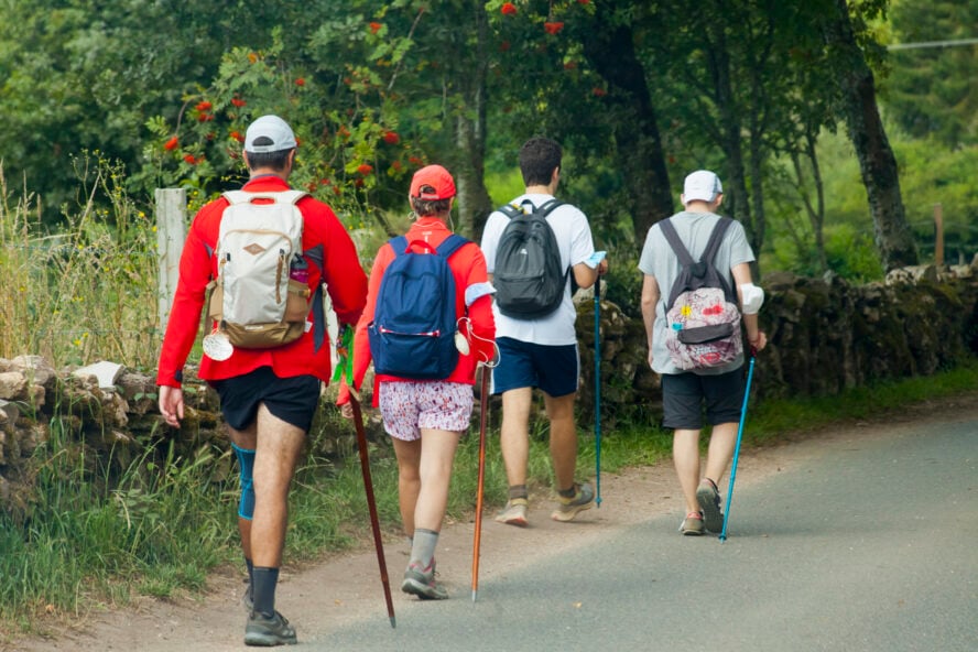

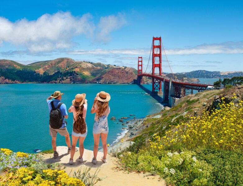
From desert floor to ancient forests, sweeping vistas to plunging gorges, there’s no shortage of mind-blowing hiking destinations across the US. I’ve trekked across many of the best hiking destinations around the world, but overall the United States has the most variety, views and rewards of any of the places I’ve been.
10 Best Places to Hike in the US
I’ve rounded up the best hikes in the US, locations from coast to coast, for all levels and abilities. Whether you’re looking for a day hike, a weekend adventure, or a six-month long-distance trek, there’s something here for you.
Easy Hiking Destinations in the US
- Big Sur – located in California, best for seeing redwoods on short trails
- Sedona – located in Arizona, best for desert-loving hikers
Moderate Hiking Destinations in the US
- Superior Hiking Trail – located in Minnesota, best for a fantastic short thru-hike
- Bear Mountain – located in Upstate New York, best for an easy adventure near NYC
- Grand Staircase-Escalante National Monument – located in Utah, best for slot canyon adventures
- Laurel Highlands Hiking Trail – located in Pennsylvania, best for family-friendly trails
Difficult Hiking Destinations in the US
- Appalachian Trail – located in multiple states in the East, best for hikers with six months to spare
- Grand Canyon – located in Arizona, best for epic hiking challenges
- White Mountains – located in New Hampshire, best for hikers ready for rugged terrain
All-round Hiking Destinations in the US
- Yosemite National Park – located in California, best for hikers looking for iconic views and wide range of hikes
Let’s find out what makes these hikes so special!
1. Appalachian Trail
The Appalachian Trail runs 2,190 miles along the spine of the Appalachian Mountains, from Georgia to the middle of Maine. It passes through 14 states, and is the most popular of the three “Triple Crown” trails in the US. The AT spends the majority of time in deciduous forest, with terrain difficulty varying from region to region.

Sections and day hike options abound along its entire length, and each year thousands of hikers attempt a thru-hike – hiking the entirety of the trail in one push. I thru-hiked the entire Appalachian Trail from Springer Mountain in Georgia to Mt. Katahdin in Maine in spring/summer 2015, taking just over five months to complete it. The mental challenges surpassed the physical challenges during the hike, but it was an accomplishment I’ll carry with me for the rest of my life.
Section, day and weekend hiking options on the AT
For those not looking to undertake an entire thru-hike of the Appalachian Trail, there are seemingly infinite options for section hikes, day hikes, and weekend hikes — with access to other trails branching off the famous white blazes.


The Appalachian Trail can be accessed from hundreds of road crossings and trailheads, with the most popular sections including the Great Smoky Mountain National Park, Shenandoah National Park, and the White Mountain National Forest.
Thru-hiking the Appalachian Trail was one of the hardest things I’ve ever done, but experiencing the east coast from Georgia to Maine on foot, was something I’ll never forget.


Appalachian Trail - Good to Know
Moderate to challenging
Spring, summer, fall
Wooded and mountainous
Full trail is 2,190 miles, with myriad options for sections and day hikes
Check out the Appalachian Trail Conservancy’s
McAfee Knob, Virginia
The Homeplace, Catawba Virginia
2. Grand Canyon
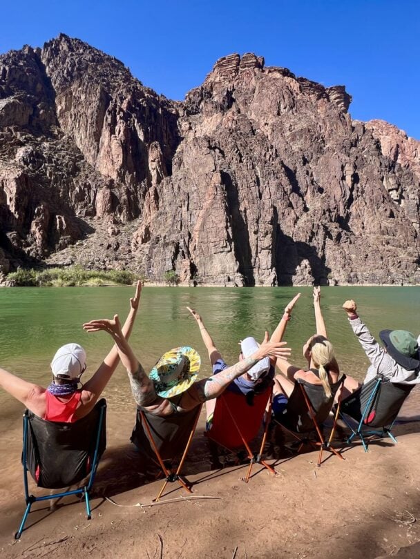
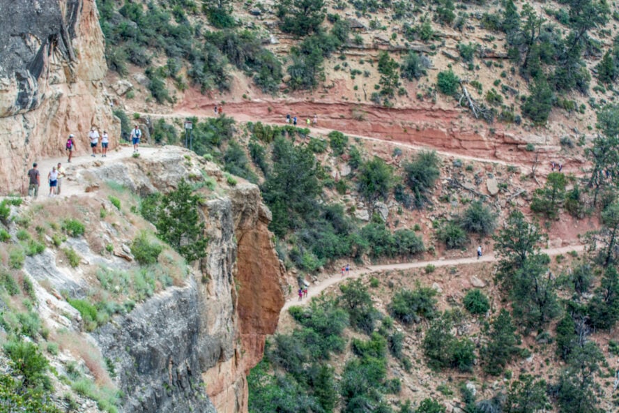
The Grand Canyon is a destination for travelers from around the world, but many of them never leave the rim. While simply standing at the edge of the precipice might be enough for some people, descending and ascending the Grand Canyon is something every avid (and fit) hiker should do in their lifetime
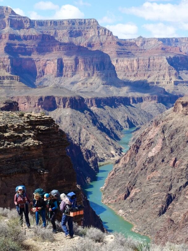

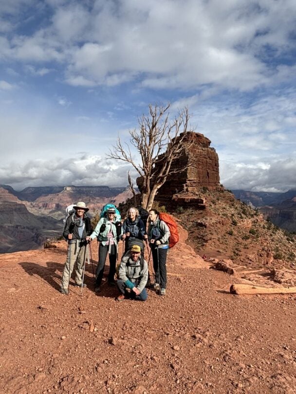
The Bright Angel Trail is the most popular way to descend from the South Rim to the Colorado River, and hikers can choose to hike back the way they came, or take the South Kaibab Trail back to the South Rim. This hike is no joke – the descent plunges hikers over 4,000’ from rim to river, and those are all distances you’ll need to hike back up.
Advice for hiking in the Grand Canyon
Before setting out to hike from rim to river, be sure your fitness and preparation are up to snuff. Each year, hikers run out of water, underestimate the difficulty of the trail, and find themselves in dangerous or deadly situations. I hiked rim-to-rim during the shoulder season, and was pretty astounded by how challenging the climb out was. I considered myself to be in good shape when I set out, but felt the effects of thousands of feet of climbing for a week after the hike.
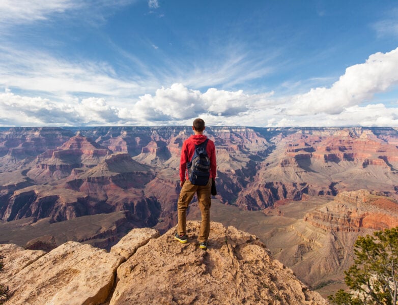
That said, the Grand Canyon is truly a life-list hiking destination, and traversing from rim to river or rim-to-rim is something you’ll never forget. In its entirety, the Grand Canyon National Park has five ecosystems. Hikers venturing from the South Rim of the river to the North Rim will hike through everything from riparian to desert scrubland to boreal forest.
The trick most people miss when visiting the Grand Canyon is that the best views aren’t from the top. The Grand Canyon is so big, that you need to hike into it to get the real scope of its size and beauty.


Grand Canyon - Good to Know
Very strenuous
Fall, spring
Steep, rugged desert hiking
Dozens of trail options, from short overlooks to ultra-length excursions
The National Park Service maps are a great overview of Grand Canyon’s hiking trails
Devil’s Corkscrew on the Bright Angel Trail
Phoenix Sky Harbor Airport is the closest international airport. The South Rim is a 3-hour drive from there.
3. Yosemite National Park
From paved strolls to multi-day high-country expeditions, hiking in Yosemite National Park doesn’t disappoint. The moment you enter the valley, the 3,000’ granite walls dominate the skyline. John Muir was so taken by Yosemite Valley that he lobbied Congress for the act that would eventually create Yosemite National Park in 1890.
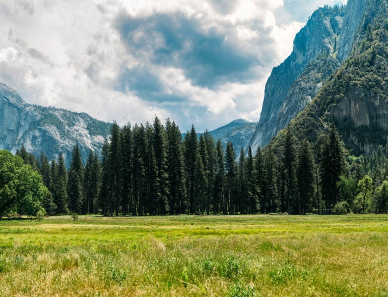
The proliferation of climbing and backcountry exploration in the 1970s drew crowds and increased the popularity of visitation to Yosemite Valley, and today the park sees an average of four million visitors each year. Hiking terrain ranges from open meadows, granite peaks, deciduous and conifer forests, and everything in between.
Plan ahead for hiking in Yosemite
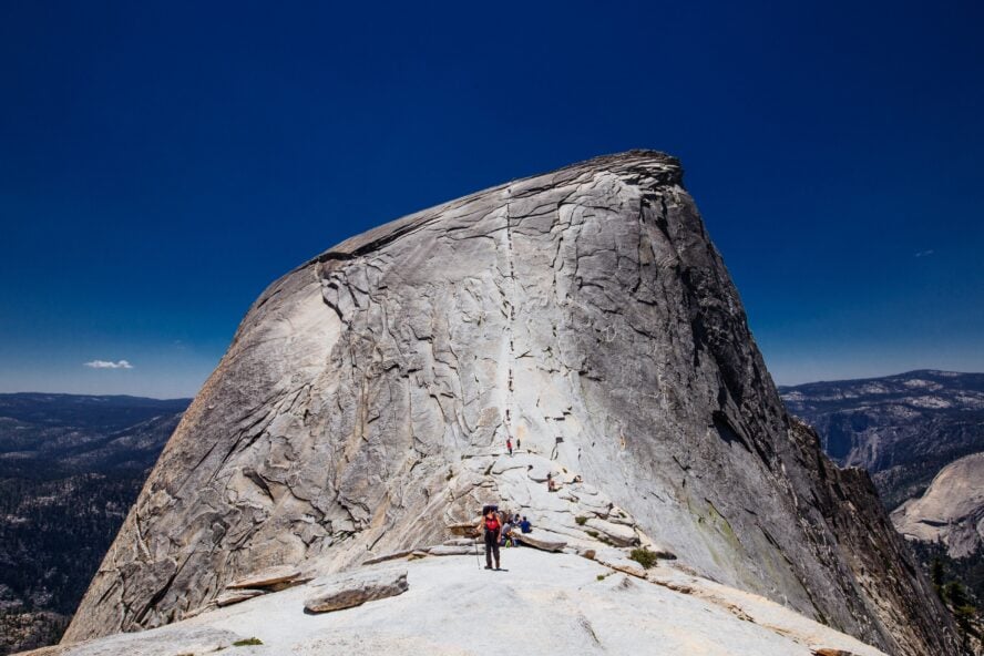
Plan your visit and routes before heading to Yosemite. My father and I started planning our six-day backpacking trip an entire year before we departed. For hiking in Yosemite, backcountry permits are required for overnight stays, and even staying in the tent cabins or other accommodations in the valley require advance booking. We knew we wanted to hike Half Dome, which also required a separate permit, and planning the campsites and permitting was logistically challenging. Even with all of our planning, we ended up with only one out of three itineraries working out, so be sure to have a backup plan (or two) when you plan a Yosemite backcountry trip.
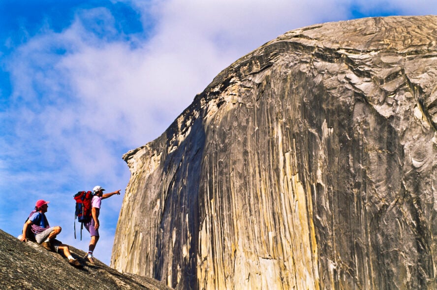
Scaling the Half Dome cables is a must do
Some of the most famous and worthwhile hikes include scaling the cables Half Dome (not for the faint of heart), or hiking the steep ascent to the top of Upper Yosemite Falls. Hikers looking for overnighters or longer backcountry treks should begin exploring the Tuolumne Meadows area as a classic launch point. Note that bear canisters are required for all backcountry travel.
If visiting Yosemite isn’t on your hiking bucket list, it should be. As a professional hiker, I’ve adventured around the world and Yosemite is one of my favorite hiking destinations anywhere.
Read pro hiker and California local Liz Thomas full guide to the best places for hiking in Yosemite National Park


Yosemite National Park - Good to Know
Easy, moderate, difficult…and everything in between
Summer, fall
Open meadows, riverside trails, granite rock faces
Everything from day hikes in the valley to multi-week sections and long-distance trails
Yosemite Hikes have a great collection of trail maps to choose from
Half Dome cables… for advanced hikers only!
The Ahwahnee Dining Room, Yosemite Valley
Hiking Yosemite National Park by Suzanne Swedo
Fresno-Yosemite International Airport and Merced Airport are both about 90 minutes from the valley
4. Big Sur
If you plan ahead, motivated visitors can pack multiple day trails into one day of hiking in Big Sur. Get the most out of the area by choosing a few hikes of varying lengths and types — some trails like the McWay Waterfall Trail will take less than a mile to get to a waterfall, while others like the Limekiln Trails will have you winding on level paths through towering redwood forests. Stone Ridge Trail in the Ventana Wilderness is an excellent loop trail that gives you a taste of Big Sur’s many ecosystems with several campsite options.
Currently closed, Cone Peak Trail will have you climbing the highest coastal mountain in the contiguous US (you’ll have to check for updates on this one). Create a loop with two of the most popular and scenic trails in Big Sur by hiking Buckeye Trail to Alder Creek Camp in the Silver Peak Wilderness area. And Salmon Creek Falls offers a great spot to cool off on a hot day.
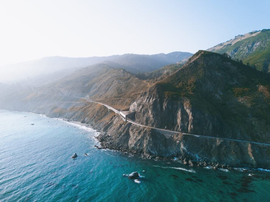
Discover family-friendly hiking in Big Sur
With few exceptions, the trails around Big Sur are perfect for families and hikers who don’t need to get deep into the backcountry to enjoy themselves. The reward for relatively short hikes is high, and exploring redwood forests is something every nature enthusiast should experience. While the hiking out here is glorious year-round, the coastal weather changes in the winter months are as crazy as what you’d find hiking New Zealand’s North Island. Bringing an extra layer is never a bad idea, as fog and drizzle can roll in and drop the temperatures rapidly.
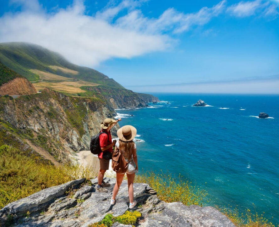
Big Sur is one of California’s natural treasures: a dramatic coastline where redwood groves sprout within sight of ocean coves.


Big Sur - Good to Know
Easy, a few moderate hikes
Spring, summer, fall, winter
Redwood forests, coastal views
Ranges from <1 mile to moderate day hikes around 6-9 miles
Check out All Trails for more than 50 Big Sur hiking trail maps
Ewoldsen Trail
Lucia Lodge, Big Sur
Car rentals, hotels, and cities are all within easy access. Travel around this area is a dream.
5. Superior Hiking Trail
The Superior Hiking Trail is an excellent option for hikers looking for easy access, moderate terrain, a forgiving hiking season, and the option to complete a “shorter” thru-hike. The entire trail can be completed in three to four weeks, and traverses primarily through old-growth forest.
The trail starts about three hours from Minneapolis at Jay Cooke State Park and ends at the Canadian border. The southern section is a 52.8-mile stretch along the Minnesota/Wisconsin state border to the coastal city of Duluth that is only open to day hikers. The northern part runs from Duluth to the Canadian border, with 269 miles of main trail with a bunch of added spur trails for hiking and camping.
The best time to hike the Superior Hiking Trail
The best time to hike the Superior Trail is late spring to early fall, but be ready for humidity, bugs, and rain throughout the hiking season. Hikers looking to get onto the SHT in the fall will be rewarded with splendid colors along its entire length.
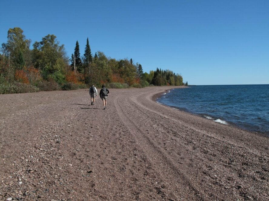
Campsites are plentiful along the majority of the trail, except for the 50-or-so miles around Duluth, Minnesota. However, this section is one of the most scenic along the Superior Hiking Trail, and is prime for day hiking to avoid the logistics of finding a campsite. The trail crosses through eight state parks and skirts Lake Superior during breaks in the tree cover.
Looking to take your first crack at thru-hiking? This 310-mile long trail in Minnesota might be your best bet.


Superior Hiking Trail - Good to Know
Easy to moderate
Late spring, summer, early fall
Old-growth forest, some lakeside sections
310 miles, options for section and day hikes
Short spur trail to the summit of Ely’s Peak
Cascade Restaurant & Pub, Lutsen, MN
Small towns every 40-50 miles make trailhead access easy
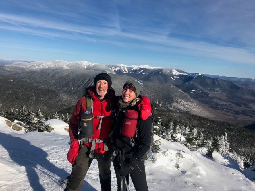
6. White Mountains
The White Mountains are where I discovered my love for hiking, and they hold a special place in my heart. The hiking here is never easy, but that’s not why I hike these trails. I’ve lived and breathed the Whites since I was barely old enough to carry my own backpack, and no matter how many times I’ve heaved myself up the flank of one of the Presidentials, I’m always inspired.

For visitors, trailhead access is easy, information on trail conditions abound, and the hikers working off the New Hampshire “lists” are some of the most dedicated trail hounds out there.
Find rugged, steep hiking in the White Mountains
The trails are incredibly rugged…you won’t find a switchback in sight. A typical peak hike in the Whites gains over 1,000’ per mile, mostly while clambering over boulders, grabbing tree roots, and traversing glorified rock slides with trail signs being the only reason you know you’re still on track. It’s well worth it though — breaking treeline and seeing the green expanse rippling out on all sides makes it worth all the effort.
The New Hampshire 48 4,000-Footers are the most popular peaks, but there’s a lot more to see. Try going off the list and exploring lesser known peaks and trails to avoid the crowds. Despite their lower elevation and (relatively) short distances from trailhead to peak, peak bagging in the White Mountains is nothing to be taken lightly. Weather can change drastically from the time you leave the car to when you reach treeline, and exposure (even in summer) is no joke. Avid New England hikers climb these peaks in all four seasons, but hikers without winter backcountry experience should stick to three-season outings.
I hike in the Whites year-round. The peaks are challenging, the views outstanding, and there are a multitude of trail options. It’s beautiful for a different reason in every season.
by Neil S — the author’s longtime trail partner


White Mountains - Good to Know
Difficult
Summer, fall
Rugged, steep mountain trails in deciduous and conifer forest; open summits
Hikes range from 2-mile day hikes to week-long peak bagging adventures
Find day hiking and backpacking trail maps on the US Forest Service website
Franconia Ridge Loop, Franconia Range
Flatbread Company, North Conway
White Mountain Guide compiled and edited by Steven D. Smith
The driving is scenic through this part of New Hampshire… visit in the fall for the famous foliage
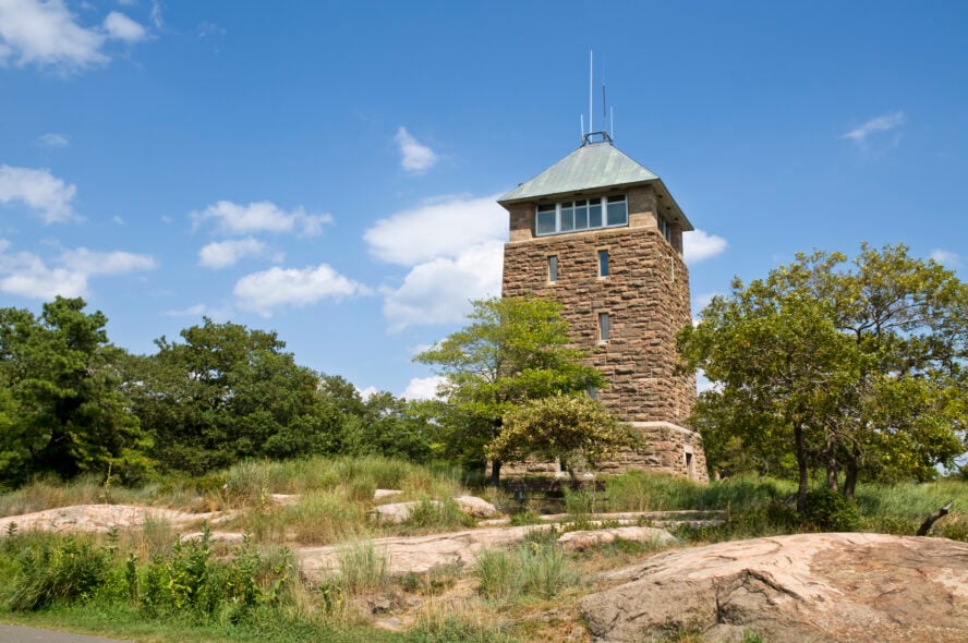
7. Bear Mountain
Bear Mountain State Park is just over an hour’s drive from New York City, making it a solid weekend option for people looking for a hiking getaway without a huge travel commitment. This 5,000-acre park has year-round recreation (skating, cross-country skiing) along with the accessible hiking trails. Hiking Bear Mountain is a must-do, just don’t be turned off by the cars at the top. Yes, you can drive to the overlook, but doing the hike is well worth it. Though steep in spots, the trail is ergonomic and very well maintained. Note the section with over 1,000 stone steps, and marvel at the amount of time and effort it took to build them.
Hiking Bear Mountain as part of the Appalachian Trail thru-hike
I hiked Bear Mountain during my Appalachian Trail thru-hike, and the stone steps were exhausting but an incredible feat of trail building. I ended up here in early July, and it was crowded. There were several school groups and a lot of families at the top. If you have a choice, aim for a weekday visit, or check it out in the shoulder season.
Plenty of things to do at Bear Mountain
There’s no shortage of things to do at Bear Mountain State Park. If the kids are too young to enjoy a longer day hike, check out the zoo, take a scenic drive, or grab lunch at the lodge. For those looking to really hit the best trails, there are more than 200 miles of trails to choose from, with enough loops to keep you busy for every outing you make. No matter how much time you have to spend, there is a mileage and trail combination suited for what you want.
The Bear Mountain Loop Trail is the classic hike, with some steep, rocky sections to get the heart rate up. The view from the top (along with the lookout tower) is worth the effort it took to get there.


Bear Mountain - Good to Know
Easy to moderate
Spring, summer, fall
Wooded trails, scenic overlooks
Day hikes ranging from 1-10 miles, many loop options
Check out the NY Parks website for your Bear Mountain State Park Trail Map
Hiking the 1,000+ stone steps
A paper version of a comprehensive Harriman-Bear Mountain Trails Map
Easy to get to from NYC via Palisades Interstate Pkwy N
8. Sedona
Looking for a winter hiking getaway? Look no further than the red rock paradise of Sedona. Many of the outings will feel less like hiking trails and more like fun rock scrambles leading to deep canyons, flat-topped mesas, and expansive overlooks.
![]()

Keep your eyes peeled to follow the cairns on hikes without defined trails, and be sure to bring plenty of water. This desert landscape is surprisingly lush, but you don’t want to get caught out of the shade without adequate hydration.
Where to find the best hiking in Sedona
Fay Canyon and Bell Rock are both rewarding hikes appropriate for families and hikers of all abilities. If these trailheads look too crowded for your liking, there are plenty more area trails that will get you out and back in five miles or less.
This incredibly beautiful area will stun new visitors with the stark contrast of red rock against blue sky, making it a place you want to visit again and again. Trail access around Sedona is concentrated in small areas and easy to find. It’s possible to get up early for a short hike to an incredible natural feature, head back into town for lunch, then pop back onto the trails in the evening for another excursion. Many trails lead out to unique natural features in just a few miles with minimal elevation gain.
The whole area is luscious red stone you can see melting into the sky, and the trails are user friendly. Hiking in Sedona is easy, supported desert hiking.
by Hannah R — hiker and friend of the author


Sedona - Good to Know
Easy
Winter, spring, fall
Desert sandstone, redrock
2 to 7-mile day hikes
View the Forest Service’s NW Trails Map and the SE Trails Map
Bell Rock, on the Bell Rock Pathway Trail
Creekside American Bistro, Sedona
Great Sedona Hikes by William Bohan and David Butler
Basecamp is Sedona, and trails can be accessed within an hour of town.
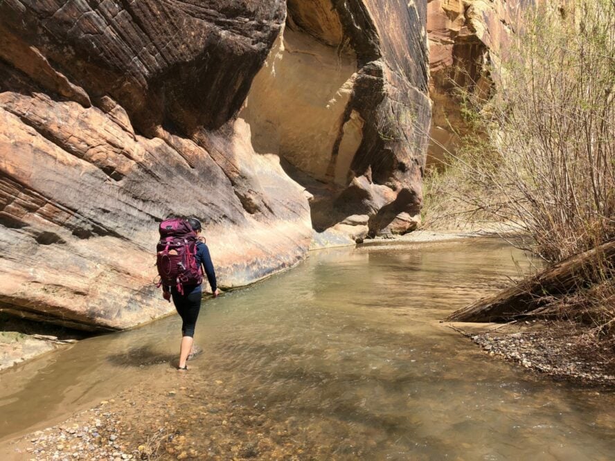
9. Grand Staircase-Escalante National Monument
Southern Utah has some of the best hiking trails in the US, and the Grand Staircase is no exception. Named for the immense “staircase” formations displaying millions of years of geological history, Grand Staircase-Escalante National Monument was originally designated as a nearly two-million acre national monument in 1996.
The size of the monument was reduced with a controversial presidential proclamation in 2017, but the area still features winding trails that cross canyons, desert floor, sandstone, and natural features that highlight some of the best hiking that Southern Utah has to offer.
Accessible camping makes Grand Staircase worth the trip
Grand Staircase has a plethora of day hikes and overnights, with easy and accessible camping. This area is less crowded than other star attractions in Southern Utah, making it a prime getaway for hikers looking to get off the beaten path.
My road-trip partner and I hit the area without a specific plan in mind. We knew we wanted to visit a slot canyon (Spooky and Peek-a-Boo), do an overnight trip (Escalante Canyon), and see some of the most famous attractions in the area (Coyote Gulch), and we were not disappointed.
Unlike national parks, we didn’t need advance reservations for overnights or hikes, and the camping was plentiful. It was easy to spend a few days here spur-of-the-moment, and the people in town were incredibly kind and welcoming.
The Grand Staircase-Escalante National Monument Visitors Center is a hotbed of information, with up-to-date beta on water sources, road conditions, and trail accessibility. Plan your trip in advance, not because you need reservations, but because there is so much to do you’ll want to make sure you don’t miss a thing. There’s base camping at any number of sites off Hole-in-the-Rock Road, and you plan your adventure from the quaint Escalante Mercantile in town.
My favorite Grand staircase escalante overnight hiking trips
A few options include mellow overnight hiking through the 14-mile Escalante Canyon, Coyote Gulch, and exploring the narrow slot canyons at Peek-a-Boo and Spooky Slots. These canyons are easily accessible and some of the most popular features in the region, but can be more crowded than other trails and hikes. No matter what you decide to do here, you can’t go wrong.
Doing an overnight end-to-end hike through Escalante Canyon was the highlight of our visit. Just be sure your feet are ready for many miles hiking through ankle-deep water!
by Kala J — hiker and friend of the author


Grand Staircase-Escalante National Monument - Good to Know
Easy to moderate
Spring, fall
Desert, sandstone, slot canyons
Day hikes, overnights
Peek-a-Boo and Spooky Slot Canyons
Escalante Mercantile, Escalante
Hiking Grand Staircase-Escalante & the Glen Canyon Region: A Guide to 59 of the Best Hiking Adventures in Southern Utah
Take Scenic Route 12 to get to Escalante. You won’t regret it
10. Laurel Highlands Hiking Trail
While the Appalachian Trail through Pennsylvania might have a bad reputation for its rocky tread, the Laurel Highlands and Ohiopyle region has some of the mid-Atlantic’s best hiking trails and terrain.
Hikers heading to this area can expect lush valleys carved by thousands of years of river currents, sweeping vistas, laurel blooms, and a wide variety of trails that offer everything from kid-friendly waterfall hikes to longer backpacking trips on well-maintained, clearly marked trails.
The Laurel Highlands Hiking Trail is one of the crown jewels of the region. This 70-mile trail has campsites and overnight areas every 10 or so miles, making it ideal for a few days out on the trail, or an easy overnight out-and-back excursion. This is a great place to experience backpacking for the first time and get your gear dialed. Utilize the Laurel Highlands Hiking Trail shelters in Laurel Ridge State Park. Accessible trailheads provide a variety of loops, out-and-backs, and trail options for all difficulty levels, and many of the trails are easy-to-moderate while offering spectacular views for not too much effort.
The amount of information, plus local outfitters in the region, makes this an easy destination throughout the entire year and a friendly community to be involved with.
by Eric K — hiker and friend of the author


Laurel Highlands Hiking Trail - Good to Know
Easy to moderate
Spring, summer, fall, winter
Forests, overlooks, waterfalls, gorges
Short day hikes to multi-day overnights
Download this free Laurel Canyons trail map
Carol and Dave’s Roadhouse, Ligonier
A Hiker’s Guide to the Laurel Highlands Trail by Pennsylvania Chapter Sierra Club
This is a populated region and is highly accessible by vehicle and from urban areas in the mid-Atlantic