At first, when you hear Washington you might think of Seattle, Mount St Helens or Mount Rainier (don’t worry, we’ll get there). To the climber, Washington stands tall as one of the best states for rock climbing. You think of snow-capped peaks, rushing rivers, rain forests and Puget Sound. Coffee, ocean, rain, desert, islands, volcanoes, seafood and cherries could all be valid one-word slogans to define this corner of the U.S. I’m personally astonished at the climbers I see in parking lots across the country with Washington plates. I wonder why they left in the first place when their home state is one of the best places to rock climb in the world!
Early exploration of Washington’s mountains likely began long ago with the first Indigenous inhabitants. The Suquamish, Duwamish, Nisqually, Snoqualmie, Yakima, and Muckleshoot tribes used the adjacent Puget Sound, Cascade Range, and eastern scablands as fertile land to live and prosper. Many formations were likely visited and named by Indigenous Peoples long before the white settlers arrived with an eye for the vast timber and other natural resources available. It’s worth your time to explore the rich history and collective stories of these great tribes before creating your own memories on rock climbing adventures!
So let’s explore why rock climbing in Washington is worth a seasonal trip — or at least to make one of the following trips once! Trust me, you will be back.
1. Mount Rainier (Tacoma)
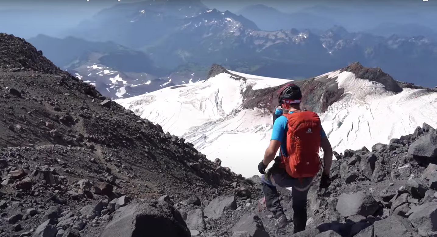
Mount Rainier needs little introduction. Rising from the continental shelf of the Pacific to an impressive 14,411ft, this volcano (yes, an active volcano) dominates everyone’s skyline from Everette to Olympia. Home to some of the best hikes in Washington, Mount Rainier is so big that it creates its own weather, which should be top of mind for climbers once standing at its base. Weather determines how long you can be up there until the mountain’s mood changes.
Mount Rainier is also the tallest mountain in the state of Washington as well as the tallest of the Cascade range. Originally known to the First People as Talol, Tacoma, or Tahoma, Captain George Vancouver of the British Royal Navy unceremoniously gave the mountain its current name. While sailing by the mountain in 1792, Vancouver named the peak after his friend, Rear Admiral Peter Rainier, a fellow officer who fought against the American Revolution. Non-native explorers first climbed Rainier in 1870 via the Gibraltar Ledges route. Ever since Mount Rainier is the lower 48’s premier mountaineering objective.
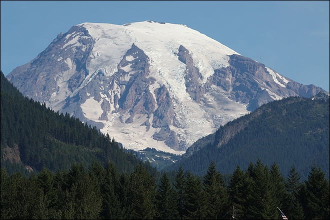
Prepare for unexpected weather when rock climbing at Mount Rainier
The most popular routes draw about as many people as the rock climbing in California and include Muir Snowfield, specifically as a path to Disappointment Cleaver, and the Emmons Glacier. Rainier season is year-round for its many enthusiasts. May through August is peak season for first-time visitors doing some of the more common routes (of which there are many). Late June to late August sees the majority of ascents because the glaciers reach a point of equilibrium with snow bridges and exposed crevasse hazards. Depending on the year, some crevasse hazards are impassable without the aid of ladders. For this reason, it’s a good idea to check many sources for Mount Rainier’s weather conditions before venturing toward the summit.
High-alpine temperature swings will keep you on your toes
In spring, it’s possible to see snow flurries and winter-like storms followed by glorious and hot sunshine. Either contingency can make progress a chore. That said, the weather can be equally agreeable at any time. Typical averages at Camp Muir and Schurman can see highs in the 60s with lows in the 20s. Keep in mind, summit temperatures can sink well below freezing, even in the summertime.
Save your spot before you head to Mount Rainier
On your first visit to the mountain, be sure to acquaint yourself with the policies of the mountain regarding camping. Registration is required when going above 10,000 feet or onto any glaciers. Registration is $45 per person per calendar year at Paradise Ranger Station, White River Wilderness Information Center, and the Wilkeson Wilderness Information Center. Advanced reservations can be made online with the National Park Service for $20. This is in addition to the $45 permit fee and does not guarantee space in the public shelter at Camp Muir. These reservations can be made between May 1 and September 30, but not before or after those specific dates.
What to know before you go
As always, leave no trace and respect the rules of the mountain as put in place by the NPS. This emphasis on regulation may seem to detract from the experience, but remember, they are in place to protect this very popular mountain. It’s popular for a VERY good reason. After a climb, I really prefer Base Camp Grill in the town of Ashford for my post-summit goodies. If you can time it right, the Rainier Mountain Festival is hosted every Labor Day. The perfect time to try some of those Mt. Rainier hikes everyone seems to be talking about.
Mount Rainier needs little introduction. Rising from the continental shelf of the Pacific to an impressive 14,411ft, this volcano (yes, an active volcano) dominates everyone's skyline from Everette to Olympia.
Mount Rainier (Tacoma) - Good to Know
Mountaineering
May-August
Disappointment Cleaver, Camp Muir, Emmons Glacier
Alpine Ascents International, American Alpine Institute
2. Mount Baker
Rising to 10,781feet with a nearly 9,000 feet prominence from sea level, MountBaker demands to be climbed. When viewed from nearby Bellingham, her relief is dramatic! For those wishing to climb Baker, it would be wise to know that after Mount Rainier to the south, Baker is the most glaciated mountain in the lower 48. Indigenous peoples called the mountain Kulshan before white settlers renamed the geological wonder. Kulshan is translated into a multitude of names including “white sentinel,” “puncture wound,” and “crater.”

U.S. Forest Service- Pacific Northwest Region, Public domain
Prepare for record-breaking snowfall at this mountain
Baker is geographically positioned to get a ridiculous amount of snow thanks to its gifted position in the range. Mount Baker lies west of a large portion of the Cascades, leaving it a prime dumping ground for any moisture moving in from the Pacific. Due to this geography, Mount Baker can see as much as 50 feet of snowfall per year. It also holds the record for the highest single-season snowfall in the world after the 1998-1999 winter dumped 95 feet of snow! Due to this fact, Mount Baker is heavily glaciated and requires thorough knowledge of glacier travel. More about that next.
My favorite routes and climbs at the Baker summit
There are many many routes that lead to the summit of Mount Baker, but the three most popular, and in my opinion most classic, are the Coleman Deming Glacier, The North Ridge, and the Easton Route. While the Eastman Route is the easiest trek, it also allows for snowmobiles making it the least appealing of the main lines to the summit. The Coleman Deming route follows named glaciers from the Heliotrope trailhead. You’ll head first to the Coleman glacier then up to a saddle between Colfax Peak and Baker’s summit where the Deming glacier is encountered. This takes you to the summit.
The North Ridge is as much an artistic expression of a climb as it is an exceptional mountain route! A similar approach as for the Coleman-Deming, one makes their way to Hogsback camp in a short approach. From camp, gentle glacier travel brings you to two options for a steep snow ramp/gulley to the ridge-proper. Typically, I prefer the left when it is not melted out, since it has less ice and rock-fall hazard. From here, amazing, low-angle glacier ice climbing is encountered transitioning into a low-angle glacier all the way to the summit. A beautiful line indeed!
The best time of year to climb Mount Baker
Typically, the best season for a guided climb on Mount Baker will run from May to August. Prime climbing season is similar to Rainier: July through early August. Because of its high snowfall, bridges of snow covering crevasses can last longer here than on Rainier. As climate change continues to raise temperatures on the mountain, however, seasonally this is becoming less common. At times, routes can be left near-impassable due to crevasses being too wide to navigate. No permits are required to climb Baker. Although to park your car at any of the trailheads, a Northwest Forest Pass can be attained online for $30. Although this is the case, it is highly advised that you register for free for your safety. Registration will allow the park to know that you are on the mountain should you need a rescue!
The Washington Cascades never disappoint. Exciting alpine terrain set deep in the wilderness makes it the perfect location for climbers looking to train for larger ventures.
Mount Baker - Good to Know
Ice climbing, glacier climbing
Il Caffe Rifugio and North Fork Brewery in Deming
July-early August
Easton Glacier
American Alpine Institute
3. Washington Pass
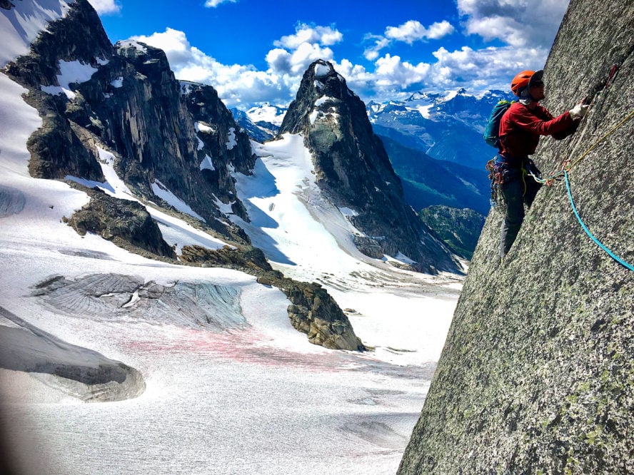
This amazing, alpine granite paradise is situated right on the Cascade Crest with a starting elevation of 4,875! As climbers, the main draw here is the Liberty Group. When approached from the east by Winthrop, the massive, immaculate granite formations stand like sentinels guarding the area. Unlike other alpine rock in the Cascades, these granite escarpments have long, continuous crack systems. These systems mean the rock is less crumbly and more consistently sustained, making for a much more pleasant and straight-forward climbing experience.

Enjoy the classics by climbing Liberty Group and Cutthroat Peak
There are, of course, many other formations in the area such as Cutthroat Peak along with some surrounding crags around Cutthroat Lake, Silver Star and the amazing Wine Spires. You’ll have plenty to do with so many other smaller crags, but the main draw here is the Liberty Group! Situated high on the pass and directly above HWY 20, this grouping of towers are the following formation listed from south to north: South and North Early Winter Spires, Lexington Tower, Concord Tower and the Liberty Bell.
Beautiful routes can be found on all of them, but the classics hone in on the SEWS, and Liberty Bell. To reach either, park on the west side of the pass at Blue Lake Trailhead using your Northwest Forest Pass. To access east-facing routes on SEWS, park at the Hairpin and work your way up the gully to your route. Know it can be steep with snow in the early season. For the eastern routes on Liberty Bell, park at a pullout just west of the hairpin turn.
My route recommendations for the iconic SEWS climb
By far the two routes I’d choose on SEWS are the South Arete (5.4 on the climb and descent) and the Southwest Rib (5.8). The Southwest Rib follows gullies and ledges across the southern flank of the formation, crossing an amazing, exposed fin of rock that goes by many names. You’ll then get into boulder hopping on the summit, which is the tallest in the Liberty Group. This is also the descent for all routes topping out the formation, so pay careful attention if planning to do other routes! Given the nature of this route’s popularity, it is typically easy to follow the well worn climbers path down. The Southwest Rib holds a spectacular position on that side of the spire with pitches each have different characters. The most notable pitch is called the bear hug. Either bring a BD #5 or don’t, but be ready for some interesting climbing!
Find advanced pitches with Liberty Bell’s classic routes
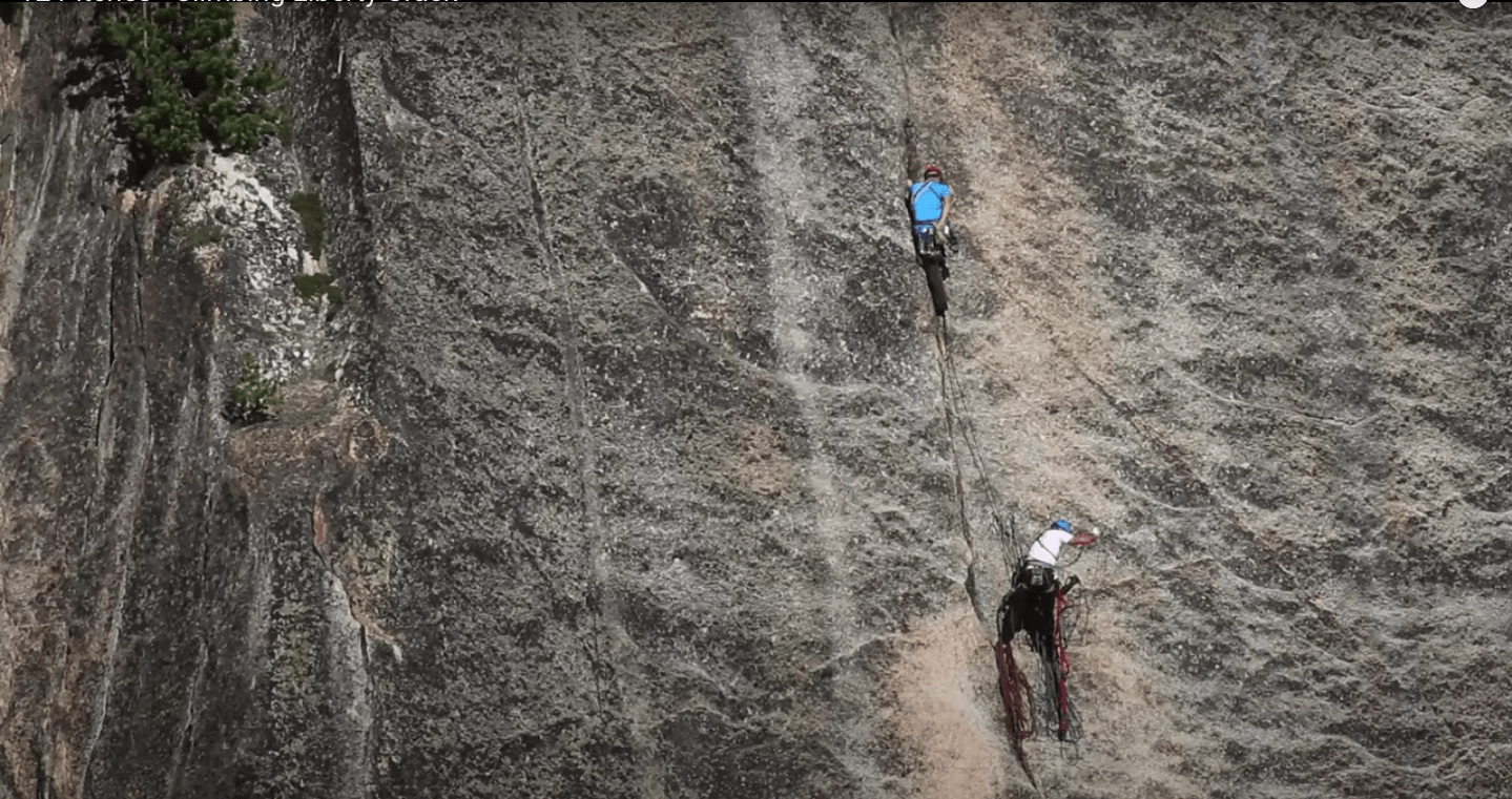
Other, harder routes also attract attention here, the Direct East Buttress being my favorite with a rating of 5.11 and well protected as Cascade rock climbs go! Further to the north, the Liberty Bell holds a plethora of classic routes from the “50 Classic Climbs,” Liberty Crack (5.11 C2) and the Beckey Route (5.7). The former is one of the best free climbs/aid routes in the country, in my opinion. With a fairly simple approach and a beautiful alpine setting, this continuous crack system has enough to keep everyone smiling! In case you’re looking for a challenge: To this date, the Lithuanian Roof on pitch 2/3 has only been freed once.
Best time of year to visit Washington Pass
This of course means the season for rock climbing is shorter than other areas in the range, with the best climbing generally done from late May to September. In May and much of June, it is not uncommon to encounter snow on your way to the routes, so check with conditions and plan accordingly. It is also worthwhile to check for the state of the road and whether or not it is open to traffic. Typically closures run from November through late May, but don’t be surprised it closures run into June.
What to know before you head out
While getting to Washington Pass, or just after leaving and heading east, I love to head to the Mazama Store in Mazama. Here, you can find pretty much anything you need from gas to groceries to beer. Right next door is Goat’s Beard, where you can find any last minute climbing gear you may need. Also, located in this store is North Cascade Mountain Guides, who can give you recent conditions updates and take you up the less-traveled terrain in Washington Pass, which highly recommend! A lot of nearby campgrounds offer a range of prices. Free, dispersed camping can be found off of Goat Creek Road in Mazama. Please leave no trace here as the area continues to become more popular. The Winthrop Rhythm and Blues Festival is held every July and is the perfect excuse to plan your trip.
The Beckey route is one of the best free climbs/aid routes in the country, in my opinion. With a fairly simple approach and a beautiful alpine setting, this continuous crack system has enough to keep everyone smiling!
Washington Pass - Good to Know
granite
Mazama Store
late May-September
South Arete; Southwest Rib
Goat’s Beard
Free camping off Goat Creek Road in Mazama, campgrounds available off HWY 20
4. Leavenworth
As you drive into Leavenworth, it becomes quickly apparent that you are no longer in a PNW, but rather an 18th century Bavarian village somewhere in the Alps. It may seem that Leavenworth is less of a destination for rock climbers as it is for boaters, anglers, and retirees looking for a quirky vacation with a Swiss theme. After the railroad rerouted outside of the town in the early 1900s, the town struggled to maintain. Then in the 1960s, town leaders decided to exploit their Alps-like location by creating a themed town to attract visitors, complete with its own seasonal festivals.
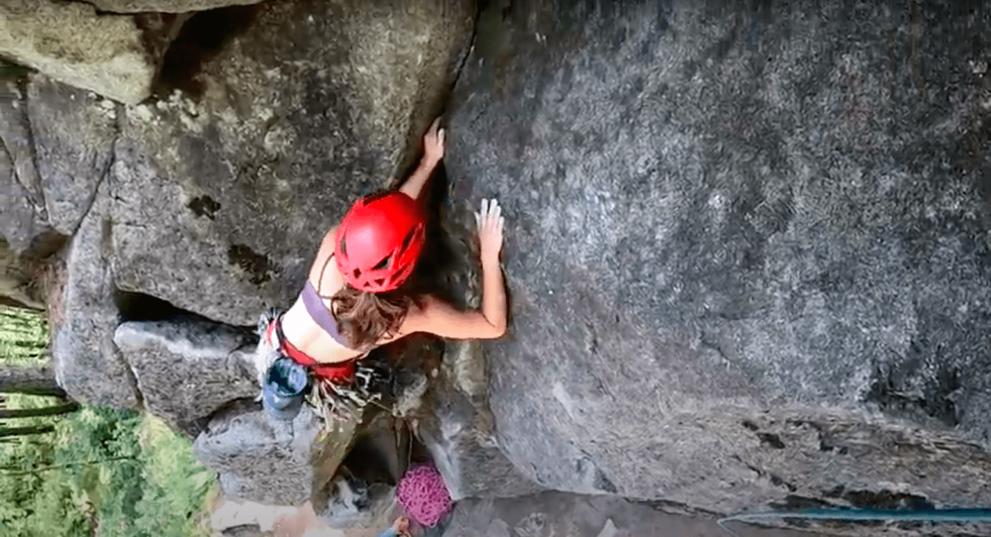
For climbers, perhaps we are indifferent, put-off, or psyched about the town’s interesting choice of theme. All said, you cannot deny the rich availability of rock climbing to be had! Located on a huge granite batholith, Leavenworth’s rock is similar to that found in Washington Pass but on smaller cliffs. That said, it’s not hard to find enormous, spectacular, alpine granite here as well.

I recommend Tumwater Canyon for stellar crags near town
The Enchantments are not to be missed. They offer some of the most concentrated and stellar climbing in any alpine terrain around the world. These rocks, however, are a story for another time! Located near town are stellar crags, ranging from 50 feet tall to 400 feet that are located in two drainages, Tumwater Canyon and Icicle Creek. Let’s look at Tumwater to start. Tumwater Canyon is the main drainage following US HWY 2 as it flows east from Stevens Pass towards Leavenworth.
You won’t want to miss February Buttress multi-pitch routes
I recommend a few main points of interest. You’ll want to head to the roadside multi-pitch areas of February Buttress with Ground Hog Day (5.6) at the mouth of the canyon on the north side of the road and the spectacular Castle Rock with routes like Midway (5.6) and Canary (5.8). Ground Hog Day on February Buttress is a mellow, three-pitch 5.6 that faces south, as does all of the climbing in the Tumwater, and rises about 280 feet from the roadside. Park just across the road from the crag just before entering, or after leaving, town around the curve. This ledgy route is best done in three pitches and rappelled. Although I suggest being careful, as the ledgy nature of the route lends itself to stuck ropes.
My advice for Washington’s first multi-pitch route
A little further upstream is the amazing Castle Rock. At 400 feet tall, Castle Rock faces south, high on the hillside, beckoning climbers with its flat face covered in cracks and corner systems. Here you can find Washington’s first multi-pitch route, Midway (5.6) with three-pitches. The prolific first ascensionist Fred Beckey first put up on the route. If you haven’t noticed, his name comes up a lot in Washington rock climbing, and mountaineering. Check out the movie, Dirtbag: The Legend of Fred Beckey, if you haven’t already.
Castle Rock also has a stellar crack route known as Canary. Leaving from Logger’s Ledge, which breaks up the formation into a lower and upper section, you take a stellar comer up to a “beached whale” maneuver on to Saber Ledge. From there, one makes a glorious step-across sequence onto a wildly exposed arete that gets as scary as the approaches you find climbing the Front Range. Have the camera ready. Follow it up an increasingly nebulous exposure to the top of the formation where you can walk off.
Now for some single-pitch routes at Icicle Creek
Located up the other drainage, leading south out of town towards The Enchantments, Icicle Creek begs for climbers to find and climb its hidden granite crags. Typically climbed in the summer, due to its deeper nature, single-pitch areas dominate the style here. The exception is the beautiful Snow Creek Wall, an 800-foot granite escarpment with one of the longest routes in the area, Outer Space (5.9). This amazing crack route climbs seven pitches of splitter granite cracks. The stellar final pitches are as amazingly exposed, hand crack. A walk off allows for a reasonably easy descent back to the base. You’ll reach this classic by parking in the Snow Creek Wall parking lot.
A single-pitch area for Icicle Creek that gives the climbing in Red River Gorge a run for its money is the Eight Mile Buttress. The area bears the route’s name and is near Eight Mile Campground. Hidden on the south side of the road, down an embankment, you actually park on top of the crag on the side of the road and hike down. In the shady trees, this small crag stays shaded even when it’s getting warm elsewhere.
Leavenworth’s quick leads and main cracks
Here are the three main cracks: Twin Cracks and Classic Crack both 5.8, with Deception Crack at 5.9. Only 50 feet tall, these are quick leads for a morning or afternoon session of moderate crack climbing. The Purina and Careno crags are other great single-pitch areas that should be for good routes in the sun. Another area to visit is the small, Little Bridge Creek Rock where two nice crack lines can be found. Crystal Time (5.7) is a great route that starts trad and switches to bolt-protected face climbing to a chain anchor. Don’t forget about Arms Control, a steal 5.10 corner climb!
Make the most of your trip to the Alps of the PNW
After your climbing, you will likely be wanting to grab a bite and perhaps some brews. Well, Leavenworth has quite the assortment to choose from. I recommend Stein Leavenworth for your dinner. For an amazing sandwich and your grocery needs, visit Dan’s Food Market and ask for the “Danwhich.” Looking for gear? Der Sportsmann downtown is a good place. If you would like to hire a guide for some serious business in the Enchantments or to push your limits locally, head over to Northwest Mountain School! Leavenworth hosts a flurry of festivals, year-round and can be found on the Leavenworth website. For climbers, the Leavenworth Rock Fest is held in early May and is not to be missed!
Located on a huge granite batholith, Leavenworth's rock is similar to that found in Washington Pass but on smaller cliffs. That said, it’s not hard to find enormous, spectacular, alpine granite here as well.
Leavenworth - Good to Know
Granite
Hand cracks, multi-pitch, single-pitch, trad, free climb
Der Sportsmann
Northwest Mountain School
5. Index
The climbing in Index is legendary for a reason. Off the map to outsiders for most of its history, due to its notoriety as an aid climbing venue, the ‘80s saw many old aid lines go free. Later, the ‘90s gave birth to a smattering of bolted sport routes. As progress continued, it was inevitable that Index would not stay a locals only spot for long. Like climbing in the Gunks, the style here is very trad—even the sport lines, short of the slab and knobby face routes have the feel.
Most areas face east to southeast, yet the lush vegetation and trees offer plentiful shade with the right area choice.

Prepare for challenging pitches at Index’s crack routes
For those looking for their granite crack fix, few areas in the country are as closely populated as Index. Grades here vary and run from 5.4 to 5.14d. Typically, grades sit between 5.9 and 5.12. Calling all Yosemite lovers! You’ll find a home here with the 5.10 and 5.11, but be wary, 5.12 elsewhere is typically considered an Index 5.11b. Moderate grades are plentiful at Index, but far between. One must walk to different walls in order to climb more than 3 or 4 routes at a grade of 5.8 or less. Fortunately, many harder routes can be top-roped by leading more moderate routes that share anchors!
My favorite climbs are broken up into Town Walls routes, then everything else
Index can be broken up into many wall areas, but I prefer to think of them as the Town Walls routes and everywhere else. By far, the most stacked and popular areas reside with the Town Walls. The Lower Town Wall is the most popular due to its large concentration of routes, many of which are 5.9 and 5.10, as well as its incredibly short approach. Be there in 2 minutes flat.
For good reason, this area is popular with 5.6-5.10 routes such as Pisces (5.6), The Great Northern Slab (5.7), Godzilla (5.9+++), Japanese Gardens (5.11d but the first pitch can be done at 5.9+), and Iron Horse (5.110/12) lending themselves to the classics.
Try these Inner and Middle Wall routes for classics and solitude
It is this author’s opinion, however, that once you leave the bounty of the Lower Wall and begin to explore, you will find both classics and solitude. For my bet, the Inner Walls are where I go on hot, weekdays where you will find beautiful, moderate crack routes like Toxic Shock (5.9) and Corner Flash (5.7) that give rock climbing in Utah a run for its money. Parking is the same here as for the Lower Town Wall.
Another favorite is the Lookout Point Area, where my favorite route is by far Rattletale (5.10b). This excellent crack route consists of three interesting and short pitches. It’s well protected and satisfying crack climbing! Park in town at Heybrook Ridge Trailhead, and walk down the railroad tracks near the general store until a trail branches off right into the forest.
Finally, another area to check out during your guided climb on Index is the Middle Wall. It’s about as crowd-free as rock climbing in Wyoming, but with much shorter approaches. Specifically, Mid Wall where you can find routes like Plum Pudding, a well-protected, lie-back burl-fest! PBR is another great corner system (5.10b) and also a line one can access the lower portion of by leading the former route!
Weather in Washington’s Index area
You won’t find the warm, dry climbs of Joshua Tree here—the climate at Index may feel a bit humid as its location on the West (a.k.a. wet) side of the Cascades, lending itself to regular rain in spring and winter. Typically summer is warm and dry and most climbers will find joy in being here during a peak leaf color, fall day.
Things to know before you head to Index
For two years, the AAC Cascade Chapter has hosted the Index Climbing Festival with potential for more in the years to come! The annual Index Arts Festival is awesome to attend! Be sure to pay a visit to the Index General Store and feel the age of this awesome, historic town! The River House is a great stop for food and beer after a long day spent climbing! Be sure to stock up on climbing gear before you leave Leavenworth or Seattle, as climbing gear will not be found in index. For a guide, Northwest Mountain School, The American Alpine Institute, and North Cascades Mountains Guides all serve this area.
Index can be broken up into many wall areas, but I prefer to think of them as the Town Walls routes and everywhere else.
Index - Good to Know
Sport, aid, trad, free
Index General Store, River House
No outfitters in Index: head to Leavenworth or Seattle
Free camping on the river near Lower Town Walls
Northwest Mountain School, The American Alpine Institute, North Cascades Mountains Guides


