Three years. That is how long I lived inside Torres del Paine National Park. Not in Puerto Natales. Inside the park itself, at a lodge so deep in the backcountry that the first sound each morning was a glacier. I have guided here for nine years total now. I still cannot decide which is my favourite view, because the answer changes with the light.
Puerto Natales is home. My wife Marina and our two kids are there, 112 kilometres (70 miles) from the park entrance. But for three of those nine years home was inside the backcountry itself. I know which section of the trail breaks people and which one restores them, and I know the French Valley before the wind arrives.
My background is in graphic design and photography, which means I think in frames. After nine years of guiding Patagonia trekking here, this mountain still gives me new ones.
This article is my attempt to explain both routes, the difference between them, and why that choice matters more than most people realise when they book. I still think the choice between these two routes is one of the most interesting decisions a person can make about how to spend a week of their life. Let me explain why.
What Makes Torres del Paine the Center of Patagonia Trekking
Torres del Paine National Park Chile sits in the Magallanes region, the last corner of the country before the continent tapers toward Cape Horn. Puerto Natales is 112 kilometres (70 miles) from the park entrance. Punta Arenas, the regional capital, is another 300 kilometres (186 miles) south.
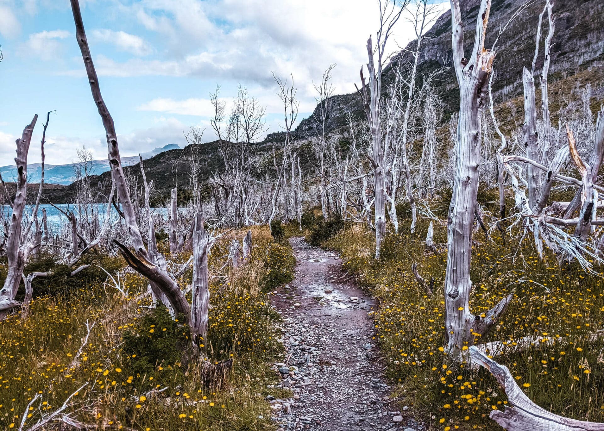
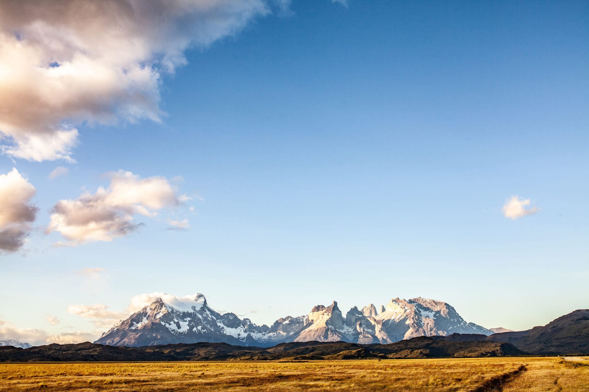
The park was declared a UNESCO Biosphere Reserve in 1978. It covers more than 180,000 hectares and holds an extraordinary range of ecosystems. Move from east to west and you pass through completely different worlds.
The east is dry grassland, open pampas reaching toward Argentina. The centre is alpine valleys and native lenga beech forest. The west is dominated by glaciers fed by the Southern Patagonian Ice Fields, the third-largest mass of ice on the planet after Antarctica and Greenland. That ice field shapes the climate, the wildlife, and the whole character of the park.
This is where Patagonia trekking concentrates, and there is a reason for that.
A mountain range unlike any other
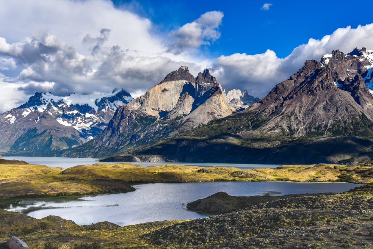
The Paine Massif at the heart of the park is not part of the Andes. The Andes formed between 60 and 80 million years ago. This range pushed up from below the surface only around 15 million years ago, which in geological terms is extremely recent.
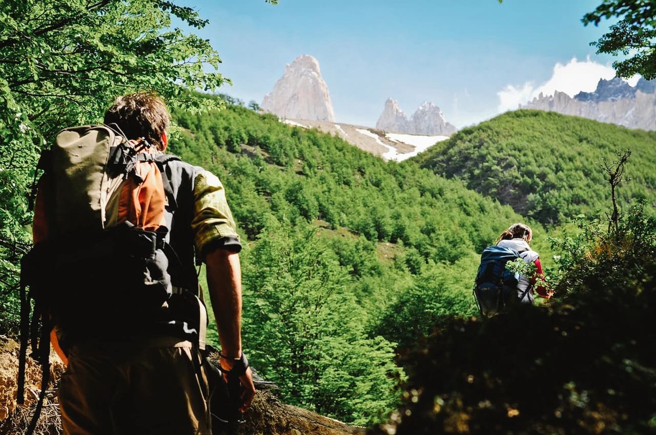
That intrusion of granite created the isolated towers and horns you see in every photograph. They sit alone in the landscape, surrounded by lakes and valleys, in a way that nothing else quite replicates.
I have looked at those towers from every angle and in every season. My photography background means I am always looking for the frame that tells the whole story. This mountain never runs out of new ones.
Wildlife that shares the trail with you
Torres del Paine is much more than mountains, and I say that clearly because many people arrive expecting only scenery and leave having experienced something far larger.
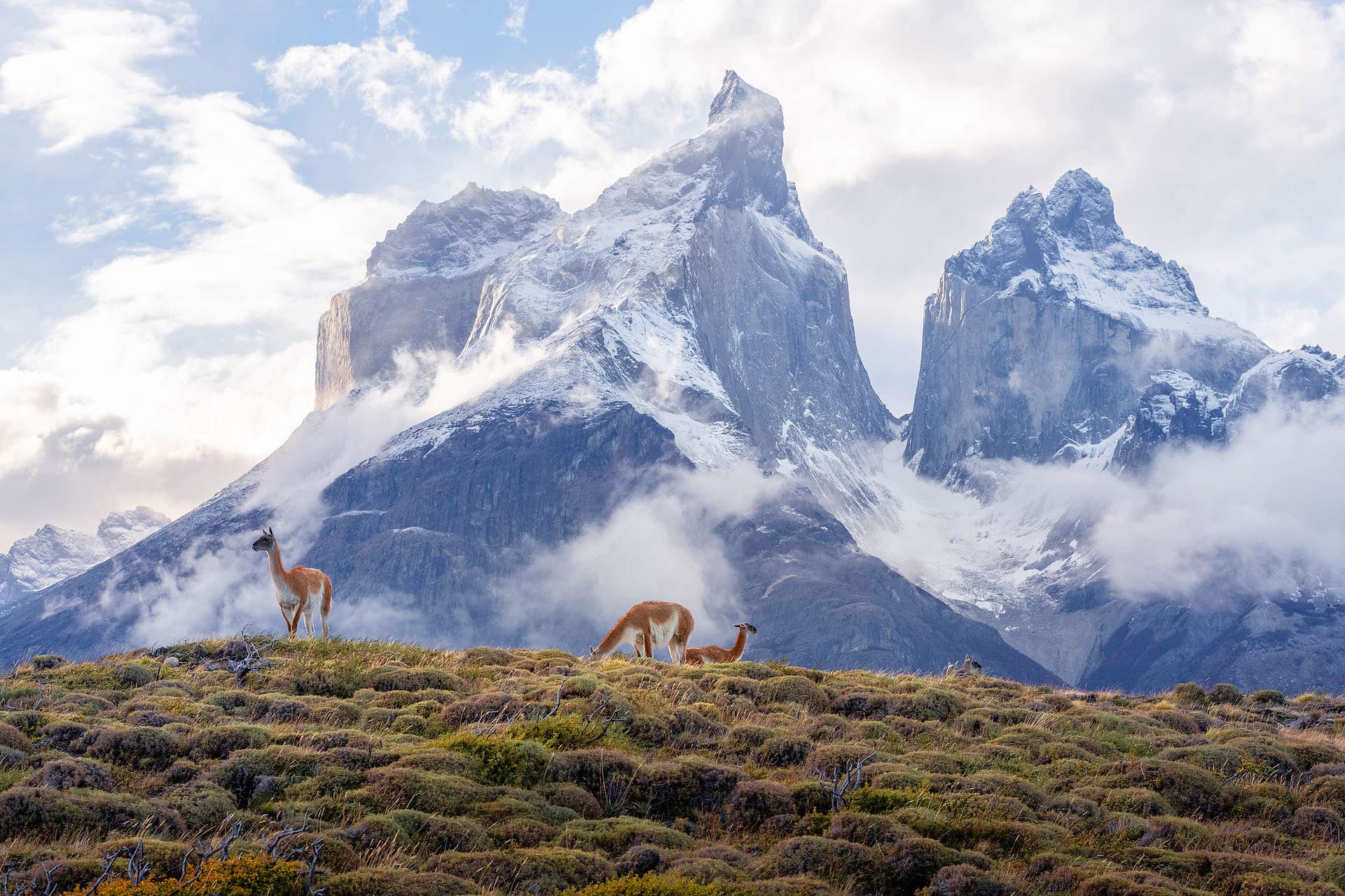
The eastern grasslands support enormous concentrations of guanacos, the South American camelid at the base of the entire local food chain. Pumas hunt them, always going for the chest and shoulder first. Once a puma abandons a carcass, the Andean condors arrive. These are scavengers, and they find a kill quickly. I have stood and watched forty or fifty condors wheeling in silence above a single guanaco.
They are enormous birds and when they finally descend, all of them together, it is one of the most extraordinary things this park offers. After the condors, the grey foxes move in. Then the skunks. Every animal in this ecosystem traces back to the same chain, and the guanaco is what holds it together. In some parts of the park, guanacos genuinely outnumber people.
Darwin’s rhea sprints through the open pampas, too fast to capture properly in a photograph. Andean deer shelter deep in the western forest, solitary and rarely seen. Their numbers have fallen to the point where they are now considered an endangered species, and a sighting is a genuine privilege.
On the O Circuit, where the back section sees far fewer visitors, puma encounters are genuinely possible if you move quietly and stay attentive. The park gives you the space and the time for that.
Stay longer than you planned
This is why I always tell people who have come this far: build in one or two extra days outside the circuit. The W and the O take you through the mountain. The eastern grasslands take you through what the mountain feeds.
You need both to understand what Torres del Paine actually is. Do a horseback ride, a day hike in the pampas, a wildlife drive. Most people never do this and most people leave with only half the park.
The gauchos and the culture they left behind
Patagonia has a human story running underneath the wilderness, and it matters here. The gauchos are the region’s cowboys, a tradition that crossed over from Argentina across generations.
In this part of Magallanes, the Andes drop west toward the fjords rather than forming a hard border, so Argentina and Chile have always been intertwined. The gauchos worked the old estancias, farming sheep across the open grassland, and their culture blended into the Chilean until the seam disappeared.
I grew up with this history around me. It is part of why this landscape feels like mine in a way I cannot always explain.
What Is the Difference Between the W Trek and the O Circuit?
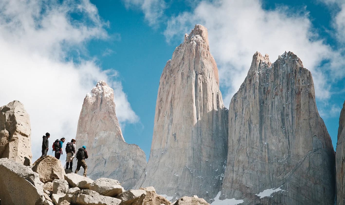
Both routes are named for the shapes they trace on a map. The W follows the southern face of the Paine Massif through three main valleys. The O wraps all the way around the massif in a complete loop, adding the remote northern section that most visitors never reach.
The clearest way to think about it: the O Circuit contains the W Trek. When you hike the O, you experience everything the W offers and then continue into the back of the mountain. For anyone new to Patagonia trekking, the W is the natural starting point.
The O adds three more days into quieter, wilder terrain. That back section crosses different ecosystems, a different climate, and a different quality of silence. In my opinion, it is the better half of the park.
How long is the W trek Torres del Paine?
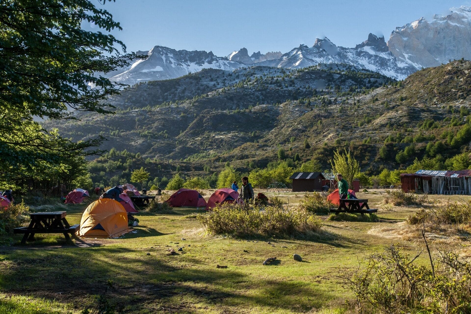
The W Trek covers approximately 75 kilometres (47 miles) with around 900 metres (2,950 feet) of total elevation gain. Most trekkers complete it in five days and four nights. The season runs from September through April. You can hike in either direction, east to west or west to east, which gives flexibility when planning logistics and transport.
How many days do you need for the W trek?
Five days is what I recommend without hesitation. Four is possible but leaves no room for bad weather or tired legs, and Patagonia is famous for both.
The conditions here can shift within an hour. A storm that grounds you for a morning can rearrange a whole schedule. Five days gives you the margin to wait it out, to sit longer at a viewpoint, to put your feet in glacial water at lunch and not feel rushed. If you are choosing between four days and five, choose five.
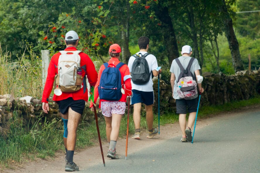
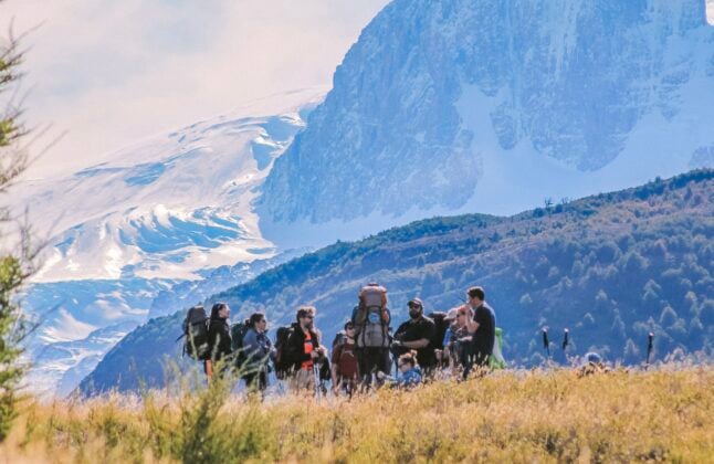
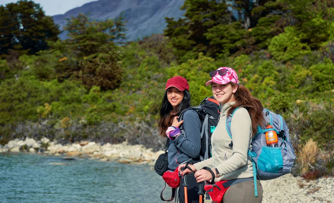
Hiking in Torres del Paine: The W Trek Experience
Patagonia trekking on the W covers three iconic sections: the towers, the French Valley, and Grey Glacier. These are the images most people carry of the park before they arrive. After they arrive, none of them feel disappointed.
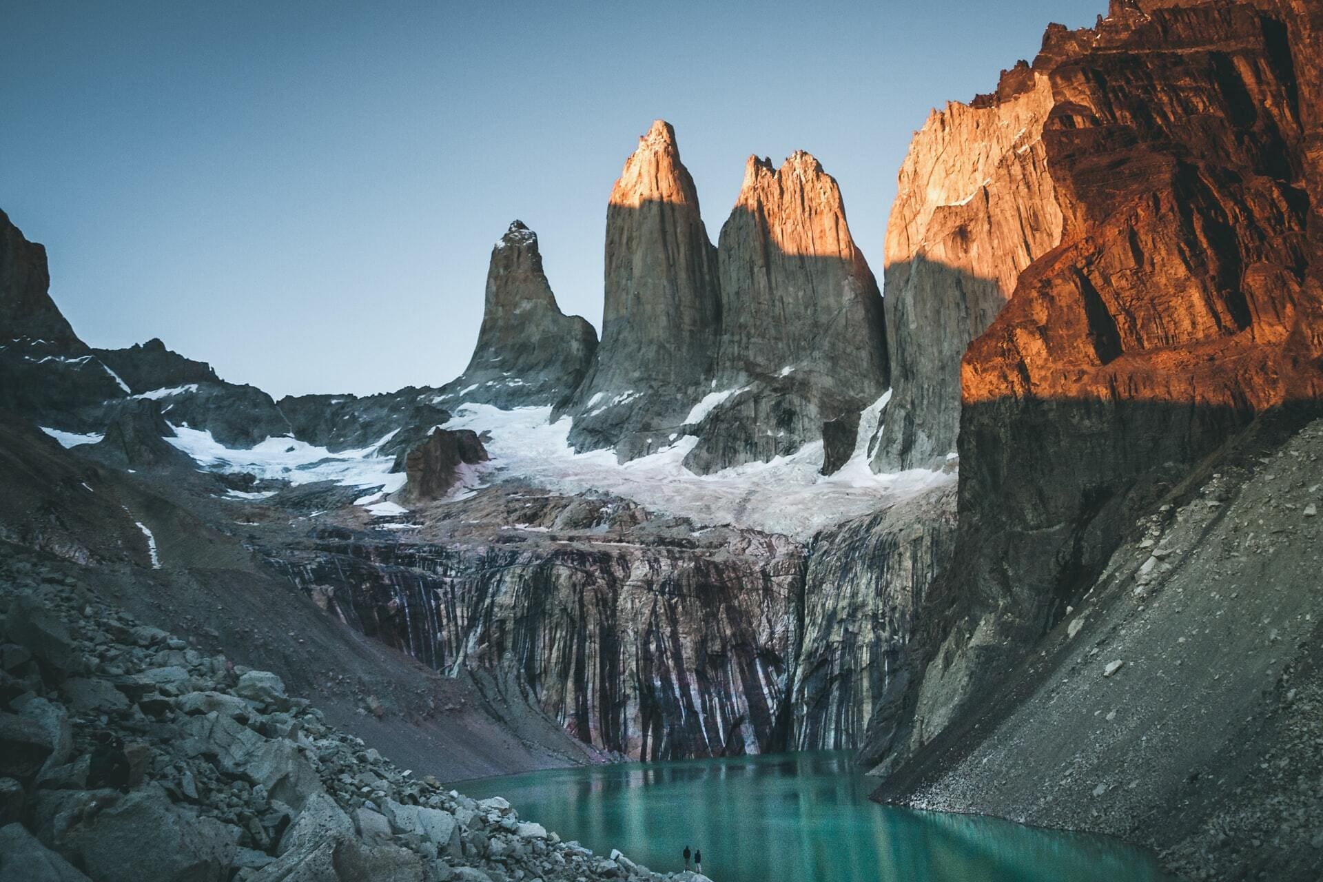
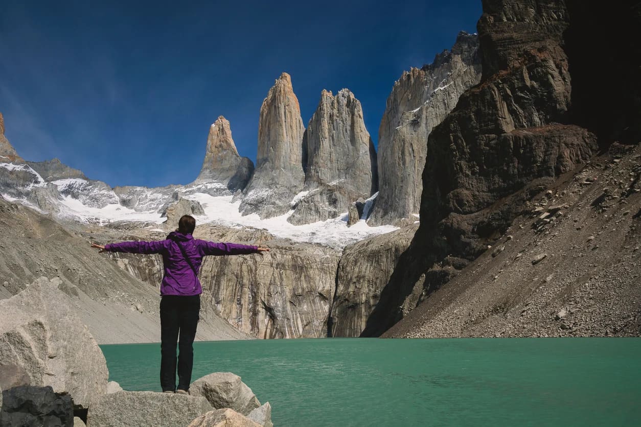
The towers

The hike to Mirador Las Torres is the signature experience of the W trek Torres del Paine. The approach trail runs almost entirely through sheltered valley forest, protecting you from wind and sun for the bulk of the day. Then, in the final kilometre, the trail pitches sharply upward.
The last section climbs around 400 metres (1,310 feet) in under a mile. The gradient reaches close to 45 degrees in places. You are scrambling over boulders and grabbing tree roots, using your hands as much as your feet.
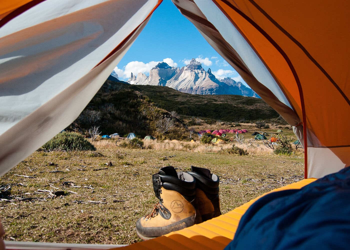
Trekking poles are essential here, not optional. It is demanding. It is not dangerous. When you arrive above the glacial lagoon with the three granite towers directly overhead, the effort stops mattering entirely.
We always stop here for a long lunch. We take our shoes off and put our feet in the water. The cold is the particular kind that only glacial water produces. I have done this walk more times than I can count but I am still not tired of it.
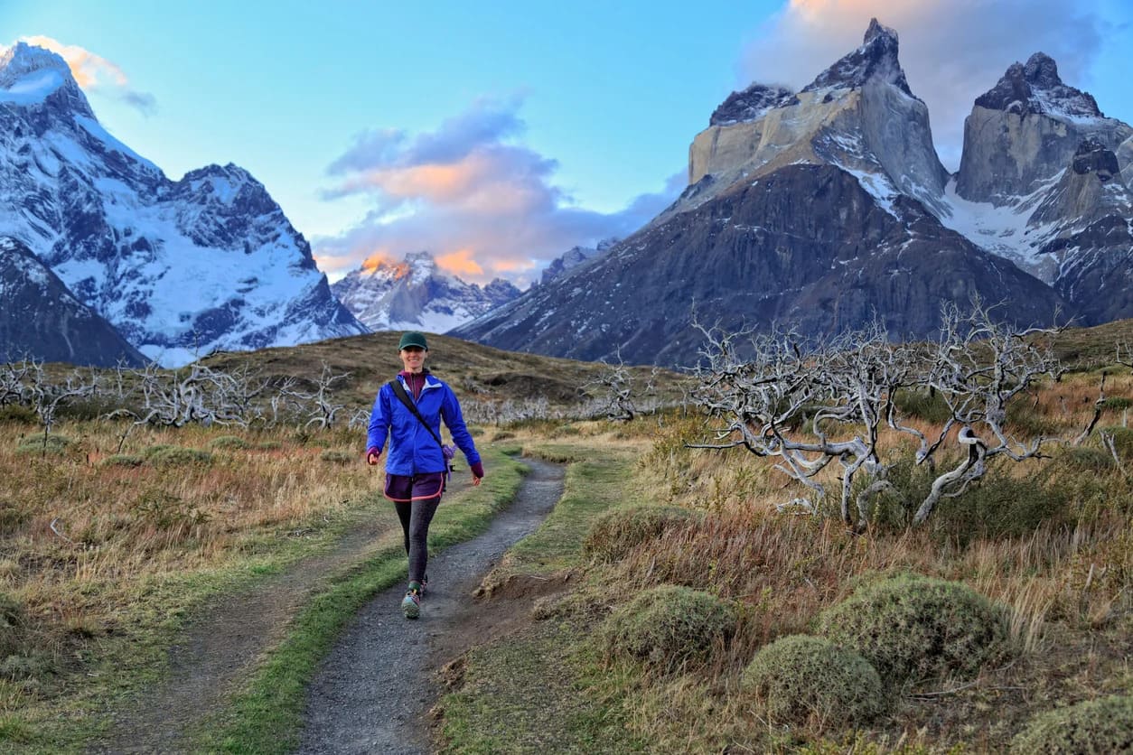
The French Valley
The French Valley is my favourite place in the entire park. It sits at the centre of the W, flanked by the Cuernos del Paine and the Paine Grande, the tallest mountain in the region at 3,050 metres (10,006 feet). A hanging glacier clings to the east face of the mountain.
When a section calves and falls, the sound rolls all the way down the valley like rolling thunder. You look up and see an avalanche already in motion. It is one of the most alive places I know.
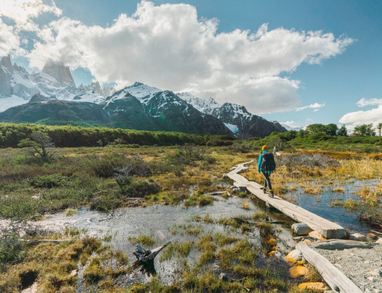
The valley has three levels of access. The lower viewpoint is gentle and reachable by almost anyone. The mid-level French lookout puts you directly facing the mountain. The Mirador Britanico at the top is a full day from Paine Grande camp, around 25 kilometres (15.5 miles) return.
It’s worth every step if your legs are willing. Keep an eye on the time, though, because the last boat from Lake Pehoé does not hold for stragglers.
Grey Glacier
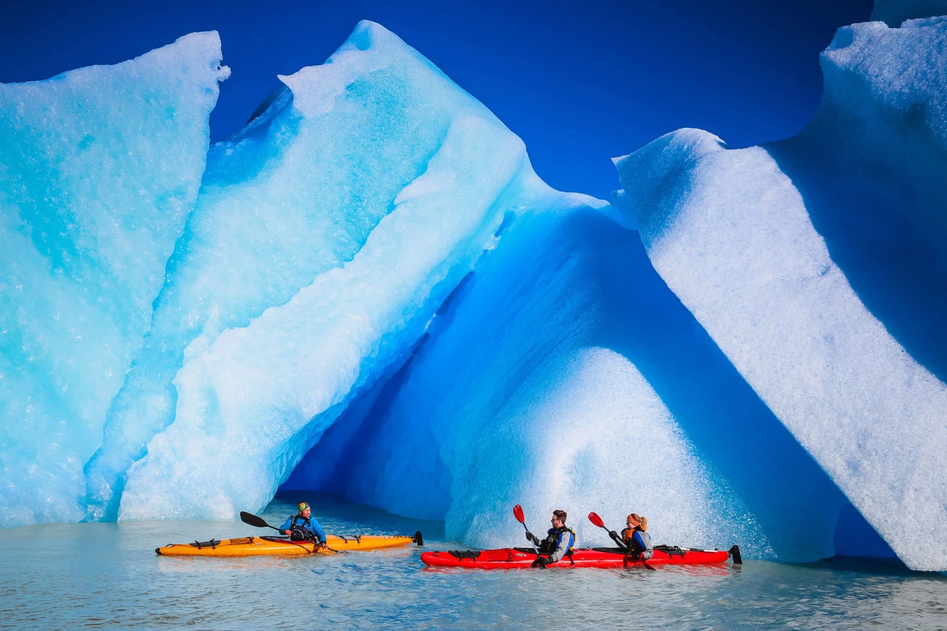
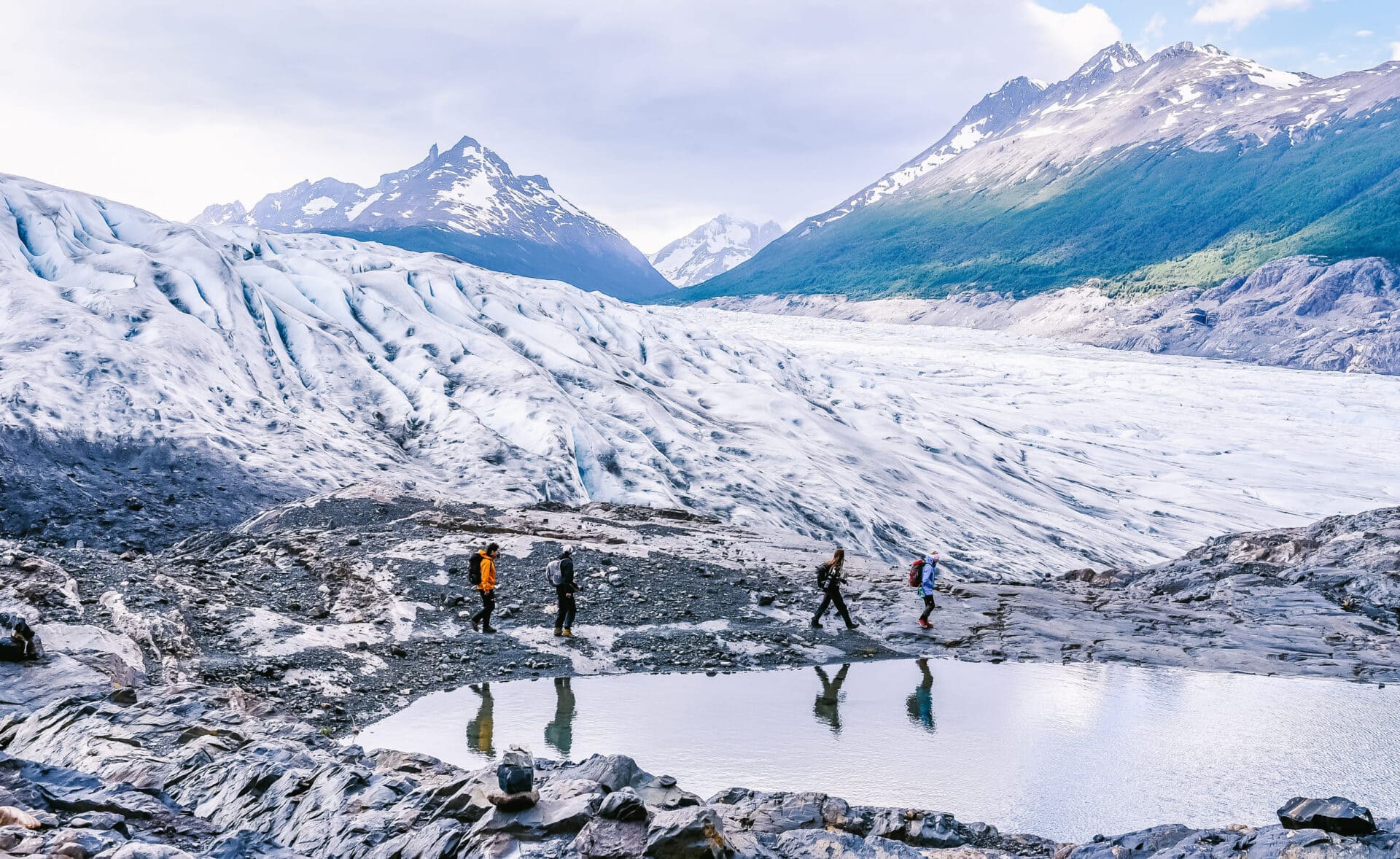
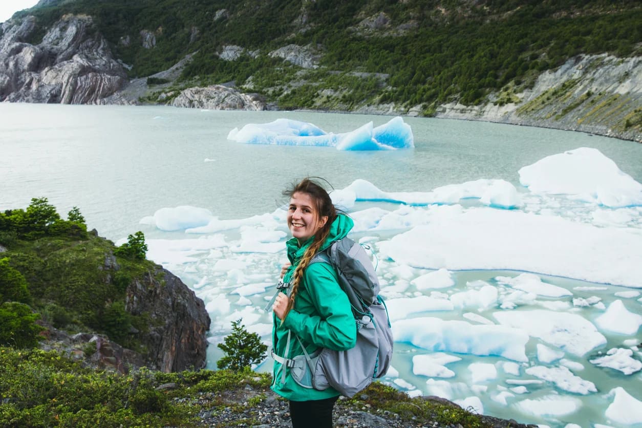
The Grey Glacier is 26 kilometres (16 miles) long, up to four kilometres (2.5 miles) wide, and 600 metres (1,970 feet) deep. Standing at the viewpoint, that depth does not feel real until you sit with it for a while. The colour of the ice is a compressed blue that comes from thousands of years of packed snow. It is not the colour in photographs. It is more intense than that.
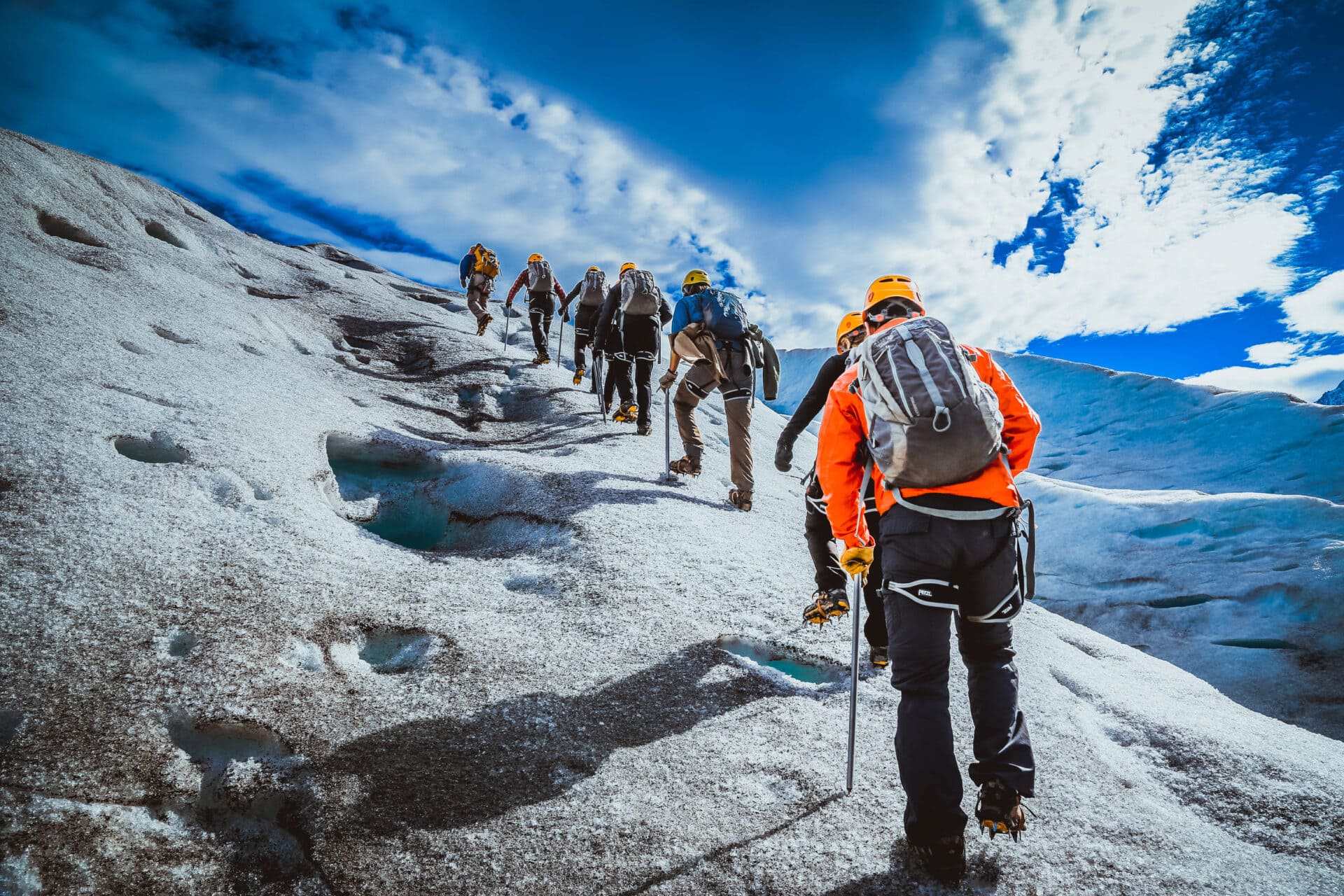
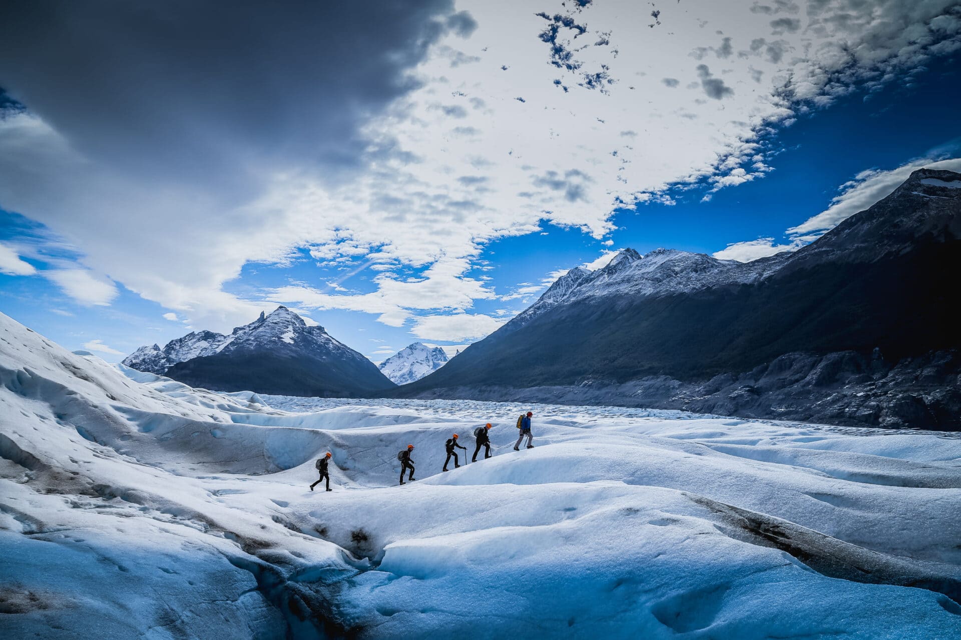
At Grey, two optional activities are available. The first is a six-hour ice hike across the glacier surface with crampons and a guide. The second is a kayak trip through the icebergs floating below the glacier face. If you can only choose one, choose the ice hike. Walking on a glacier that feeds from the third-largest ice field on Earth is not something you leave behind easily.
When the W Trek ends, it ends on the water. From Paine Grande camp you take a boat across Lake Pehoé, and for the first time in days you have real distance from the mountains. The whole massif opens up behind you as you cross: the Cuernos, the Paine Grande, the towers somewhere behind the ridgeline.
It is one of the best views of the park, and you get it on the way out, too tired to expect it. Most people look back when the boat docks.
The O Circuit: Patagonia Trekking for Experienced Hikers

The O Circuit covers approximately 120 kilometres (74 miles) and runs for seven days and six nights. The season is shorter than the W Trek, November through March, because the northern back section holds snow further into spring. The circuit always runs counterclockwise, east to west around the massif. This is not a preference. It is the direction CONAF, Chile’s national park authority, requires.
The back section passes through three days of terrain the W never reaches. You start in the dry eastern grasslands. By day three you are deep in dense Magellanic forest, so humid that a particular fungus, known locally as old man of the deer, grows thick on the bark of the trees. It is an indicator of clean air and healthy forest. I point it out on every trip. After nine years of Patagonia trekking here, it still feels significant.
Camp Dickson, on the back section, is the camp I always mention when people ask what makes the O worth the extra days.
You set up beside a glacial lake with the Dickson Glacier hanging at the end of the valley. The Paine Massif appears from an angle you have not seen before, from behind, showing a completely different mountain. It is the moment the whole geography of the park clicks into place.
How difficult is the Torres del Paine O circuit?
The O Circuit is harder than the W in one critical way: you carry your full pack the entire route. On the W Trek, the most demanding hikes, including the towers, are done as day hikes with your heavy pack left at the refugio.
On the O, every long day includes your full load on your back. I recommend keeping total pack weight between 11 and 12 kilos (24 to 26 pounds). More than that and the cumulative effect announces itself by day three or four.
Is the O circuit harder than the W trek?
Yes. The John Gardner Pass is the reason. At 1,240 metres (4,070 feet), it is the highest point in the park and the defining section of the circuit. The pass is exposed and windswept, and the weather can change without notice. Snow is possible even in peak season. Visibility can drop quickly.
W trek difficulty is real, especially on that final climb to the towers. But that is one concentrated effort on a sheltered trail. The O Circuit asks for seven days of sustained endurance, with the pass arriving mid-route when your legs are already carrying accumulated fatigue.
The rule I give every client on the John Gardner Pass: do not cross it alone. There are always other trekkers on the O Circuit. Make friends for the day and cross together.
The reward is immediate. You come over the top and the Grey Glacier opens below you. The Southern Patagonian Ice Field fills the entire horizon behind it. It is one of the most powerful views in Patagonia trekking. I have seen it many times, and it still stops me in my tracks.
The hanging bridges
The descent brings you to two hanging suspension bridges crossing above the drainage below. I am not afraid of heights. It still took me close to twenty minutes to cross one of them the first time. On a calm day these bridges move. On any day with wind they dance.
The technique is to keep walking, keep your eyes forward, and not think too hard about it. They are perfectly safe. They are also pure Indiana Jones. Once you cross, the forest closes in and the trail drops toward Camp Gray.
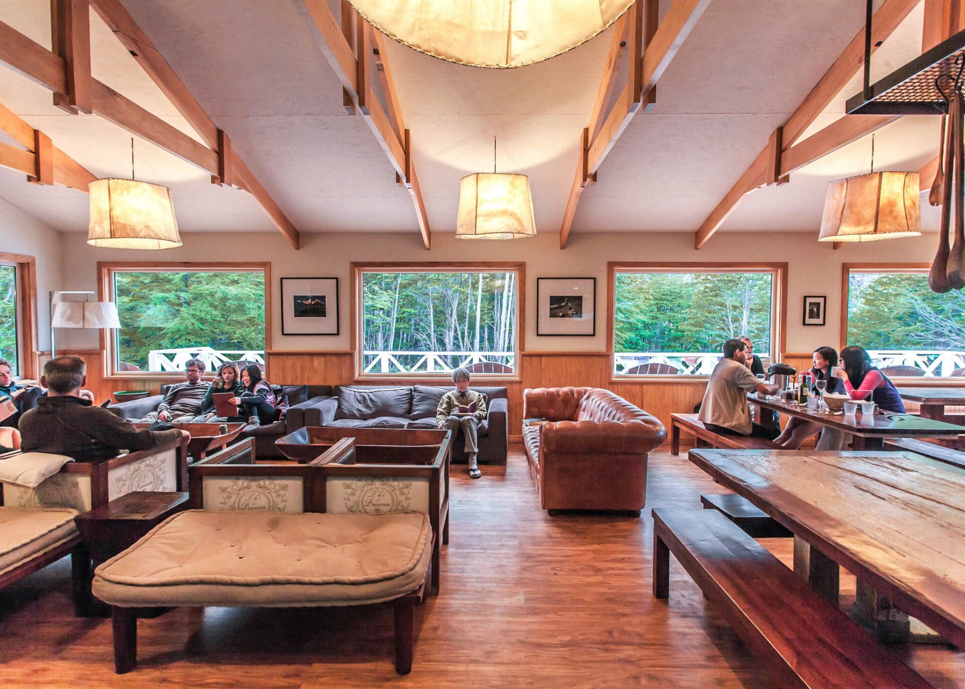
Camp Gray has the best restaurant on the entire circuit, W or O. You have just crossed the highest pass in the park with a full pack on your back so you sit down at a proper table in a warm room with food and wine in front of you. Outside, the wind is doing what Patagonian wind always does. Inside there is warmth, wine, and the specific satisfaction of a body that has done something difficult and is finally allowed to stop.
I have eaten that meal many times. It earns itself every time.
What Is the Best Time to Hike Torres del Paine?
The W Trek runs from September through April. The O Circuit runs from November through March. Those windows define the Patagonia trekking season here, and they fill up fast. December, January, and February are high season.
The trails are busiest, the rifugios fill up months in advance, and the Patagonian wind is at its strongest. That wind comes off the ice fields with real force. I have watched it knock people sideways. It is not an exaggeration.
My recommendation is October, November, or March. The weather is less predictable but the trails are quieter, the bookings are more manageable, and the light is exceptional. October brings wildflowers to the eastern grasslands. March turns the lenga beech forest amber and red.
Book early regardless of when you go. Refugios and campsites fill months in advance.
How to get to Torres del Paine national park
Most international travellers fly into Punta Arenas, which connects from Santiago de Chile, and it is the standard gateway for any Patagonia trekking trip to the region. From Punta Arenas, a bus to Puerto Natales takes roughly three hours. Direct flights from Santiago to Puerto Natales also exist and save time. From Puerto Natales, bus transfers to the park entrance run every morning during trekking season and take around two hours.
Plan at least one night in Puerto Natales before entering the park. You need time to confirm bookings, check your kit, and eat a proper meal before the trail starts. The town has good gear shops if you have forgotten something, and the restaurants are better than you might expect for a place this size.
What Gear Do I Need for the W Trek or O Circuit?
Patagonia trekking rewards preparation and punishes overloading equally. The goal is a balanced, trusted kit, not the heaviest or the most minimal.
Backpack size
For the W Trek, 35 to 40 litres is sufficient. For the O Circuit, 45 to 50 litres. No larger. The refugios and camps provide sleeping mats, and meals are available at every stopping point on both routes. You do not need to carry a kitchen.
Inside the pack, use dry bags or a simple trash bag liner to protect your gear from moisture. Do not use a backpack rain cover in Patagonia. The wind will pull it off the pack. I have watched them end up in lakes so many times.
Footwear
Do not buy new boots for this trip. Come in shoes you already trust. The trails are well-maintained and mostly dry. Trail running shoes work well for many people on the W Trek. For the O Circuit and the John Gardner Pass crossing, something with more ankle support makes sense.
But the most important factor is always familiarity. New boots on day one is one of the fastest ways to make yourself miserable on a long trek.
Trekking poles
Bring them, even if you do not usually use them. Poles reduce knee impact by around 30 percent. On a five or seven-day trek over varied terrain, that accumulates in a way you will notice on day six.
The descent from the towers and the descent from the John Gardner Pass are both steep and uneven. Poles give you stability and protect your joints. They are worth the space.
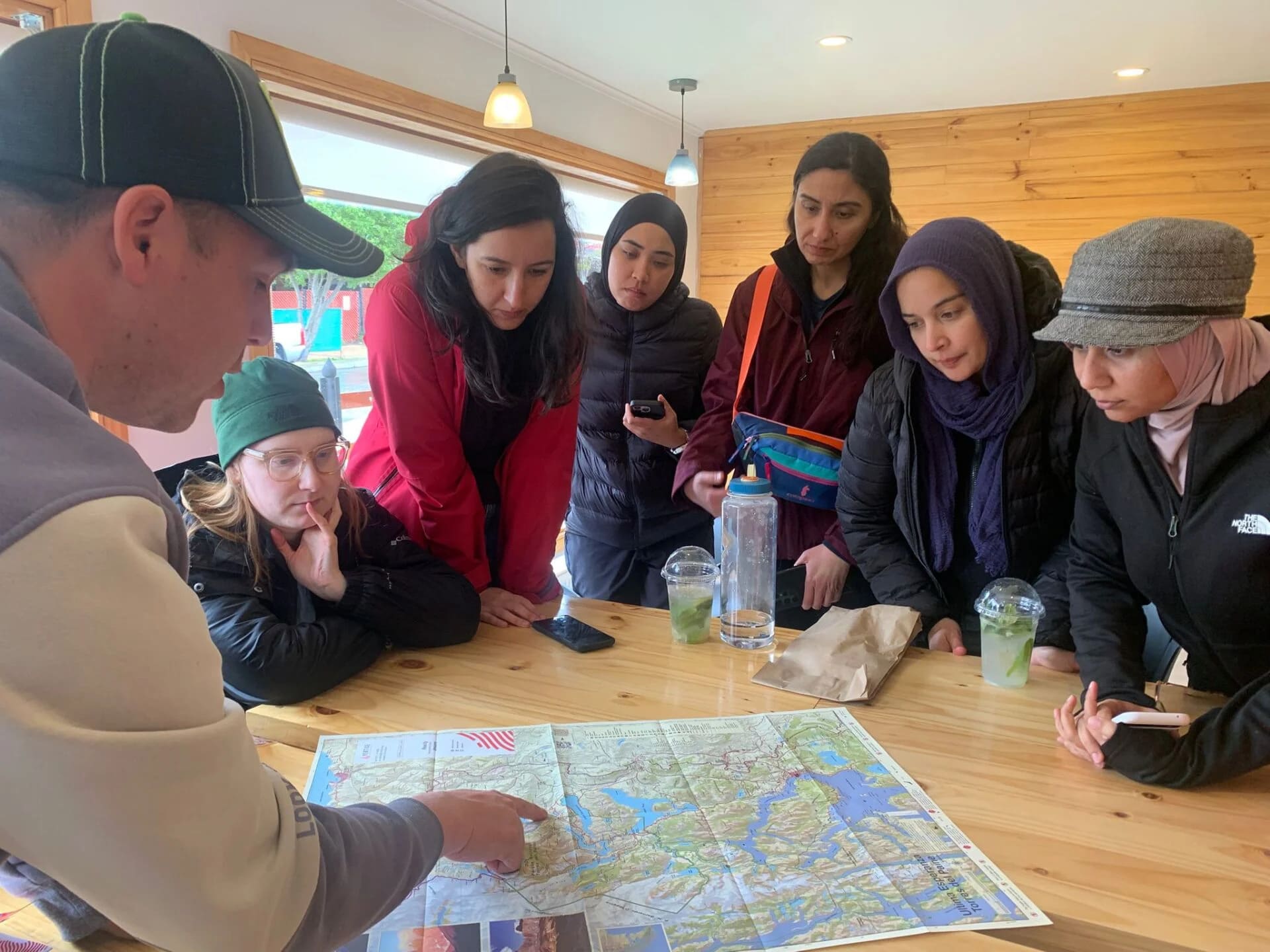
Planning a Torres del Paine Guided Trek
A Torres del Paine guided trek changes what you see, not only where you go. The guanaco you almost walked past. The fungus on the bark that tells you something about the health of the whole forest. The moment the glacier calves above the French Valley and you understand, in your whole body, what the Southern Patagonian Ice Field actually is.
Hiking in Chilean Patagonia with a guide means permits, transfers, refugio bookings, and logistics are handled. What you bring is your attention and your energy. The O circuit vs W trek decision is the most important one to make before you arrive, and a guide with experience on both routes can help you get it right.
This is a Torres del Paine hiking guide built from nine years on these trails, and the recommendation is always the same: if you have the time and the conditioning, choose the O.
The bottom line
The W is excellent. It earns its reputation every season. But the O gives you something the W cannot. You see the mountain from every angle. You pass through every ecosystem. By the end, you understand what Torres del Paine national park Chile actually is.
A few things I know for certain after so many years. You’ll underestimate the wind and you’ll reach the John Gardner Pass and stand there longer than you planned. And at some point on the trail, whether it is at the towers or in the French Valley or on the boat back across Lake Pehoé, you will have one of those moments of complete, involuntary clarity.
You have gone far enough from everything ordinary to finally see it differently. The route you choose determines where that moment finds you. Choose carefully.
A Torres del Paine guided trek is the simplest way to make sure you do.