
When you think of Tuscany, you may conjure up beautiful rolling hills, glasses of sweet Vin Santo wine, brightly painted villages, and acres of green vineyards. That’s true, of course, but it is more than a low-lying pastoral utopia full of rustic luxury.
What is often left out of the advertisements is the diversity in landscape and history that accompanies these lands. In contrast with the sun-soaked fields stand the craggy Apennines, their peaks so high they tangle with the clouds.
While I love the famous Cinque Terre hiking trails, if you’re looking to trek on dirt paths instead of cobble walkways—and get away from more touristy areas—hiking in Tuscany’s mountains, far above the common tracks, unlocks the magic of the region.

Pros and Cons of Hiking in Tuscany
A Rockier Side of Tuscany
Ah, Tuscany. Birthplace of the Italian Renaissance. The land of Dante and Chianti. Home of Michelangelo’s immaculate marble hero. While the region and its capital, Florence, are known for high art and culture, for hiking in Tuscany you’ll want to get away from these well-known locales.
Luckily, that’s close by, in the northwest province of Lucca.

Located between the Tuscan–Emilian Apennines in the northeast and the more rugged Apuan Alps to the west—both part of a mountain range that runs the length of the peninsula—sits the Garfagnana Valley. Known as the “Great Forest” in Italian, this steep, densely wooded region is pocketed with ancient villages, cut through by the Serchio River, and full of sweet chestnut trees. Naturally isolated, the area and its people developed a unique culture within the country, and it still happens to be one of the least visited hiking areas of Tuscany.
Want to go hiking in Tuscany? Meet the mountains
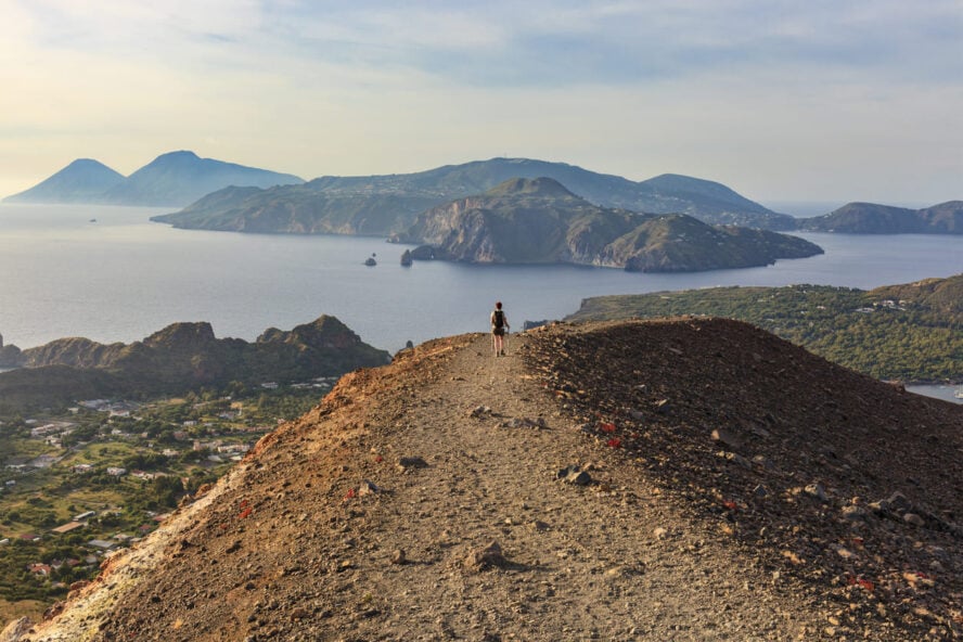
On the flipside, it’s a haven for the outdoors, especially for hiking and mountain biking. Here you’ll find two distinct ranges, from the bare peaks of the Apuan—known for their world famous marble at Carrara—to the lush Apennines. The highest point is Monte Cimone at 2,165m (7,103 ft), with Pisanino, at 1,947m (6,387 ft) the highest in the Apuan Alps. But there are plenty of peaks above 1,000m (and many more under), so you can find a hike to match your fitness level.
Wherever you venture, you can still see the outlines of vineyards or the Ligurian and Tyrrhenian Sea from the from the talus ridgelines and pillow lava peaks—which brings a surprising pleasure knowing that unexpected landscapes are never too far from the familiar sights.

Growing up in the Garfagnana Valley
For generations my family has lived in Garfagnana. In my youth, I awoke each morning to the bright swards and meadows against the gray of the mountain faces, and set out to explore the narrow shepherd’s paths, ridgelines and craggy tops. It was a way to connect to the rich history around me—and to uncover some secret places (at least to me).
Now as a hiking guide for the last nine years with my company, Wild Trails, it has given me the opportunity to navigate what I deem a respectful kind of tourism. That means welcoming others to see how a landscape reveals itself, incorporating sustainable outdoor practices, and introducing parts of Tuscany that are not commonly seen in tourist brochures.
Hiking in Tuscany, Italy: Following In the Footsteps of Poets and Partisans
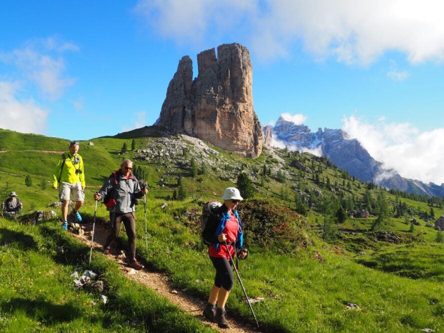
Everyone knows about the exquisite hiking in the Dolomites, but did you know there are over 4,000 mountains—and many more walking paths—located in the region of Tuscany? To help you get on the right track, I’m sharing a few of my favorite hikes and landmarks that will take you throughout this beautiful part of Italy.
Grotto Rotondo
Fast facts:
-
- Distance: 7.1km (4.4 mi) loop
- Elevation: 324m (1,062 ft)
- Difficulty: Moderate
- Best for exploring relics from WWII
Hiking in the Garfagnana begins amidst a dense forest that blends to a ridgeline. Here, the view of the valley stretches out before you. In these lands the Gothic Line, Hitler’s last line of defense to cross Italy, runs west to east. On these paths it is still possible to find bunkers and foxholes, small secrets from history.

Sentiero della Libertà of Monte Rovaio
Fast facts:
-
- Distance: 3.9km (2.5 mi) lollipop
- Elevation: 221m (725 ft)
- Difficulty: Moderate
- Best for seeing small villages
The Sentiero della Libertà translates to “the path of freedom” and commemorates the local partisan brigade called Gruppo Valanga, who fell during a battle at Monte Rovaio during the Second World War. It starts from the chapel of Piglionico, descends to a small hamlet, then steadily rises as it navigates around Mount Rovaio with plenty of panoramic views. This is my recommendation for a more moderate walk here in Tuscany.
Monte Prato Fiorito and Bagni di Lucca
Fast facts:
-
- Distance:10.1km (6.3 mi) loop
- Elevation: 763m (2,503 ft)
- Difficulty: Hard
- Best for a ridge walk
Prato Fiorito, which roughly translates to flowery meadow, runs along rolling hills that top out at around 1,300m (4,265 ft). The walk follows a shepherd’s track, which was used to take flocks up to the grazing areas and pastures.
Today, this area is popular with mountain bikers, horse riders, and birders. However, in the 19th century it was probably better known among the English than it was here—Bagni means “thermal bath” in Italian, and it was a popular destination for writers and poets, including Lord Byron and Mary Shelley, who wrote parts of Frankenstein here. The thermal springs still flow from the Colle di Corsena’s slopes, with natural steam caves reaching temperatures up to 47°C (117°F).

One of the many historic buildings along these hiking trails is the church of San Cassiano. It is still standing after 900 years, with original floors, a display of power and strength for the small mountain village around it.
Monte Forato
Fast facts:
-
- Distance: 9.8km (6.1 mi) lollipop
- Elevation: 3715m (2,345 ft)
- Difficulty: Moderate
- Best for a unique geological feature
The arch of Monte Forato (“Holed Mountain”) is one of the most iconic symbols of the Apuan Alps. This natural arch—which was created through the weathering of wind and water—stands 26 meters (85 feet) high and connects two twin peaks. The hole is visible from the towns of Garfagnana and Versilia below.
Hiking to the arch of Monte Forato follows an old salt road that was previously a trading route that linked Garfagnana with the seaside. The view all around this area is stunning and the panoramic mountain views are unforgettable.
Orecchiella Natural Reserve
Fast facts:
-
- Many trails to choose from so distance, elevation, and difficulty varies
- Best for walking in Tuscany with families as a way to experience a wide range of terrain and see wild animals on relatively easy paths
This natural reserve is located in the Apennine side of Garfagnana and is characterized by the natural wonders of northern Tuscany: luxurious forests, gentle slopes, and mix of chalked massifs which deviate from the typical Apennine sandstone. The area covers about 12,400 acres, and because of its diverse morphology there are all sorts of microenvironments; you’ll find beech and chestnut forests, narrow canyons, blueberry moors and high mountain wildflower meadows. It also is home to many wild animals such as deer, boars, bears, and birds of prey.

Hiking in the Orecchiella Natural Reserve offers several educational trails with a museum and an enclosure for rescued wild animals. The trails are suitable for anyone and some of them lead to the peak overlooking the vast Garfagnana area. Explore the Natural Reserve with a guide and enjoy the fresh air and interesting wildlife along the way!
Pania della Croce
Fast facts:
-
- Several trails to choose from so distance, elevation, and difficulty varies
- The Queen of Alpi Apuane offers marvelous 360° panoramas
One of the most biologically important areas in Tuscany—and most beautiful—is the Alpi Apuane UNESCO Global Geopark, which was established to protect the nature and culture within the range. Spreading over 21,000 hectares (52,000 acres), it combines contrasting features from vast underground karst systems to spectacular alpine environments.

Within this range, hiking the Pania della Croce (1,858 m/ 6,100 ft) is a must do as it is considered the signature mountain. There are multiple routes leading to the top, where views spread all the way to the coast of the Tyrrhenian Sea, and the seaside villages. You may even imagine the busy shopping streets, the smell of espresso, and the street vendors selling fresh fruit and vegetables from here.

The road to Monte Prado
Fast facts:
-
- Distance: 15km (9.3 mi) loop
- Elevation: 900+ (2.953 ft)
- Difficulty: Hard
- Best for a big day out
Prado, “the roof” is the highest point of Tuscany, at 2,054m (6,739 ft). Following a grassy ridgeline is like walking in the sky, with views as far as 500km (311 mi) on a clear day—you can see the Alps in France and the coastline of Liguria.
The walk starts from Casone di Profecchia and crosses forests of beech trees then into grazings of the Apennines. On the ridgeline you’ll be on the border between Tuscany and Emilia Romagna, where you can see the villages that comprise the famous Cinque Terre hike and all of northern Tuscany. Then you descend the east face towards the fairy Lake of Bargetana, through blueberry meadows, and with views of Mount Cusna.

Useful Information for Hiking in Tuscany and the Garfagnana Valley
Difficulty of the hiking trails in Tuscany and the Garfagnana Valley
There are a variety of hikes in the Garfagnana Valley, however difficulties and lengths primarily range between 6 to 13km (3.7 to 8.1 mi), with a maximum of 500-800m (1,640-2,625 ft) in elevation gain. Some hiking is rather strenuous at times, with steep ascents and descents, and long climbs to the peaks. Because many of the trails are accessible from the villages, you can link together different routes to create multi-day hiking trips—camping or staying in town—through this part of Tuscany.
How to get to the Garfagnana Valley
Luckily, the Garfagnana Valley is well linked to the airports in the region. From either the Pisa International Airport (about 82km/51 mi) or the Florence Airport (about 110km/63 mi away), you can take a train or a bus to the valley, or you can rent a car and drive. Because of the proximity, this makes it one of the best places for hiking near Florence—you can enjoy a day hike and be back in the city in about 1.5 hours by train.
Where to stay in the Garfagnana Valley
One of the incredible options for housing in the Garfagnana Valley is at an original Tuscan farm called the Lavacchio Farm. Run by two chefs, staying in the farmhouses amidst these beautiful fields and meadows will promise top-notch food for every moment during your stay. The community aspect of Lavacchio Farm is one of its highlights, along with private rooms, a panoramic pool, and hammocks to relax in the late afternoon sun.
In addition to the farm, the Garfagnana Valley also has cabins and farm houses to rent, as well as various options on AirBNB and other house-sharing sites.

Where else to hike around Italy?
There are plenty of other areas to hike in the country and in the surrounding regions. If you’d like to do a longer town-to-town-based trek, try the pleasure of the Alpe Adria Trail hike, which passes through eastern Italy. For something a bit steeper, consider hiking in the Dolomites, or even go rock climbing in the Aosta Valley near Mont Blanc. Maybe you’d like to test your limits? Check out what many consider Europe’s toughest hiking trail, Corsica’s GR20 hike.
Sharing the Secret
The sun rises and runs along the jagged ridgelines and rolling hills of the Apennines, illuminating Tuscany in a golden glow. This landscape is poetry, and I’m grateful to have grown up in the shadows of its mountains, learning the ins-and-outs of the land.
These paths in the Garfagnana Valley are perfect for those looking to explore new terrain and move beyond the Tuscany that is commonly advertised. If you’d like to visit, I’d be happy to show you some of our many secret hiking spots.