2. Torrey Pines State Park Loop
For one of the most iconic beach hikes in and around the San Diego area, check out Torrey Pines State Park. Named after the Torrey Pine (Pinus torreyana), one of the most endangered pine trees in the world, this reserve is home to over half of the world’s population of 6,000 trees. The whiplash-inducing transition from forest to shrub to beach reminds one of the best hikes in Olympic National Park but in a more compact package.
This loop trail hits highlight viewpoints from Razor Point to Yucca Point past the Big Basin down the Beach Trail to Flat Rock and up Broken Hill back to the West Overlook. For beginner hikers, this is a great option for a guided hiking tour in San Diego.

How Long Is the Torrey Pines Hike?
Torrey Pines is best hiked as a five-mile loop, although there are trails that are ⅔ of a mile (Guy Fleming Trail), ½ mile (Parry Grove Trail), and the High Point Trail (100 yards). It’s common to see locals running along the loop I describe because it’s so scenic and well-defined. The State Reserve does an excellent job of marking trails and delineating where they are. They even have cables along the edges of many trails to serve as “bumper lanes” that prevent hikers from confusing animal paths for the real trail.
Starting at the West Overlook
Start at the West Overlook, where there is parking, toilets, and a viewpoint. Be sure to fill up your water bottles here as this is the last spot on this hike with any water. An information board, trail signs, and take-with-you paper map all help point the way.
Follow the Razor Point Trail to a red, rocky outcropping. This is the spot to take epic photos because it is so prominent against the coastal bluffs and has great views of the ocean behind. From this viewpoint, descend towards Razor Point. After half a mile, you’ll be at an overlook right over the ocean.
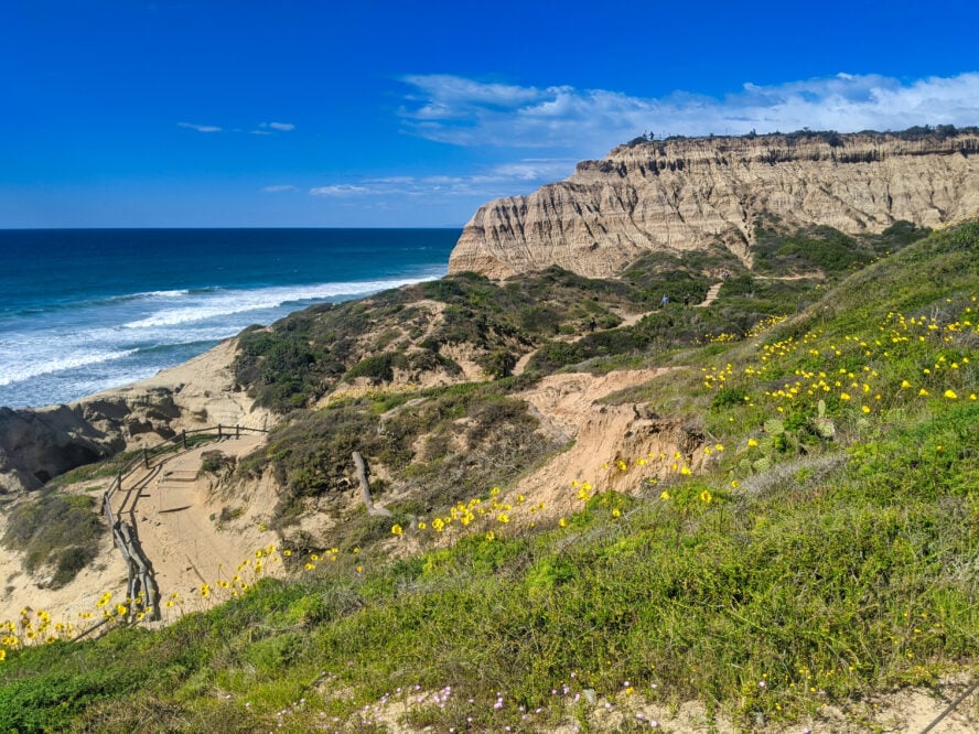
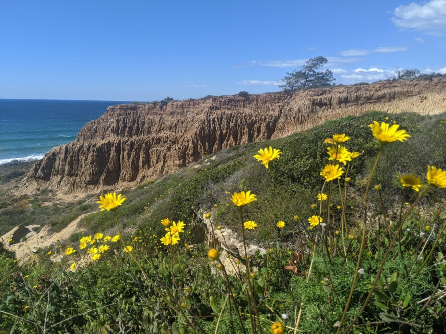
From Razor Point, ascend back to an intersection that takes you towards Yucca Point via the Beach Trail. You’ll circumnavigate around Big Basin, famous for its “badlands” like erosion. Approximately 160,000 years ago, rivers deposited silt and sand that eroded to form steep slopes, canyons, hoodoos, gullies, buttes, and mesas. In the spring, I like coming here to see abundant wildflowers like the bright yellow sea dahlia, blue wild hyacinth, and purple wild lupine.

Continue On to the Torrey Pines Beach
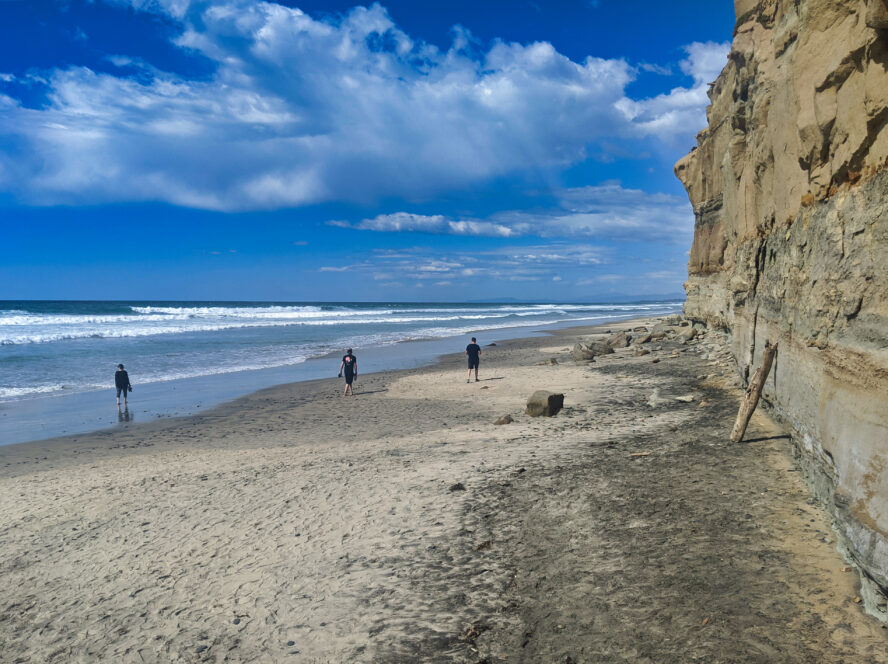
A highlight of this hike is the maze-like narrow canyons of rock that take you on the last descent towards the beach. You’ll swirl around a small cave before walking on the thin edge of a cliff. Descend stairs, and you’ll reach a secluded cove. Check the tides before you leave the Torrey Pines visitor center. During high tide, the beach is underwater.
From here, you can see the crowded Torrey Pines Beach to your right. More sandy coves, cliffs, and bluffs are to your left. Adventurous locals will run from Torrey Pines State Beach all the way to Black’s Beach, sometimes holding onto the cliffside to get around bluffs. Enjoy some of the most scenic seaside views you’ll find on the West Coast, as good as those along the legendary backpacking trails in Big Sur.
After the beauty of the beach, I can’t help but feel bittersweet turning around and heading back up the stairs. But returning to the car on the Broken Hill Trail lets you see a part of the park that is a little less crowded. With chaparral, sagebrush, and just a few trees, there’s plenty of scenic views to be had.
Towards the end of the hike, you’ll see the backside of the Torrey Pines Golf Course. I always enjoy comparing the natural area that I’ve been hiking in with the manicured grass on the other side of the reserve boundary.

You top out on a road closed to motor vehicles (but open to bikes). From here, walk the flat, Torrey-pine lined ridge. Below you is Peñasquitos Lagoon, where freshwater streams reach the tidal saltwater creating a shallow, coastal lagoon. In the distance are the high granite mountains of San Diego.
These mountains were created millions of years ago from a chain of volcanoes formed by the collision of tectonic plates, a process also responsible for the best hikes in Washington. The volcanos eroded, and the granite was lifted and carved into mountains by rivers. As is the case with the top Oahu hikes, these volcanic mountains make up some of the best hiking areas in the county.
Return to your car having viewed or hiked through many of the major ecosystems in San Diego County. As you descend more than 500 feet (and have to climb back up), budget some extra time for this hike.
