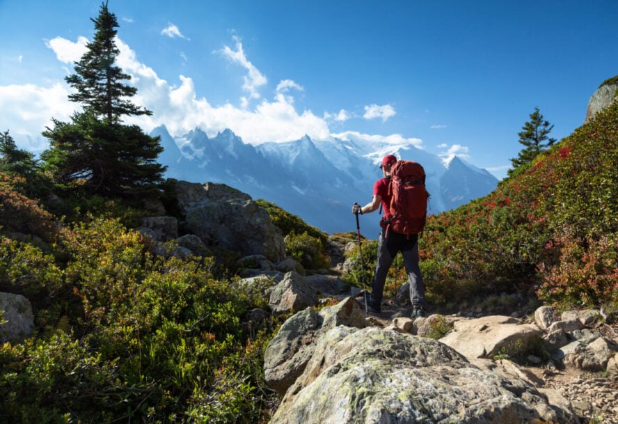
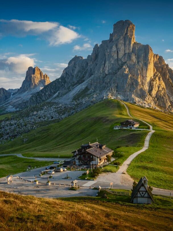
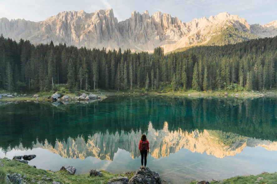
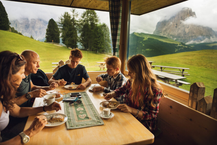
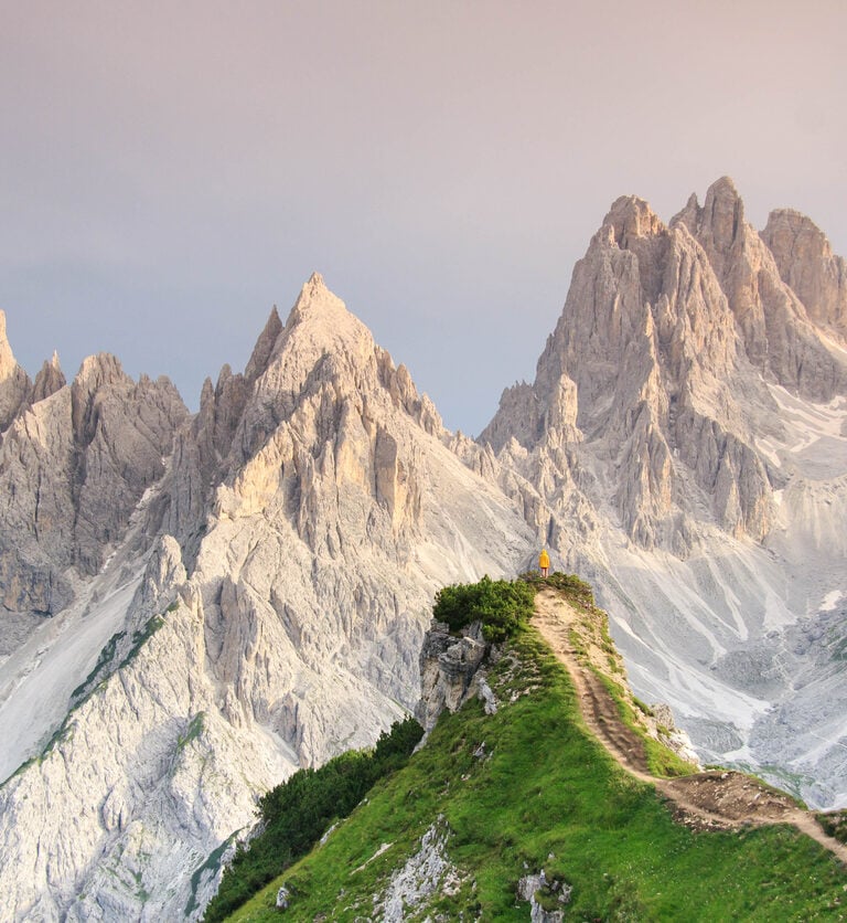
Jagged limestone peaks pierce the sky, with emerald valleys unfolding below and the faint echo of cowbells drifting on the breeze. The sun warms your face as you pause at a rustic mountain hut, savoring a hearty plate of pasta while swapping stories with hikers from around the world.
The air hums with anticipation, your boots laced tight, ready to embark on a journey that feels like stepping into a painting, one where every ridge and meadow tells a story of adventure and resilience.
That’s the magic of Alta Via 1, the most famous multi-day hike in the Dolomites.
What is the Alta Via 1
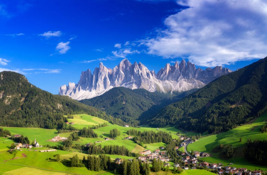
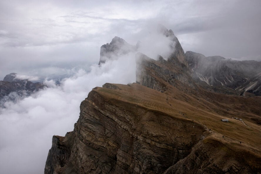
The Alta Via 1, often called AV1 or the “High Route 1,” is a legendary long-distance hiking trail. It slices through the heart of Italy’s Dolomites, a UNESCO World Heritage site renowned for its dramatic limestone formations, lush meadows, and crystal-clear lakes.
The trail stretches from the serene Lago di Braies in the north to the charming town of Belluno in the south. It weaves past World War I relics, alpine pastures, and vertigo-inducing cliffs.
Alta Via 1 is a full-on cultural immersion into the Ladin heritage of the region, with stops at cozy rifugios (mountain huts) where you’ll refuel on local specialties like speck (cured ham) and strudel.
Why is the Alta Via 1 so iconic?
What makes hiking the Alta Via 1 special?
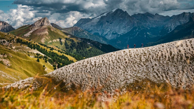
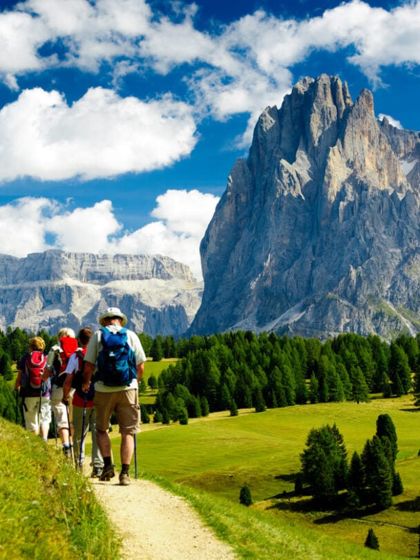
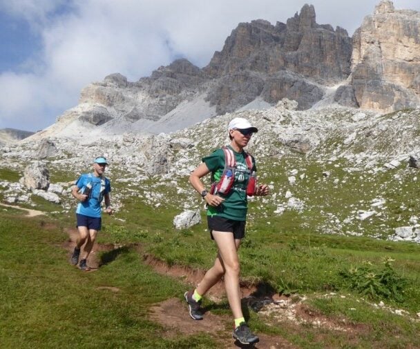
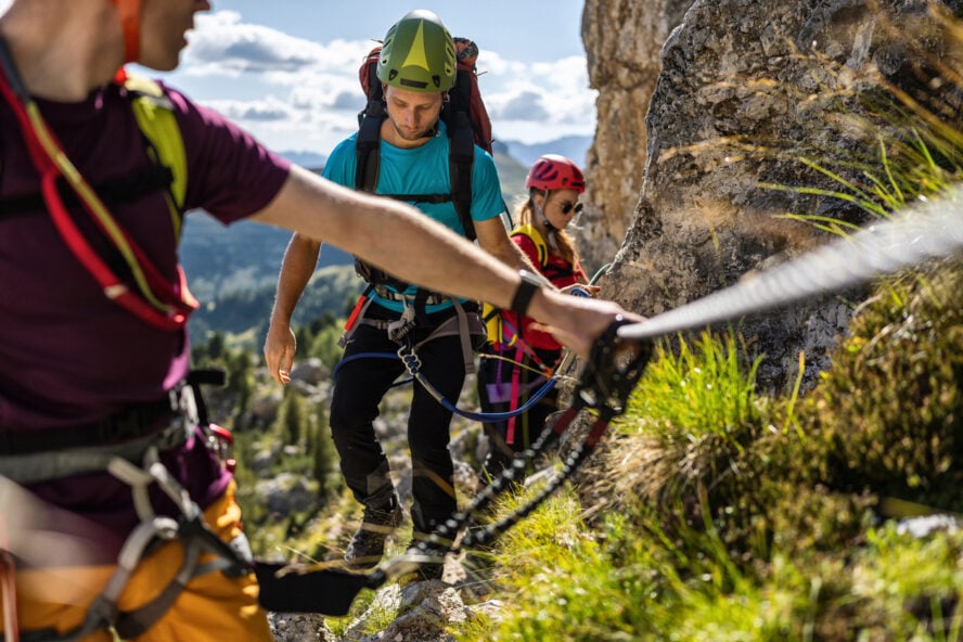
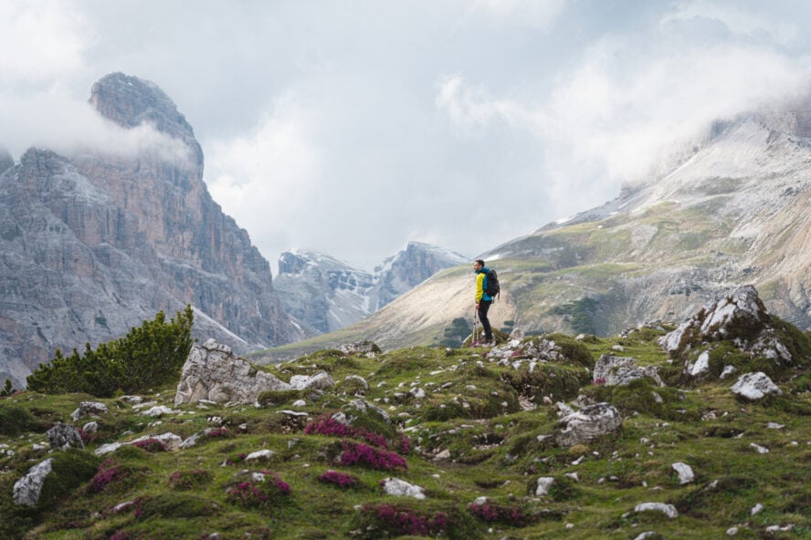
It’s accessible for less experienced hikers, while still delivering jaw-dropping panoramas & exposure that rivals the hikes in Nepal. You’ll go from gentle forest paths to exposed ridges with fixed cables for security (via ferrata sections, though milder than on other routes) in a day.
The trail was established in the 1960s as part of a network of “high routes” to promote tourism in the Dolomites, and it quickly became one of the most popular trails in Europe. Elevation gains total around 6,660 meters (21,850 feet) of ascent and 7,700 meters (25,260 feet) of descent. It will challenge your legs, yes, but you’ll be rewarded with views of iconic peaks like the Tre Cime di Lavaredo and Monte Pelmo.
For us, the Alta Via 1 embodies the spirit of adventure. Uplugging from daily life, pushing your limits, and connecting with like-minded souls. It’s perfect for solo travelers, couples, families, and anyone seeking a transformative experience.
Alta Via 1 vs 2: What’s the Difference?
The Dolomites boast ten different Alta Via routes, but Alta Via 1 and Alta Via 2 get most of the traffic. They each offer a unique flavor of alpine magic.
While both trails traverse the Dolomites from north to south, they cater to different skill levels and preferences.
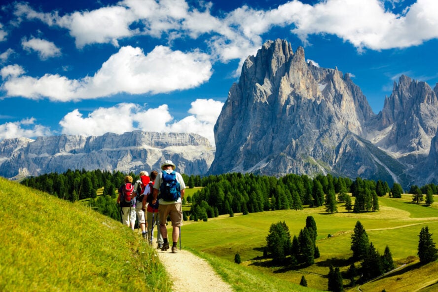
The Alta Via 1 is the more approachable sibling, spanning about 120 km (75 miles) with moderate elevation changes and fewer technical demands. It focuses on panoramic views, wildflower-strewn meadows, and historical sites like WWI trenches, The trail isiideal for those wanting a balanced mix of challenge and enjoyment.
In contrast, the Alta Via 2 is longer. It stretches at around 160 km (100 miles), with steeper ascents (over 12,000 meters/39,370 feet of gain) and more demanding via ferrata sections. You’ll encounter ladders, cables, and exposed ridges that require a head for heights and some scrambling experience.
Weather plays a role too: AV1’s northern sections can be cooler and wetter, while AV2 dives deeper into rugged, remote areas where there’s potential for sudden storms. AV1 huts are more frequent and accessible, often with family-friendly vibes, whereas AV2’s rifugios feel wilder and more isolated.
To simplify, Alta Via 1is a scenic stroll through postcard-perfect valleys. Alta Via 2 is an adrenaline-fueled quest over knife-edge passes.
How to Choose Between the Alta Via 1 vs. Alta Via 2
Deciding between the two trails boils down to your fitness, experience, and what you really want from a hike.
If you’re new to multi-day treks or prefer views without constant heart-pounding exposure, go for the Alta Via 1. It’s a moderately challenging hike, with daily stages averaging 10-15 km (6-9 miles) and options to shorten via buses or cable cars. It’s family-friendly (with some modifications) and perfect for photographers or history buffs.
On the flip side, choose the Alta Via 2 if you’re an experienced hiker seeking thrills. Its technical elements demand via ferrata gear (harness, helmet, carabiners) and a tolerance for vertigo, but you do get unparalleled solitude and dramatic scenery.
Regarding timing, both are best hiked in the summer, but AV1 opens earlier due to lower snow risks. Budget-wise, AV1 is slightly cheaper with more hut options, while AV2 might require extra nights or gear rentals.
If you’re unsure, start with AV1 to build confidence. Many hikers return for AV2 later!
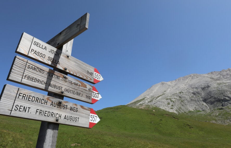
How to Get to the Alta Via 1
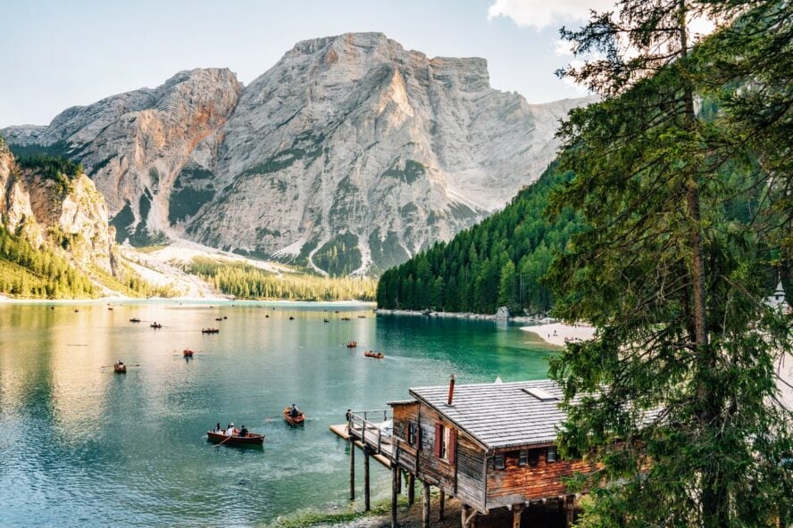
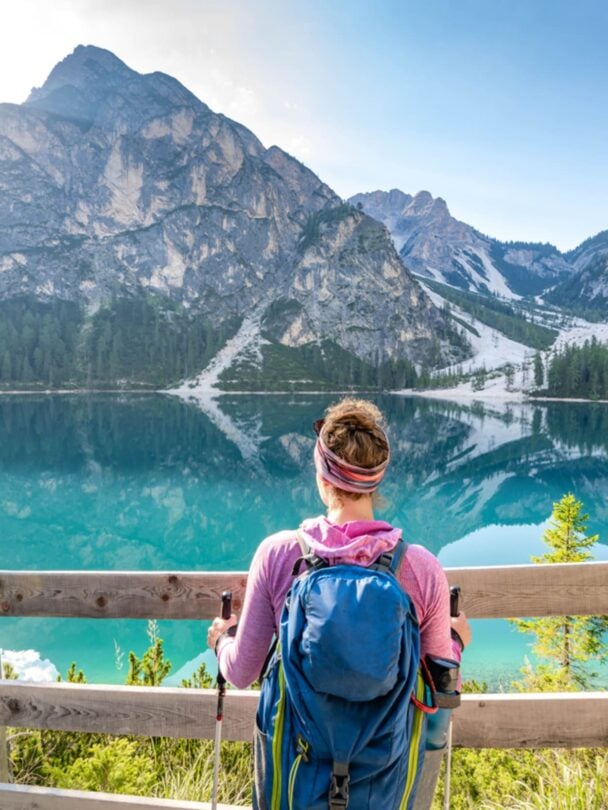
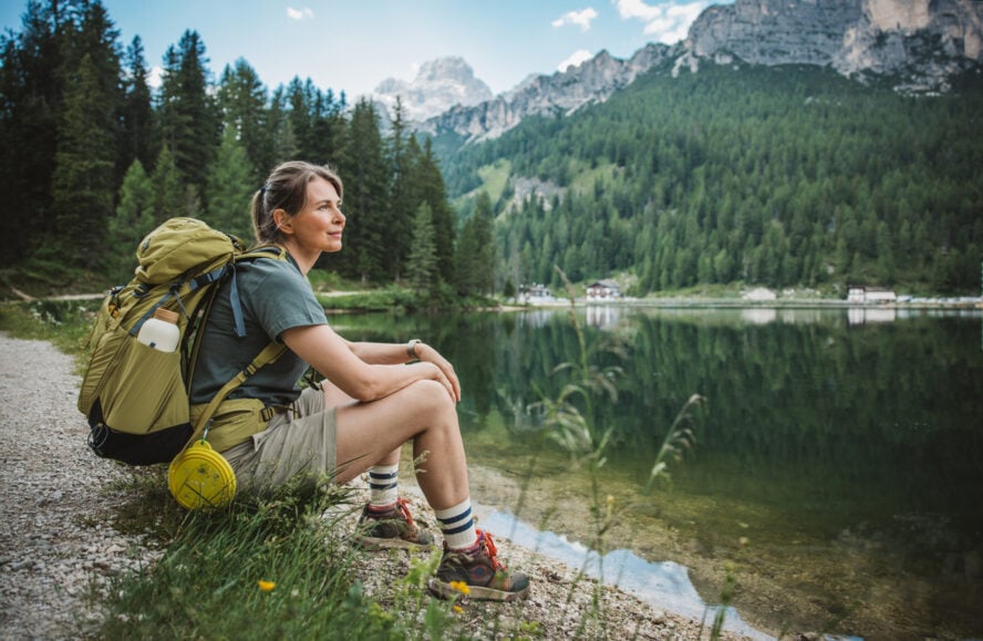
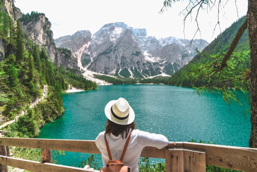
The Alta Via 1 kicks off at the stunning Lago di Braies (Pragser Wildsee). It’s a turquoise alpine lake nestled in the Fanes-Sennes-Braies Natural Park at about 1,496 meters (4,908 feet) elevation.
The starting point sets the tone with its mirror-like waters reflecting towering peaks. Perfect for that first inspirational photo.
Getting there is straightforward, whether flying in or arriving by train.
The nearest major airports are Venice Marco Polo (VCE), about 150 km (93 miles) south, or Innsbruck (INN) in Austria, roughly 130 km (81 miles) north.
From Venice, hop on a train to Dobbiaco (Toblach) via Verona or Bolzano (2-3 hours, €20-€40), then catch the SAD bus line 442 directly to Lago di Braies (30 minutes, €5-€7; runs frequently in summer).
If flying into Innsbruck, take a bus or train to Dobbiaco (2 hours, €15-€25), then the same 442 bus. Driving? Rent a car at the airport and follow signs to the SS51 highway north from Venice or south from Innsbruck—parking at Lago di Braies costs €10-€15/day, but arrive early as spots fill up.
For eco-friendly options, consider the Südtirol Mobil Card (€28 for 7 days) for unlimited bus/train travel in South Tyrol. No matter how you arrive, the journey to Lago di Braies builds anticipation for the epic trek ahead.
How Long is the Alta Via 1?
The Alta Via 1 clocks in at around 120 km (75 miles). This is for the classic north-to-south route, though variations like shortcuts or side trips can nudge it to 130-150 km (81-93 miles).
Daily sections average 10-15 km (6-9 miles), which leaves you time for breaks, photos, and soaking in the scenery. The trail’s linear design means no looping back. You have to plan your return from Belluno. Thankfully, buses or trains connect easily to major cities.
What stands out is the vertical drama: expect 6,660 meters (21,850 feet) of ascent and 7,700 meters (25,260 feet) of descent. The Alta Via 1 is a proper rollercoaster of ups and downs that will test your endurance in certain stages.
Compared to other high-profile European treks like the Tour du Mont Blanc (170 km/106 miles), the Alta Via 1 feels more approachable, even with the vertical changes. It’s quality over quantity.
How Many Days Does It Take to Finish the Alta Via 1?
Most hikers complete the Alta Via 1 in 8-11 days, depending on fitness, weather, and whether you opt for the full route or shortcuts.
An average pace covers one stage per day, with built-in flexibility for rest or detours, like lingering at a scenic viewpoint or exploring WWI sites. Fit trekkers might crush it in 6-7 days by combining stages. Beginners or hikers with heavy packs often take 10-12 days to savor the experience and avoid burnout.
The hiking season runs mid-June to mid-September, when huts are open and snow has melted from higher passes. Early summer means wildflowers and fewer crowds, but potential rain; late season offers more stable weather but cooler nights.
Factor in acclimation. Start slow to adjust to the altitude (up to 2,752 meters/9,029 feet at Forcella Lagazuoi).
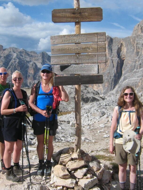
Alta Via 1 Stages: A Day-to-Day Breakdown
The Alta Via 1 is divided into 9-11 stages, each a self-contained adventure.
We’ve outlined a 9-day example itinerary below, based on standard divisions. Distances and elevations are approximate, and times assume moderate fitness (4-7 hours/day). Always check current conditions, as weather or trail maintenance can affect routes.
Day/Stage 1: Lago di Braies to Rifugio Biella (Sennes)
Kick off with a gentle 12 km (7.5 miles) warm-up. You’ll gain 1,200 meters (3,937 feet) through pine forests and open meadows. Skirt the lake’s edge, then ascend to Forcella Sora Forno pass for your first Dolomite panorama.
The trail eases into alpine pastures dotted with wildflowers. End at cozy Rifugio Biella (2,327 meters/7,635 feet), where a sunset over Croda del Becco caps the day. This stage builds excitement without overwhelming you; perfect for shaking off travel fatigue.
Time: 5-6 hours.
Day/Stage 2: Rifugio Biella to Rifugio Fanes
Cover 15 km (9.3 miles) with 600 meters (1,969 feet) ascent and 800 meters (2,625 feet) descent, traversing the Sennes Plateau’s rolling highlands. Pass crystal-clear streams and spot chamois grazing.
A highlight is the descent into the Fanes Valley, famous for its dramatic karst formations. Arrive at Rifugio Fanes (2,060 meters/6,759 feet), nestled in a fairy-tale amphitheater. The open vistas here remind you why the Dolomites are hiking heaven.
Time: 5 hours.
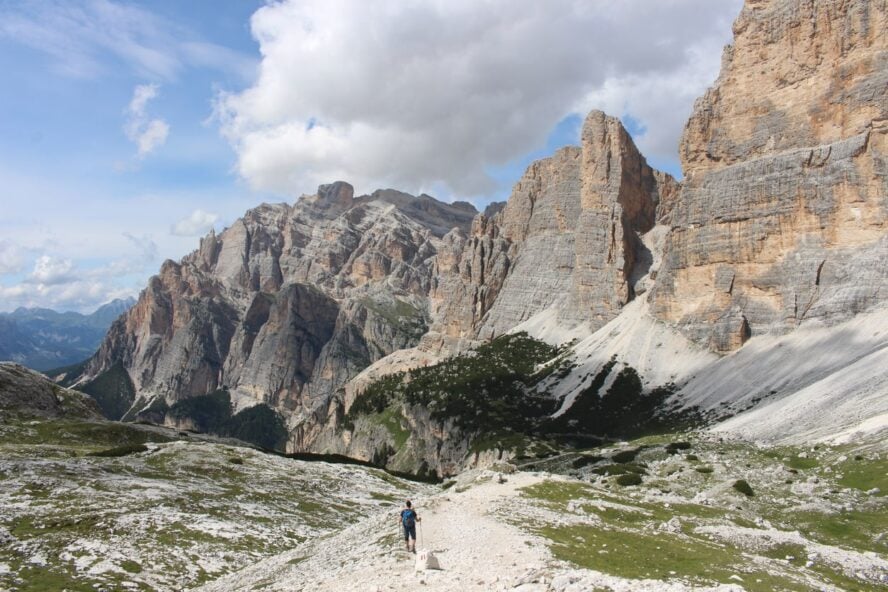
Day/Stage 3: Rifugio Fanes to Rifugio Lagazuoi
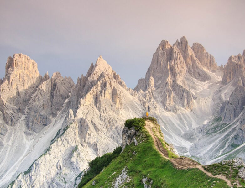
This 13 km (8 miles) stage ramps up with 1,000 meters (3,281 feet) gain, climbing to Forcella del Lago and the iconic Lagazuoi pass (2,752 meters/9,029 feet). Skirt Lago di Lagazuoi’s turquoise waters and explore WWI tunnels etched into the rock. A poignant history lesson.
The views of the Marmolada glacier are breathtaking. End at Rifugio Lagazuoi, perched high with epic sunsets. If heights bother you, fixed cables provide security.
Time: 6 hours.
Day/Stage 4: Rifugio Lagazuoi to Rifugio Nuvolau
Descend 14 km (8.7 miles) with 700 meters (2,297 feet) ascent and 1,200 meters (3,937 feet) descent, passing the Cinque Torri rock towers, the perfect spot for a photo break.
The trail undulates through meadows and scree fields, with glimpses of falcons soaring overhead. Climb to Rifugio Nuvolau (2,575 meters/8,448 feet), one of the oldest huts with 360-degree views. This day’s mix of history and scenery is a trekker’s delight.
Time: 5-6 hours.
Day/Stage 5: Rifugio Nuvolau to Rifugio Città di Fiume
Tackle 12 km (7.5 miles) with 500 meters (1,640 feet) gain and 900 meters (2,953 feet) descent as you skirt Monte Averau’s base. The path meanders through larch groves and past grazing deer, with optional detours to via ferrata routes.
End at Rifugio Città di Fiume (1,918 meters/6,293 feet), overlooking Monte Pelmo’s imposing face. It’s a recovery day with stunning Pelmo panoramas.
Time: 4-5 hours.
Day/Stage 6: Rifugio Città di Fiume to Rifugio Vazzoler
Push 16 km (10 miles) with 800 meters (2,625 feet) ascent and 1,000 meters (3,281 feet) descent, crossing Forcella Coldai’s high pass. Lakeside breaks at Lago Coldai refresh you before descending into forested valleys.
Rifugio Vazzoler (1,714 meters/5,623 feet) awaits with botanical gardens nearby. The high pass views will make you forget the leg burn.
Time: 6-7 hours.
Day/Stage 7: Rifugio Vazzoler to Rifugio Carestiato
A shorter 10 km (6.2 miles) with 700 meters (2,297 feet) gain, ascending to Forcella di Col Rean and skirting Civetta’s massive walls. Wild orchids line the path in summer. Rifugio Carestiato (1,834 meters/6,017 feet) offers cozy vibes and Civetta sunsets. Use the extra time to relax, explore, or drown in local food & vino.
Time: 4 hours.
Day/Stage 8: Rifugio Carestiato to Rifugio Sommariva al Pramperet
Hike 14 km (8.7 miles) with 600 meters (1,969 feet) ascent, traversing wild Zoldo Valley. Spot marmots and eagles amid boulder fields. End at Rifugio Sommariva al Pramperet (1,857 meters/6,093 feet), in a serene meadow. The remoteness here feels magical.
Time: 5 hours.
Day/Stage 9: Rifugio Sommariva al Pramperet to Belluno
Finish with 18 km (11.2 miles) and 1,500 meters (4,921 feet) descent through forests to Belluno. Celebrate with gelato in this Venetian gem. If extending, add side trips.
Time: 5-6 hours.
Where to Stay Along the Alta Via 1
Staying in rifugios is the AV1’s charm; cozy mountain huts offering beds, meals, and camaraderie. Book through the CAI (Club Alpino Italiano) website or apps like Booking.com, or grab a guided tour with 57hours.
What Are the Huts/Rifugios Like
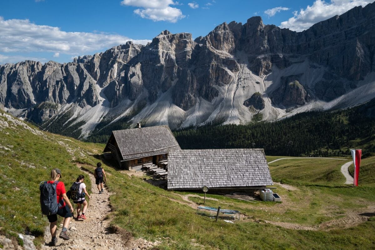
Rifugios are the soul of the Alta Via 1. They blend rustic charm with warm hospitality that makes every evening feel like a celebration.
Often perched on cliffs or nestled in meadows, they offer dorm-style accommodations with bunk beds (bring a sleeping bag liner for hygiene). Most have 4-10 person rooms, though private rooms are available at some rifugios for €10-20 extra.
Shared bathrooms are clean, with hot showers (€3-5) at rifugios like Lagazuoi, which also boasts a sauna for post-hike bliss.
Meals are a highlight; hearty dishes like polenta with wild mushrooms, venison stew, or homemade dumplings (€15-30), paired with local wines or schnapps. Breakfasts (€10-15) fuel you with bread, cheese, yogurt, and espresso to kickstart your day.
The vibe is electric. Hikers from across the globe swap stories over candlelit dinners and create bonds that linger long after the trek.
Some rifugios are bare-bones. No Wi-Fi or showers, but you do get unbeatable 360-degree views. Others, like Biella, have solar-powered charging stations.
Many are family-run, steeped in Ladin tradition. Their hosts stoked to share tales of the Dolomites’ history. We’ve spent evenings at Rifugio Vazzoler marveling at stars so bright they felt within reach, and at Carestiato, the sunset over Civetta is pure magic.
Fun fact: Rifugio Nuvolau, built in 1883, is one of the oldest huts in the Dolomites. You can get a glimpse into alpine life over a century ago!
Why You Should Book Your Alta Via 1 Huts in Advance
Huts fill fast in peak season (July-August), especially weekends. Booking 6-12 months ahead secures spots and lets you plan stages. Last-minute? Risk camping (permitted in some areas) or detours.
What’s the Elevation Profile of the Alta Via 1?
The Alta Via 1 elevation profile is all over the place. The trail starts at 1,496 meters (4,908 feet) at Lago di Braies, peaks at 2,752 meters (9,029 feet) at Lagazuoi, and drops to 430 meters (1,411 feet) in Belluno.
Daily gains average 700-1,000 meters (2,297-3,281 feet), with descents matching. Early stages climb steadily, mid-trail features high passes, and the end descends sharply. Use apps like Komoot for detailed profiles, and make sure to acclimatize to avoid altitude sickness.
What’s the Weather Like Along the Alta Via 1?
The weather in the Dolomites is influenced by the Mediterranean and Alpine climates. This creates a unique mix where you might hike in shorts one hour and bundle up against a chilly squall the next.
From mid-June to mid-September, daytime temperatures range from 15-25°C (59-77°F) in valleys, cooling to 5-10°C (41-50°F) at higher passes. Nights can dip near freezing, especially in early summer or late season, so pack warm layers.
Summer brings long daylight hours (up to 15 hours in June), perfect for early starts, but afternoon thunderstorms are common. They often roll in by 2 PM with lightning and heavy rain. These storms can turn trails slick, so we always aim to summit passes by noon. June sees occasional snow patches on high passes, adding a slippery challenge, while September means clearer skies but chillier mornings.
Fog or low clouds can obscure views, particularly in northern sections like Sennes, so check daily forecasts via Meteo.it, Südtirol Weather, or apps like Windy for real-time updates. Wind gusts on exposed ridges (e.g., Forcella Coldai) can hit 40-60 km/h (25-37 mph). Trekking poles can be a lifesaver. Snow is rare by July, but microclimates vary. Valleys stay warm, while peaks feel alpine.
Alta Via 1 Packing List for a Safe Hike
Your packing list for the Alta Via 1 should be about balancing weight, comfort, and safety to keep you agile across its miles of rugged terrain.
Your backpack should weigh 10-15 kg (22-33 lb), as anything heavier slows you down on steep ascents or long descents. Every gram counts, but skimping on essentials can leave you stranded or uncomfortable. Below is a detailed list to ensure you’re prepared for the variable conditions:
Clothing
-
Base layers: Moisture-wicking tops and bottoms (merino wool or synthetic, 2 sets). Rotate these to stay dry. Sweat-soaked clothes chill fast at night.
-
Mid-layer: Fleece or lightweight puffy jacket (200-300g). Our go-to for chilly evenings at rifugios.
-
Outer shell: Waterproof, breathable jacket and pants (Gore-Tex or similar). Essential for afternoon storms. Might save you during a downpour.
-
Hiking outfit: Durable pants (convertible to shorts), 2-3 moisture-wicking shirts, 3-4 pairs of wool socks. Pack light but enough to rotate; socks prevent blisters.
-
Insulation: Warm hat, lightweight gloves, and a buff for wind protection on exposed passes. We add a spare beanie for cold nights.
-
Gaiters: Mid-calf models keep pebbles and snow out of boots, especially in early season or scree fields.
-
Sun protection: Wide-brimmed hat or cap, UV-protective sunglasses. The high-altitude sun is intense.
Footwear
-
Hiking boots: Mid-height, waterproof boots with good ankle support and grippy soles (e.g., Salomon or La Sportiva). Break them in over 50-100 km (31-62 miles) to avoid blisters. Many learn this the hard way!
-
Camp shoes: Lightweight sandals or slip-ons (e.g., Crocs) for rifugio evenings. They’re a luxury for sore feet after 15 km (9 miles).
-
Spare laces: A backup pair saves you if laces snap mid-trail.

 Dolomites Hiking ToursAdventure CatalogIf you have questions or need help with planning a trip, schedule a call with one of our adventure experts.
Gear
-
Backpack: 30-40L, with a rain cover. We use a 35L for day-to-day comfort; 40L if carrying extra gear. Look for padded straps and hip belts.
-
Trekking poles: Collapsible, with wide baskets for stability on scree or muddy paths. They could save your knees.
-
Headlamp: With extra batteries (or USB-rechargeable). Crucial for early starts or late arrivals at huts.
-
Sleeping bag liner: Silk or cotton for hygiene in rifugio dorms. Some huts provide blankets, but you might want to bring your own.
-
First-aid kit: Bandages, blister plasters (Compeed), ibuprofen, antiseptic wipes, personal medications, and tape for minor injuries.
-
Multi-tool: Compact, with a knife and screwdriver for gear fixes or cutting food.
-
Water system: 1-2L water bottle or hydration bladder, plus a filter (e.g., Katadyn BeFree) for streams. Many hikers refill at rifugios but carry a filter for remote stretches.
Navigation
-
Map: Tabacco 1:25,000 maps (sheets 03, 015, 025 cover AV1). Durable and detailed for off-grid navigation.
-
Compass/GPS: A reliable compass or GPS app (e.g., Gaia GPS, Komoot) with offline maps. Cross-check both for accuracy on foggy days.
-
Power bank: 10,000mAh to keep your phone or GPS charged. Some rifugios have solar charging, but it’s not guaranteed.
Via Ferrata (Optional)
-
Kit: Harness, helmet, Y-shaped lanyard with carabiners for exposed sections (e.g., Lagazuoi’s cables). Rent in Cortina (€20-30/day) if not guided. Only pack this for specific detours, as the ferratas on Alta Via 1 are mild.
-
Gloves: Via ferrata gloves protect hands from cold metal cables.
Food and Safety
-
Snacks: High-energy bars, nuts, dried fruit (500g total). Pack enough for 2-3 snacks daily, as rifugio meals cover breakfast and dinner.
-
Sunscreen: SPF 50, small tube (100ml). Reapply often, as UV is brutal at 2,500 meters (8,202 feet).
-
Whistle: For emergencies in fog or remote areas.
-
Emergency blanket: Lightweight foil blanket for unexpected bivouacs.
-
Trash bag: Small, sealable bag for packing out all waste, per Leave No Trace principles.
-
Cash: €200-300 in small bills. Many rifugios don’t take cards, and showers/meals add up.
Personal Items
-
Toiletries: Travel-size toothbrush, toothpaste, biodegradable soap, quick-dry towel (microfiber), hand sanitizer. Keep it minimal. Huts have basics.
-
Documents: ID/passport, Südtirol Mobil Card (if using), CAI membership (for hut discounts), travel insurance proof. I store these in a waterproof sleeve.
-
Notebook/Pen: For journaling or noting trail markers. We love jotting down thoughts at sunset.
Optional Extras
-
Binoculars: Compact (8×25) for spotting chamois or eagles. It’s fun to watch marmots near Vazzoler.
-
Camera: Lightweight mirrorless or phone with a good lens for capturing the enrosadira.
-
Earplugs: For noisy rifugio dorms. Trust us, snoring happens!
Some Additional Pro Tips
The Alta Via 1 is as much about preparation as it is about passion. Over our years of hiking, we’ve picked up tricks that make the journey smoother and more rewarding. Here are four pro tips to elevate your experience:
1) Train Like a Local
Build stamina with 2-3 hour day hikes carrying a 10 kg (22 lb) pack at least 2-3 times a week for 6-8 weeks before your trip. Mimic the Alta Via 1’s ups and downs by tackling hilly trails near home or interval walking on an icline. Strength exercises like squats and lunges help, and yoga improves flexibility for rocky scrambles.
2) Learn Basic Ladin Phrases
The Ladin culture adds soul to your trek, and a few phrases go a long way in rifugios.
Learn “Bun dé” (good morning), “Gratias” (thank you), and “Ci vadal pa?” (how much is it?). We’ve seen hosts’ faces light up when hikers try Ladin, often earning you an extra slice of strudel. It also helps with trail directions from locals. Apps like Duolingo or local phrasebooks are great starting points.
3) Pack for Microclimates
The Alta Via 1’s weather shifts fast, so pack versatile layers. Carry a lightweight puffy jacket even in July. It’s a lifesaver when clouds roll. Include a waterproof stuff sack for electronics. A small dry bag for spare socks keeps your feet happy.
4) Respect the Alpine Code
Follow Leave No Trace principles: pack out all trash, stick to trails to protect fragile alpine plants, and keep noise low to avoid disturbing wildlife like chamois or marmots.
We always carry a small trash bag and bury human waste if nature calls away from huts. Binoculars enhance wildlife spotting; watching golden eagles soar near Civetta is a moment worth the extra weight.
The Alta Via 1 will change your life
The Alta Via is a soul-stirring odyssey through the Dolomites’ timeless beauty. It will challenge your body while nourishing your spirit.
From Lago di Braies’ serene start to Belluno’s triumphant finish, every step unveils wonders: towering spires, historic echoes, and unbreakable bonds with fellow hikers. Whether tackling it solo or with our expert guides, you’ll emerge stronger, inspired, and craving to go beyond. Good thing there are 9 more to explore!