Why didn’t anyone tell me about the obsidian desert? How did you know to stop at that exact spot above Álftavatn? What do I actually need to pack for this thing? This article is my answer to all of it, before you set foot on the trail.
My name is Aron. I’m a local guide from Iceland, and I’ve been leading groups across the Laugavegur hiking trail for four years now. Growing up here, I spent every spare moment escaping into the outdoors. Glaciers, mountains, anything to get away from the homework. Eventually, I made the outdoors my job. It’s a pretty nice office, to be honest.
After 22 tours, I know exactly where people struggle, where they underpack, where they push too hard on day two and pay for it on day three. I know which views deserve ten extra minutes and which sections catch people completely off guard.
All of that is in here, and it’s yours before you even book your flights.
Where Does the Laugavegur Trail Start and End?
The Laugavegur hiking trail runs through Iceland’s central highlands, starting at Landmannalaugar in the north and finishing at Þórsmörk in the south. Those two names are worth getting familiar with early, because everything on this trail is measured by the distance between them.
Landmannalaugar sits deep in the highlands, surrounded by rhyolite mountains that glow red, green, and gold depending on the light and the minerals in the rock. It’s the kind of place that makes people reach for their cameras before they’ve even put their bag down.
Þórsmörk, where the trail ends, is almost the opposite, a lush valley of dense birch forest with glaciers pressing down from the peaks above. The trek from Landmannalaugar to Þórsmörk is the whole story of the Laugavegur hiking trail.
In between, the landscape shifts more times than most people expect. You pass through obsidian deserts, black sand plains, glacier-fed river valleys, and moss-covered highlands. It’s a lot of Iceland compressed into one trail, and that compression is exactly what makes it so good.
How Long Is the Laugavegur Trail?
The official Laugavegur hiking trail is 55 km (34 mi) and is typically completed in four days. That works out to an average of roughly 14 km (9 mi) per day, though the days vary quite a bit. The first is a short warm-up of around 8 km (5 mi). The longest day stretches to 24 km (15 mi). The final two days sit somewhere in between.
Walking time each day ranges from around 4 hours on the easiest section to 8 or more hours on the longest. That’s important to understand before you come. These are full days on your feet, not strolls. The terrain adds time too, because you’re moving across snow patches, uneven volcanic rock, and occasionally wading rivers.
We also offer a two-day extension beyond Þórsmörk, bringing the full experience to six days and roughly 77 km (48 mi). If you have the time, I always recommend it.
Walking the Trail: From Landmannalaugar to Þórsmörk
Rhyolite mountains and the only hot spring on the trail

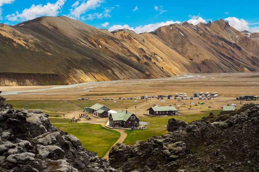
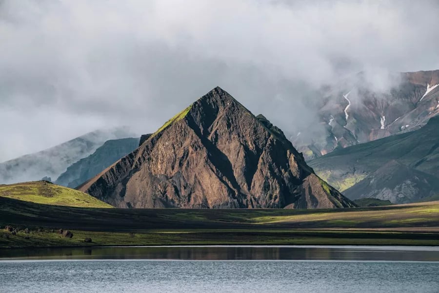
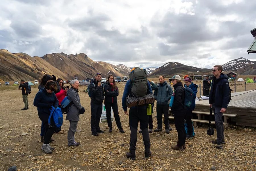
The trail begins at Landmannalaugar, and the first thing that hits you is the color. The mountain directly in front of you is called Brennisteinsalda, the Sulphur Wave, and it’s painted with iron red, copper green, and gold. To the left sits a lava field from a volcanic eruption in 1477. You are walking through a lava field into rhyolite mountains, and it is genuinely beautiful.
The first section of the Laugavegur hiking trail is intentionally gentle, around 8 km (5 mi) over roughly 4 hours. It’s a warm-up designed to ease legs into the terrain and give me a read on the group before the harder days arrive.
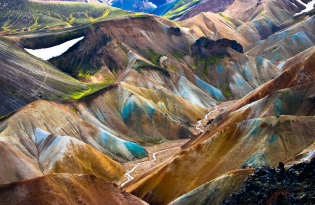
The landscape on this stretch is some of the most visually striking on the whole trail, all steam vents and mineral-stained ridges, so people tend not to mind the slower pace.
That evening, I always send everyone to the hot spring at Landmannalaugar. It’s the only one on the entire trail. After a long travel day and a first hike on unfamiliar terrain, sitting in warm geothermal water with mountains above you is exactly the right way to start.
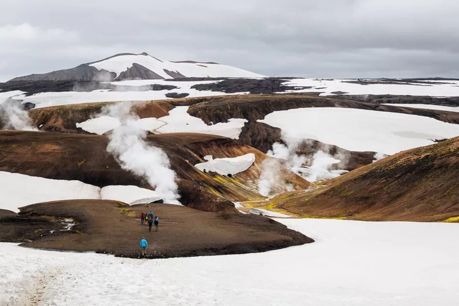
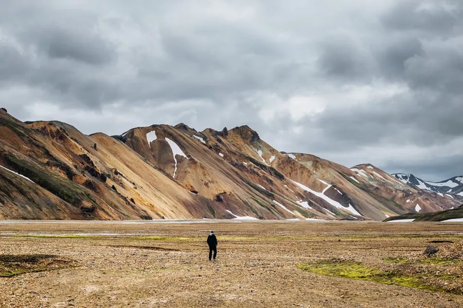
The obsidian desert and the view that silences everyone
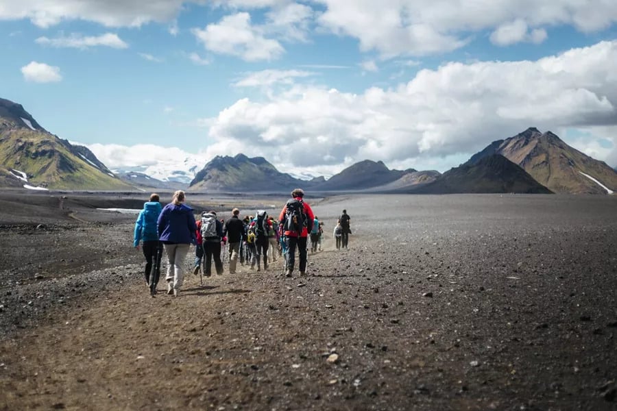
The next section is our longest, 24 km (15 mi), and the one people ask me about most. We leave Landmannalaugar and climb through more rhyolite terrain with steam vents rising on both sides. Low clouds often hang between the peaks here, which makes the whole stretch feel dramatic in a way that’s hard to describe. Don’t worry about navigation on this part. I know every cairn on this route.
As we gain elevation, snow appears underfoot. Then the landscape opens into the Obsidian Desert, a wide field of black glassy rock formed from ancient lava flows. It’s sharp enough to cut through gear, so we move carefully and stay on the trail. The visual contrast here, black rock, white snow, coloured ridges behind, is one of the more surprising moments on the Laugavegur hiking trail.
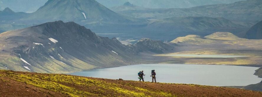
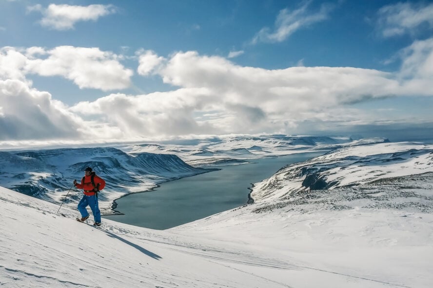
Near the end of this section, I always stop at the same spot. Below is Álftavatn, the Swan Lake, with glaciers rising in the distance and mossy fields filling the valley between them. I sit down and wait for the group to catch up. Nobody asks what we’re doing. Nobody says anything at all. Everyone just sits and looks. It happens every single tour, and I never get tired of it.
That night we stay at Álftavatn. There is a Highland Bar at the hut. After 24 km (15 mi) on volcanic terrain, people tend to find it without any guidance from me.
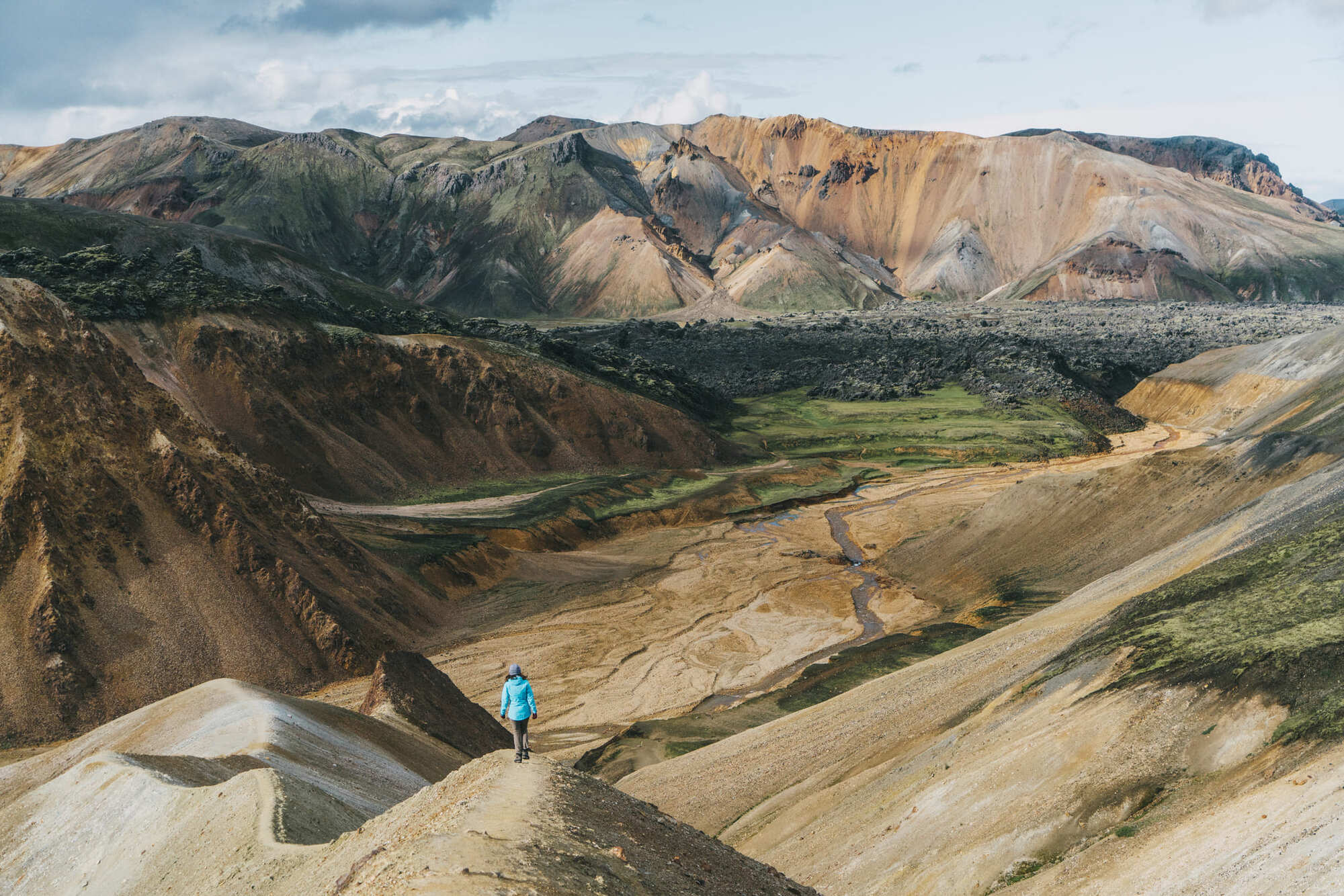
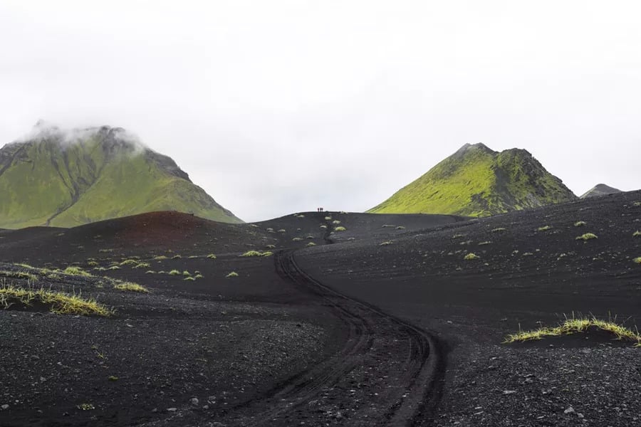
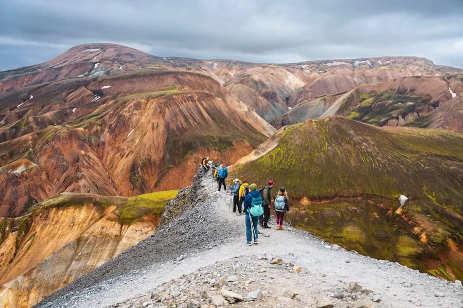
Black sand, moss, and the canyon nobody expects
After the longest day, we get a late start on the next section, around 10 am. At 16 km (10 mi), it’s noticeably more relaxed, and the terrain shifts into something new again.
For most of this part of the Laugavegur hiking trail, you’re walking through a black sand desert with vibrant green mountains rising on every side and glaciers sitting in the distance. I’ve done this section 22 times and I still stop to look. The colors in good light are almost unreasonably good.
Iceland has 606 species of moss, and you’ll see much of it on this stretch. One rule I hold firm on: we stay on the trail. Icelandic moss takes roughly 100 years to grow, and one footstep off the path can undo a century of it. No exceptions.
Near the end of the day, if conditions allow, I take everyone to Markarfljótsgljúfur Canyon, a gorge carved 200 m (650 ft) deep into the highland plateau. It’s weather dependent and I won’t take people there in poor visibility, but on a clear day the detour is non-negotiable as far as I’m concerned.
Emstrur, where we spend the night, is my favorite camp on the trail. Three small huts, around 20 beds each, cozy in the way that only a highland hut surrounded by nothing can be. That evening we cook together and share the highs and lows of the trail so far.
By this point, the group has become something. You can feel it in how people sit together.
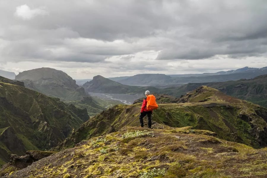
Into the birch forest at Þórsmörk
The final stretch of the official Laugavegur hiking trail is 15 km (9 mi) and takes around 6 to 8 hours. We leave Emstrur, cross glacier moraines, wade a glacial river, and then arrive at Þórsmörk.
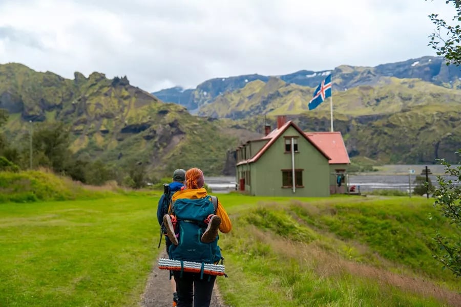
Walking into Þórsmörk after days in the open highlands is one of the more disorienting moments on the trail, in the best way.
You step out of the volcanic landscape and straight into a dense birch forest with canyons carved into the hillsides and glaciers above the treeline. People always make jokes about Iceland having no trees. Then they walk into Þórsmörk and go completely quiet.
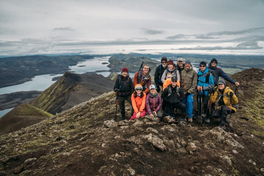
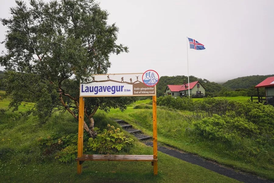
We take the group photo at the official trail sign. At that point, you’ve covered all 55 km (34 mi) of the Laugavegur hiking trail on foot. Then someone finds the shop, and the celebration beer appears, and that’s usually when the smiling starts and doesn’t stop.
Beyond Þórsmörk: What the Extension Looks Like
For those with more time, we offer two additional days beyond the official trail. Day five is a serious undertaking, 22 km (14 mi) with 1,100 m (3,600 ft) of elevation gain, heading up to the 2010 volcanic eruption site of Eyjafjallajökull.
The views from the plateau on the way up are, in my honest opinion, more impressive than the craters themselves. Standing up there looking out at that scale is the reward. At the top, you stand directly on two craters from the 2010 eruption, the ones responsible for stopping air traffic across Europe.
Day six is the recovery day. Late start, a short hike up to a nearby summit for wide views, then a detour into the Singing Cave. Whether there’s actual singing depends on the guide and the group. I make no promises. We catch a bus at 3 pm and that’s where it ends.
How Difficult Is the Laugavegur Hiking Trail?
Laugavegur Trail difficulty sits at moderate for most fit hikers. This is not a technical route. There’s no scrambling, no glacier crossing, no ropes. But the days are long, the terrain is uneven, and Iceland’s weather adds a layer of unpredictability that you need to be ready for.
The thing I tell everyone before they arrive: train for endurance, not speed. When you’re fit, you walk uphill and turn around to look at the view. When you’re not, you stare at your boots and count your steps.

The difference in experience is enormous. I prepare for my season by hiking local mountains repeatedly and trying to beat my own time without going out of breath. Something like that, done consistently in the months before you come, makes a real difference.
River crossings are another thing people underestimate. They’re not dangerous with proper footwear and a guide, but they’re cold and they require focus. Snowfields on the upper sections of the trail demand the same. None of it is beyond a fit, prepared hiker, but it all adds up across four days.
When Is the Best Time to Hike the Laugavegur Trail?
The best time to hike the Laugavegur trail is late June through August. This is when the highland roads are open, the huts are staffed, and the trail is at its most accessible. In Iceland, we say that if you don’t like the weather, wait ten minutes.
In the highlands, that’s not entirely a joke. You can get all four seasons in one day up there, and you will be layering and de-layering throughout.
What summer gives you is 24-hour daylight, genuinely, you never have to worry about running out of light, and the most stable weather windows of the year.
Early June can still have significant snow blocking sections of the trail. September is possible but huts start to close and conditions become harder to predict. For the first time on the Laugavegur hiking trail, July or August is the window I’d aim for.
What to Pack for the Laugavegur Trail
The Laugavegur Trail packing list comes down to one core principle: Iceland in summer is not warm. The highlands are colder, more exposed, and more unpredictable than anything most visitors expect, and your gear needs to reflect that.
On clothing, a proper waterproof jacket and trousers are non-negotiable. Not a rain poncho, real waterproofs that will hold up in sustained rain and wind. A warm mid-layer, moisture-wicking base layers, a warm hat and gloves round out what you need for your upper body.
For footwear, hiking boots with solid ankle support are essential. Not trail runners, not sneakers. You will be walking through snow and slush across multiple days, and your feet need to stay dry and supported throughout.
On the trail each day, hiking poles make a genuine difference on uneven volcanic terrain. They make you look a bit like a grandparent, but I use them on every single tour so I won’t apologize for recommending them.
A daypack of around 20 to 25 liters, a water bottle or hydration system, sunscreen, sunglasses, and a headlamp as a backup are the other essentials. In your main bag, which our drivers carry between huts, bring a sleeping bag liner, a quick-dry towel, and any personal medication.
Where You Sleep on the Laugavegur Hiking Trail
Laugavegur Trail accommodation is built around traditional Icelandic mountain huts at each overnight stop. These are shared sleeping spaces with fully equipped communal kitchens, bathroom facilities just outside, and hot showers available for a small fee.
Hut to hut hiking Iceland-style is a specific experience, communal, a little snug, and genuinely enjoyable once you settle into the rhythm of it.
Each hut has its own character. Landmannalaugar has a hot spring just outside. Álftavatn has the Highland Bar. Emstrur is my personal favorite, smaller, quieter, with the most authentic highland atmosphere on the whole trail.
We also offer a tenting option for those who want a more immersive experience. You get your own personal tent for the full four days, access to a shared kitchen tent, and all camp facilities.
It’s more exposed to the elements, and in Iceland that means something real, but it’s also a deeply satisfying way to sleep on this trail. Luggage is transported between camps by highland drivers in a modified vehicle with 44-inch tires built to cross glacial rivers. All you carry each day is a daypack.
How to Navigate the Laugavegur Hiking Trail
For anyone planning logistics, the Laugavegur Trail map runs roughly north to south through Iceland’s central highlands. The four main overnight stops, Landmannalaugar, Álftavatn, Emstrur, and Þórsmörk, are well established, and the trail is marked with cairns throughout. In good weather and clear visibility, the path is generally straightforward to follow.
In fog, on snowfields, or when conditions deteriorate quickly, navigation becomes a different matter.
The trail passes through genuinely remote terrain with no road access, no shortcuts, and no mobile signal across most sections. This is one of the main reasons guiding the Laugavegur hiking trail makes a practical difference, not just for the experience, but for knowing when to move, when to wait, and which lines are safe when the weather turns.
What to Do After the Laugavegur Trail
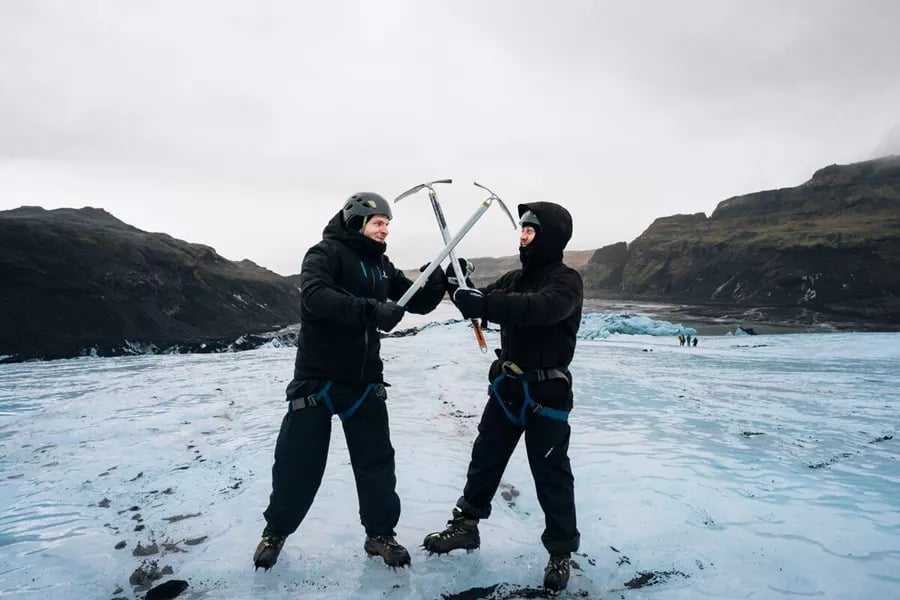
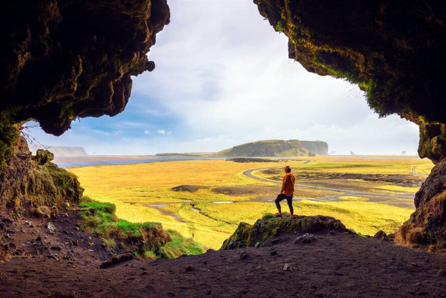
Once you’ve finished the Laugavegur hiking trail, Iceland has plenty more to offer. Glacier hiking is something I always recommend first. Walking on pure ice with crampons, looking into crevasses, it’s something most people have never done, and it gives you a completely different perspective on the landscape you’ve just crossed on foot.
The Golden Circle covers Þingvellir National Park, where you can stand between the North American and Eurasian tectonic plates, along with Geysir and the Gullfoss waterfall.
The south coast adds black sand beaches and waterfalls you can walk behind. For those wanting more adventure, ice cave exploration, snorkeling at Silfra in Þingvellir, or a helicopter flight over an active volcanic eruption site are all genuinely available.
And if you miss the Northern Lights in summer, because you will with 24-hour daylight, that’s simply a reason to come back.
There’s always a reason to come back to Iceland.
The Things I Wish Every Hiker Knew Before Arriving
The trail is not the hard part. Getting yourself ready for the trail is the hard part, and most people underestimate it.
The biggest thing: your boots matter more than your fitness level. I’ve guided very fit people who struggled because their footwear wasn’t right, and less fit people who had a brilliant time because they came prepared. Broken-in, waterproof hiking boots with ankle support will change your experience more than any amount of training.
The second thing: the longest day comes early. Day two on the Laugavegur hiking trail is 24 km (15 mi), and it comes before your legs have fully adjusted to the terrain. Don’t go out too fast in the morning. Pace yourself on the climb out of Landmannalaugar, eat and drink consistently, and trust that the view above Álftavatn at the end of the day is worth every step.
The third thing: the weather will surprise you, and that’s fine. Some of the most memorable moments I’ve witnessed on this trail happened in mist and rain, not sunshine. Come with the right gear and an open mind, and Iceland will reward you regardless of what the sky is doing.
And finally, this trail is genuinely for everyone willing to prepare properly. I’ve guided people in their twenties and people in their seventies on the Laugavegur hiking trail. What they had in common wasn’t fitness or age.
It was preparation, curiosity, and a willingness to take it one section at a time.
That’s all it takes.