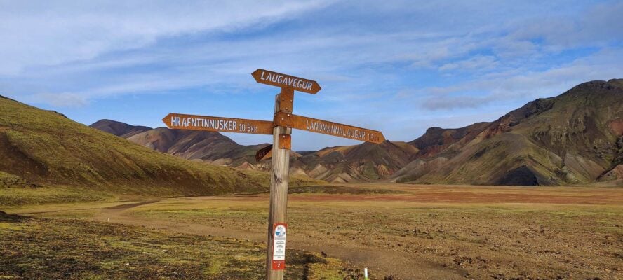
What I love about the Laugavegur Trail is how rapidly the landscapes melt into each other across 55 kilometers (34 miles). All the headliners Landmannalaugar is known for make an appearance throughout the four-day trek.
With that said, the Laugavegur trail is one of the most renowned in the world. It’s well developed, easy to follow, and comes with crowds to boot.
It’s the “Landmannalaugar Trail” for a reason
So maybe it doesn’t come as a surprise that “lauga” is actually the truncated version of Landmannalaugar. If you can’t dedicate several summers to roaming every inch of the area, the Laugavegur Trail is pretty good bang for your buck—it features views of Landmannalaugar’s iconic rainbow mountains, a stint through a cosmically black desert, and lush green forests.
The trail’s southern terminus is in Þórsmörk, which translates to something like “Thor’s forest,” named for the Norse god. (That “P”-looking letter makes the “th” sound and today only exists in Icelandic. The more you know!) It’s the perfect name for the valley as Þórsmörk has more trees than you’ll find in most other places in Iceland.
Hiking the Laugavegur Trail
Most hikers follow the trail from north to south, and that’s the route I typically recommend. Of course you can start in Þórsmörk and end in Landmannalaugar, but be prepared for a few days’ climb before a quick descent into Landmannalaugar.
Day 1:
People typically do this over four days with the first day being objectively the toughest with 457 meters (1,500 feet) of elevation gain. The first part of the trail ascends up to the Laugahraun lava field and then crosses it. It’s mostly a steady climb up from there, but you’ll have breathtaking views of some of the area’s most iconic mountains. After about 12 kilometers, you’ll arrive at Hrafntinnusker, a mountain (that is actually a volcano) with a hut.
Day 2:
The journey onward from Hrafntinnusker is less strenuous. On day two, you’ll lose most of the elevation you gained the day before. The trail covers about 12 kilometers (about 7.5 miles) to the Álftavatn huts, which sit near the deeply blue Lake Alftavatn. If 12 kilometers doesn’t feel like enough in one day, you could push on to the facilities in Hvanngil.
Day 3:
For those who chose to stay in Álftavatn, the next leg is a bit longer. It’s 16 kilometers (nearly 10 miles) to the next hut and campground in Emstrur. This is the area where the colors Landmannalaugar is known for give way to a huge volcanic desert, where black rock extends seemingly forever.
Day 4:
But the monochromatic landscape doesn’t last forever. On the final day, as you approach Þórsmörk over the trail’s final 15 kilometers (about nine miles), you’ll enter the woodlands of Thor’s woodlands, while descending another 300 meters.
It’s hard for me to describe how phenomenal this hike is, which is why I’ve come to appreciate photography so much. Some people might think they could reasonably cover 55 kilometers in only a day or two, but I bet the urge to stop every few steps to take photos would slow down even the most focused hiker.
Huff it during the day, hut it at night
There is a network of huts along the trail, owned and operated by Ferðafélag Íslands, the Iceland Touring Association, (FÍ). The huts vary in size and amenities, but they all typically fit a few dozen people and most have running water, a bathroom, and kitchen. The huts at Álftavatn and Emstrur have showers.
Note that even if you aren’t spending the night—just using the bathroom, say, or hanging out on the benches—you’ll still be asked to pay a facility fee to help cover maintenance costs.
If you plan on spending the night, make sure to reserve your space well in advance, as they often fill up very quickly. There’s space for camping as well, and you’ll still be able to use the facilities at the hut. Be sure to bring a durable tent and take advantage of the rocks at campsites to keep your shelter pinned down—it is hard to drive pins into the ground. (Also note that the hut asks you to return the rocks to the wooden crates in the vicinity after use.)
Keep in mind that the weather in Iceland is unpredictable. I’m talking high winds, low temperatures, and unrelenting rain. Rain gear and proper layers are vital; last season, dozens of people were rescued from the trail for risk of hypothermia, right in the height of summer.
While hot food and a place to crash are nice and everything, the huts’ finest features are priceless: the wardens. These are the folks who can answer any questions you may have about the trail or advise you on the weather, so be sure to take advantage of their knowledge.
