There was an error with your log in
2026 is sold out — book 2027, or find a last minute deal.
Self-guided Haute Route

Self-Guided Walker’s Haute Route: From Chamonix to Zermatt

9 days | Challenging | 5.00
From $2,185 ()
Book a call

The best way to fully experience the magic of the Alps has to be by trekking the Walker’s Haute Route! This epic, world-renowned route stretches from the outskirts of Chamonix to the charming Zermatt, and its iconic Matterhorn. Lots of people prefer walking and exploring on their own and at their own pace—if you’re one of them, you’ll love this self-guided tour. Available as a 9- or 11-day hiking journey, it was put together by local guides who’ve lived in the Alps all their lives, and they will make your self-guided trek smooth and worry-free—your accommodation, most meals, maps, and support are all taken care of. Get your cameras ready: these landscapes feel like stepping into a postcard. And staying there for more than a week.

Adventure Highlights

  • Alpine scenery every step of the way: From valleys and forests to snow-capped Matterhorn and pristine lakes, take it all in
  • The iconic Walker’s Haute Route: This route connects two Alpine capitals, allowing you to explore all the beauty in between
  • Set your own hiking pace: Self-guided tour is carefree, since accommodation, most meals, and route maps are taken care of
Duration
9 days
Season
July through September
Group size
Up to 16 people
Accommodation
Standard: Domitory-style lodging
Difficulty
Challenging: Excellent fitness & previous multi-day hiking experience required
What's included
Lodging, most breakfasts & dinners, route notes & travel information, on-site support

The adventure, day by day

This is the tighter version of the classic traverse, for when you want to hike all the way from Chamonix to Zermatt but have a few days less. Over nine days, you’ll follow the Walker’s Haute Route across the Swiss Valais, crossing high passes like the Col de Louvie, the Col de la Forcletta, and the Augstbordpass, and walking past glaciers, dams, and some of the wildest valleys in the Alps. Expect between 11.5 and 24 km (7–15 mi) a day, with nights in mountain huts and dormitory-style lodging. Eight nights of accommodation, most breakfasts and dinners, a detailed route description with walking times, and a map are all arranged before you set off. The trek ends in Zermatt, right below the Matterhorn.

Day 1: Montroc — Trélechamp — Trient
Aiguillette des Posettes

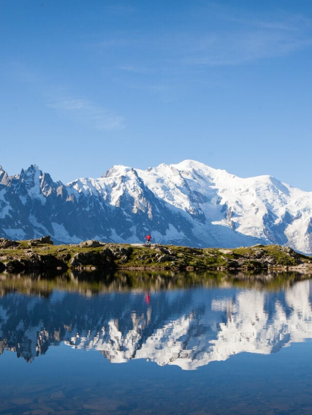
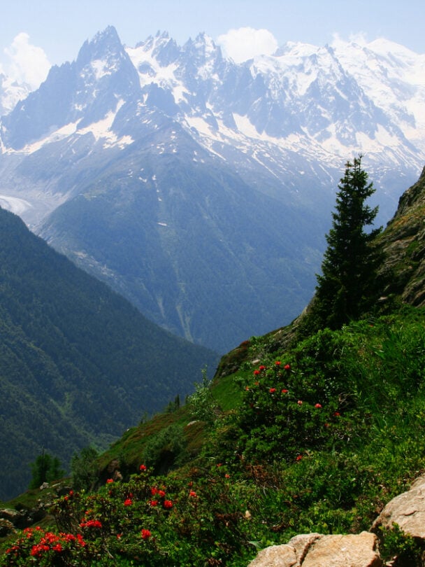
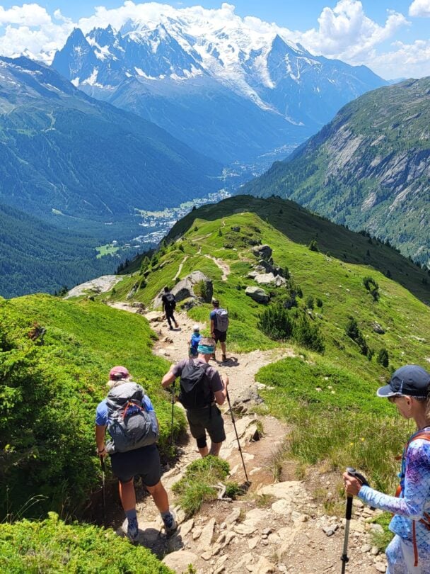
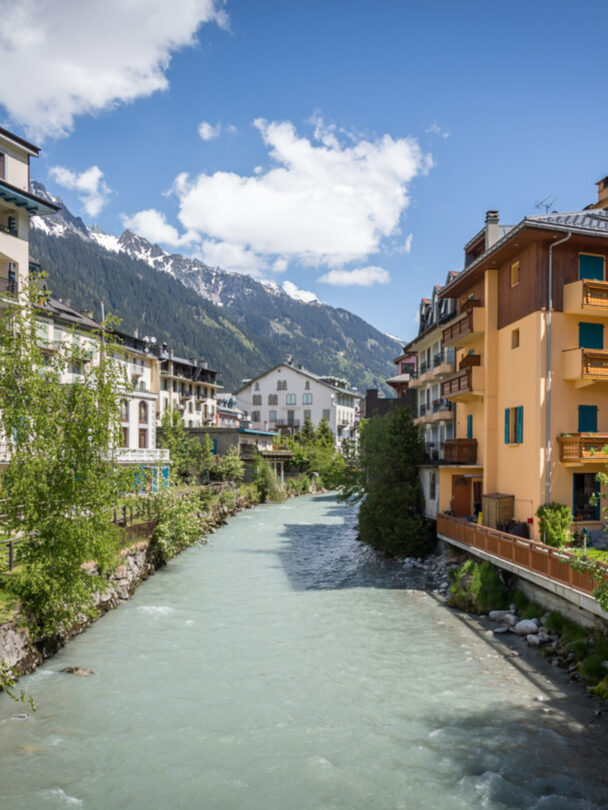
Start your self-guided journey in the village of Montroc, just 20 minutes from Chamonix, and hike up to the Aiguillette des Posettes. This ridge is one of the most panoramic spots on the route, with views over the Mont Blanc range, its main summits, and the Chamonix valley. The mountain pastures of Posettes and Balme are the last ones still in use near Chamonix. From here, a path along the mountainside takes you across the French-Swiss border and through the alpine pastures of Catogne. The village of Trient is your destination for the night.

Meals: Dinner
Distance: 13.9 km (8.6 mi)
Elevation: +1,175 m (+3,855 ft) / -1,260 m (-4,134 ft)
Accommodation: Dormitory

Day 2: Trient — Champex, via Bovine alpine pastures
Grand Combin massif

The day begins with a climb up to the Col de la Forclaz. From there, the trail winds through a beautiful larch forest and reaches the alpine pastures of Bovine, with views of the Dents du Midi and the foothills of the Bernese Alps. Further east, the Pennine Alps come into view, along with the Grand Combin massif. Farmers still use the Bovine route to bring their cattle through the mountains. The trail then descends to Plan de l’Au and finally to Champex-Lac, a small village set on a mountain lake.

Meals: Breakfast and dinner
Distance: 14.5 km (9 mi)
Elevation: +945 m (+3,100 ft) / -790 m (-2,592 ft)
Accommodation: Dormitory

Day 3: Champex — Mille hut
Champex le Lac

From Champex-Lac, a pleasant descent through forest, hillsides, and small hamlets brings you to the bottom of Val d’Entremont and the village of Orsières, at the foot of the Great St Bernard Pass. This is where the Valais Alps begin. A long climb up the western side of Val d’Entremont leads to the crests of Mont Brûlé, where you’ll get one last look at the summits on the northeastern end of the Mont Blanc range. The trail then reaches the Mille hut, perched at 2,473 m (8,114 ft), where you’ll spend the night.

Meals: Breakfast and dinner
Distance: 15.5 km (9.6 mi)
Elevation: +1,700 m (+5,577 ft) / -700 m (-2,297 ft)
Accommodation: Dormitory at the Mille hut

Day 4: Mille hut – Louvie hut
Val d’Entremont view

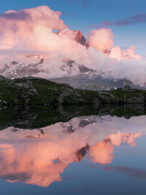
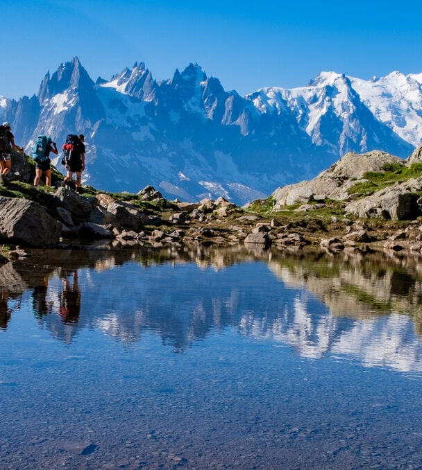
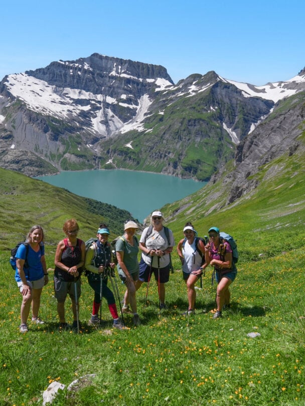
Today’s stage is long but easy, through beautiful open landscapes. It links two huts with wonderful panoramas: the Cabane de Mille, overlooking Val d’Entremont, and the Cabane de Louvie, overlooking Val de Bagnes. A very pleasant trail takes you past the Brunet hut before descending into Val de Bagnes. From the village of Fionnay, the path climbs toward the Louvie hut and its magnificent lake, where you’ll see the immense Corbassière glacier reflected in the water.

Meals: Breakfast and dinner
Distance: 21 km (13 mi)
Elevation: +1,260 m (+4,134 ft) / -1,500 m (-4,921 ft)
Accommodation: Dormitory at the Louvie hut

Day 5: Louvie hut — Prafleuri hut, via the Louvie and Prafleuri passes
Grand Desert in the Alps

There are two passes on today’s program: first the Col de Louvie (2,921 m / 9,583 ft), then the Col de Prafleuri (2,939 m / 9,642 ft). Between them lies the Grand Désert, a vast plateau of moraines and rocks left behind by the retreating glaciers. The landscape here is stark and rocky, dotted with lakes, cairns, and markers that guide you across. From the Col de Prafleuri, the trail descends to the Prafleuri hut, where you’ll spend the night.

Meals: Breakfast and dinner
Distance: 11.5 km (7.1 mi)
Elevation: +1,040 m (+3,412 ft) / -625 m (-2,051 ft)
Accommodation: Dormitory at the Prafleuri hut

Day 6: Prafleuri hut — Grande Dixence dam — Evolène, via Col de la Meina
Grande Dixence Dam

Today’s route skips the Col de Riedmatten and the Pas de Chèvre. Both are technical, exposed sections with unstable rocky terrain and tall vertical ladders. Instead, from the Grande Dixence dam, the tallest gravity dam in the world, you’ll descend into the Hérémence valley to a spot called Motôt (1,905 m / 6,250 ft). The path crosses the Merdéré torrent and later reaches the alpine pastures of Novélé (2,082 m / 6,831 ft). Crossing the Col de la Meina takes you into Val d’Hérens and down to the pretty hamlet of La Meina, where a chairlift eases the way down to Lannaz.

Meals: Breakfast
Distance: 15.5 km (9.6 mi)
Elevation: +1,000 m (+3,281 ft) / -1,515 m (-4,970 ft)
Accommodation: Dormitory

Day 7: Evolène/La Sage – Zinal, via Col de Torrent and Lac de Moiry
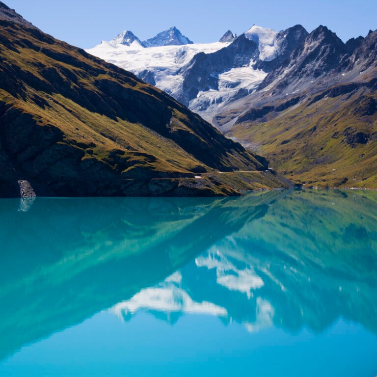
Reservoir Lac Moiry

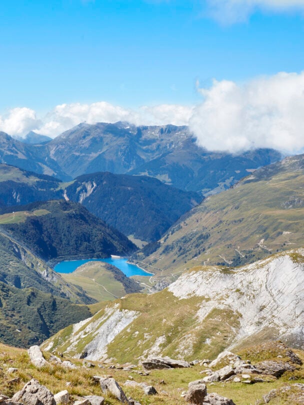
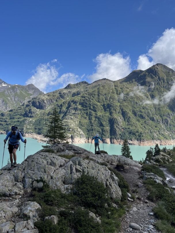
From La Sage in Val d’Hérens, set off toward Zinal. You’ll first cross the Col de Torrent, where the Moiry dam and its strikingly colored lake come into view below. From there, hike down to the lake through the alpine pastures. Once you reach the dam, a local shuttle takes you from Moiry to Zinal, a mountain village at the head of Val d’Anniviers, where you’ll spend the night.

Meals: Breakfast and dinner
Distance: 12 km (7.5 mi)
Elevation: +1,260 m (+4,134 ft) / -665 m (-2,182 ft)
Accommodation: Dormitory

Day 8: Zinal – Gruben, via Col de la Forcletta
Zinal cow

The climb to the Col de la Forcletta is long and varied. A steep forest path leads to a long, pleasant balcony above Val de Zinal, then on to welcoming alpine pastures before the final steep slope. The descent into the Turtmanntal feels like a step back in time. The valley is cut off in winter, and it’s the wildest one in Valais. In the distance, you’ll spot the Augstbordpass, which you’ll cross tomorrow, and the Turtmann glacier, framed by the Bishorn on one side and the Weisshorn on the other. Tonight, you’ll stay in the hamlet of Gruben.

Meals: Breakfast and dinner
Distance: 24 km (14.9 mi)
Elevation: +1,500 m (+4,921 ft) / -1,350 m (-4,429 ft)
Accommodation: Dormitory

Day 9: Gruben – St. Niklaus – Zermatt
View of the Swiss resort town of Zermatt, one of the stops during the Tour of Monte Rosa, and the towering Matterhorn during summer.

The ascent to the Augstbordpass (2,892 m / 9,488 ft) is long, through forest, alpine meadows, grassy slopes, and rocky terrain. It’s the last real challenge of your journey, and the pass rewards you with a spectacular view of the Zermatt valley and the Mischabel massif. The descent follows the valley below the pass to a junction at 2,095 m (6,873 ft). It then continues along the rather steep side of the Twära toward Jungu (1,954 m / 6,411 ft), a tiny hamlet perched high above the valley. From there, a small cable car takes you down to St. Niklaus, and the train carries you on to your final destination, Zermatt.

Meals: Breakfast
Distance: 17.2 km (10.7 mi)
Elevation: +1,250 m (+4,101 ft) / -1,090 m (-3,576 ft)

Note

We’re happy to customize your journey and hear your wishes—and we’ll do our best to meet your expectations, contact us!

The itinerary, distances, and altitudes may vary slightly for many reasons beyond your organizer’s control, including weather and terrain conditions.

Accommodation prior to Day 1 and on Day 11 are not included in the self-guided tour. Your guiding company can arrange this for an additional cost.

This is the full version of the Walker’s Haute Route, with two extra days at the end to make the most of Zermatt. Over 11 days, you’ll hike from Montroc, near Chamonix, across the Swiss Valais. Along the way, you’ll cross high passes and the rocky Grand Désert, tackle a few technical sections, and stay in mountain huts like Mont Fort and Prafleuri. Once you reach Zermatt, the trek continues to the Fluhalp hut for a night at 2,606 m (8,550 ft). Next morning, you’ll head up to the Gornergrat (3,090 m / 10,138 ft) for views of the Monte Rosa range and nearly 30 peaks over 4,000 m, then ride the rack railway back down. Ten nights of accommodation, most breakfasts and dinners, a roadbook, and GPS tracks are all arranged for you.

Day 1: Montroc – Trélechamp – Trient
Aiguillette des Posettes

Begin your self-guided journey in the morning from the village of Montroc, just 20 minutes away from Chamonix. Start hiking to Aiguillette des Posettes, a ridge offering fantastic views. You’ll see the Mont Blanc range, its main summits, the Chamonix valley, and the alpine pastures of Posettes and Balme. You will soon cross the French-Swiss border and pass through the alpine pastures of Catogne. The village of Trient is your destination for the night.

Meals: Dinner
Distance: 11.5 km / 7 miles
Elevation: +1,000 m / +3,280 ft | -1,200 m / -3,940 ft
Accommodation: Dormitory

Day 2: Trient — Champex, via Bovine alpine pastures
Grand Combin massif

Hike up to the Col de la Forclaz. The trail will take you through a beautiful larch forest and reach the alpine pastures of Bovine, overlooking the upper Rhone valley and located upstream from Lake Geneva in the Swiss Valais. You’ll also be able to admire the range to the south as well as the peaks of Bernese Alps. Further east, the Pennine Alps (Valaisannes) welcome you with the Grand Combin massif. The Bovine route is used by farmers to guide their cattle through the mountains. The trail then goes down to Plan de l’Au and, finally, Champex le Lac.

Meals: Breakfast and dinner
Distance: 15 km / 9.3 miles
Elevation: +850 m / +2,820 ft | -1,000 m / -3,280 ft
Accommodation: Dormitory

Day 3: Champex — Mille Hut
Champex le Lac

Departing from Champex le Lac, a lovely trail takes you down through the forest, hillsides, and small hamlets. Finally, you’ll reach Val d’Entremont and the village of Orsières located at the bottom of the Grand St. Bernard Pass. And then, the Valaisan Alps show up! A long climb on the western side of the Val d’Entremont is necessary to reach the crests of the Mont Brûlé which allows you to admire the summits one last time. The trail then leads you to the Mille Hut perched at 2,473 m above sea level, and this is where you’ll stay overnight.

Meals: Breakfast and dinner
Distance: 13 km / 8 miles
Elevation: +1,700 m / +5,580 ft | -1,700 m / -5,580 ft
Accommodation: Dormitory

Day 4: Mille Hut — Mont Fort Hut
Val d’Entremont view

A long and easy day starts at Cabane de Mille overlooking the Val d’Entremont. A very pleasant track takes you to the Brunet Hut, and then goes down into the Val de Bagnes. From the village of Fionnay, the path goes up towards the Cabane Mont Fort, where you’ll overnight.

Meals: Breakfast and dinner
Distance: 21 km / 13 miles
Elevation: +1,275 m / +4,183 ft | -1,510 m / -4,954 ft
Accommodation: Dormitory

Day 5: Mont Fort Hut — Prafleuri Hut, via the Louvie and Prafleuri passes
Grand Desert in the Alps

Two exciting passes today! First the Louvie pass at 2,921 m and then the Prafleuri pass at 2,939 m. You will marvel at the Grand Desert nestled between these two passes—this is a vast plateau punctuated by lakes, cairns, and beacons that will guide your crossing. From the Prafleuri pass, the trail goes down to the hut, where you’ll spend the night.

Meals: Breakfast and dinner
Distance: 12 km / 7.4 miles
Elevation: +1,200 m / +3,938 ft | -1,400 m / -4,593 ft
Accommodation: Dormitory

Day 6: Prafleuri Hut — Grande Dixence dam — Evolène via Col de la Meina
Grande Dixence Dam

For today’s itinerary, your guiding company prefers to skip Riedmatten or Pas de Chèvre, as they are very technical and not suitable for those uncertain of their footing in rocky, unstable terrain and for those with a fear of climbing high vertical ladders. So today’s trail leaves the Grande Dixence dam and descends into the Hérémence valley to Motôt. Cross the Merdéré torrent and reach the alpine pastures of Novèlé sometime later. Crossing of the Meina Pass allows the switch to the Val d’Hérens, and when you descend you will reach the pretty hamlet of La Meina. A chairlift will facilitate the descent to the Lannaz village.

Meals: Breakfast
Distance: 19 km / 12 miles
Elevation: +1,050 m / +3,445 ft | -1,560 / -5,120 ft
Accommodation: Dormitory

Day 7: Evolène / La Sage — Zinal, via Col de Thorens et Lac de Moiry
Reservoir Lac Moiry

From La Sage in the Val d’Hérens, head towards Zinal and first pass by the Col de Torrent. The view of the Moiry Lake dam with its piercing blue hues is a sight to behold. You will then hike down to the lake by crossing the alpine pastures of Thorens. From the dam, take the local shuttle service to Zinal where you will spend the night.

Meals: Breakfast and dinner
Distance: 11 km / 7 miles
Elevation: +1,200 m / +3,940 ft | -700 m / -2,300 ft
Accommodation: Dormitory

Day 8: Zinal — Gruben via Col de la Forcletta
Zinal cow

The climb to the Col de La Forcletta is a long one. A steep forest path will lead you to a long, pleasant balcony above the Val de Zinal, and then to a welcoming alpine pasture area on the final steep slope. You will go down to the wildest valley in the Valais, the Turtmanntal (Val Turtmann). In the background, you’ll get a glimpse of the Augtsbordpass that’s on tomorrow’s itinerary, as well as the Turtmann glacier surrounded by the Bishorn on one side and the Weisshorn on the other.

Meals: Breakfast and dinner
Distance: 17.2 km / 10.7 miles
Elevation: +1,250 m / +4,100 ft | -1,090 m / -3,580 ft
Accommodation: Dormitory

Day 9: Gruben — St Niklaus — Zermatt
View of the Swiss resort town of Zermatt, one of the stops during the Tour of Monte Rosa, and the towering Matterhorn during summer.

The day starts with a long ascent through forests, alpine meadows, grassy slopes, stones, and rocks to the Augstbordpass at 2,892 m. This is the final major push of the journey and the rewards are immense: Val de Zermatt and the Mischabels massif. The descent goes into the valley and then continues on the steep side of the Twära mountain in the direction of the suspended hamlet of Jungu at 1,954 m. From there, a cable car takes you down to St Niklaus, then a train to Täsch and then to your final destination of Zermatt.

Distance: 13 km / 8 miles
Elevation: +1,100 m / +3,610 ft | -1,000 m / -3,280 ft
Accommodation: Dormitory

Day 10: Zermatt — Fluhalp Hut
Hiking with the sight of Matterhorn

A relaxing half-day hike will take you through the, once again, idyllic setting of the Alps. You will reach the Fluhalp Hut, allowing you to experience the romantic atmosphere of staying there. The sunrises and sunsets will stay with you forever.

Meals: Dinner
Distance: 8.6 km / 5 miles
Elevation: +1,200 m / +3,940 ft | -200 m / -660 ft
Accommodation: Dormitory

Day 11: Fluhalp Hut — Gornergrat — Zermatt
Gornergrat train

After a night spent at 2,606 m, you’ll hike even further up to the Gornergrat. At 3,090 m, you will enjoy panoramic views of the Monte Rosa range in the distance, the Pointe Dufour at 4,624 km (Switzerland’s highest mountain) and 29 other peaks over 4,000 m. Finish your adventure with a ride aboard the highest rack railway in Europe on your way down to Zermatt. Congrats! You’ve finished your epic 11-day hiking journey through the heart of the Alps!

Meals: Breakfast
Distance: 9 km / 5.6 miles
Elevation: +970 m / +3,185 ft | -350 m / -1,150 ft

Note

We’re happy to customize your journey and hear your wishes—and we’ll do our best to meet your expectations, contact us!

The itinerary, distances, and altitudes may vary slightly for many reasons beyond your organizer’s control, including weather and terrain conditions.

Accommodation prior to Day 1 and on Day 11 are not included in the self-guided tour. Your guiding company can arrange this for an additional cost.

Meet Scout, your adventure agent
Tell it what you’re after. You’ll have a day-by-day trip in a minute, quoted by a certified local guide.
Let’s build your itinerary. What are you into?
Talk to Scout

Photo gallery

Adventure, packed to go

Adventure brochure
Download to share and explore full itineraries, key info, FAQs, and guide details.
Download now

What others say about this adventure

5.00 (3 reviews)
M
Monica Z.
|August 2024
This was the most scenic hike I have ever been on. The views were spectacular, the huts fabulous and the food was great too. We were very impressed with the local guides with Nuyama.
L
Lisa Tyerman

As we prepared to leave we contemplated our amazing adventure and sense of accomplishment. Thank you to Nuyama for great organizational skills, prompt responses, sound advice along the way and the perfect for us choices of routes for each day. As we interacted with hosts and fellow hikers it became obvious Nuyama has built solid relationships and is highly respected. We felt confident doing this hike self guided because of our own experience and the support given. Thank you Nuyama! Experience of a lifetime!!

L
Ludovic Botzung

A beautiful organization. No complaints. Marion was very good advice. I recommend without any hesitation. Thank you

5.00(3 reviews)
M
Monica Z.
|August 2024
This was the most scenic hike I have ever been on. The views were spectacular, the huts fabulous and the food was great too. We were very impressed with the local guides with Nuyama.
L
Lisa Tyerman

As we prepared to leave we contemplated our amazing adventure and sense of accomplishment. Thank you to Nuyama for great organizational skills, prompt responses, sound advice along the way and the perfect for us choices of routes for each day. As we interacted with hosts and fellow hikers it became obvious Nuyama has built solid relationships and is highly respected. We felt confident doing this hike self guided because of our own experience and the support given. Thank you Nuyama! Experience of a lifetime!!

L
Ludovic Botzung

A beautiful organization. No complaints. Marion was very good advice. I recommend without any hesitation. Thank you

Things to know

  • Both itineraries follow the Walker’s Haute Route from Montroc, near Chamonix, to Zermatt, and they share most of the same stages. The main differences are length and how technical the terrain gets.

    The 9-day itinerary ends in Zermatt and follows a non-technical route that avoids exposed sections and ladders like the Pas de Chèvre. On Day 4, you’ll stay at the Louvie hut instead of the Mont Fort hut. It’s a great fit if you’re a strong hiker who wants the full traverse without the technical parts. Just keep in mind that the days are still long, with up to 24 km (15 mi) on the longest stage.

    The 11-day itinerary includes technical sections that require mountaineering skills, and it adds two extra days after Zermatt: a night at the Fluhalp hut and a hike up to the Gornergrat (3,090 m / 10,138 ft), with views of the Monte Rosa range. Choose this one if you have the experience and want to finish the trek high above Zermatt, not down in the village.

  • Included:

      • 9- or 11-day self-guided Walker’s Haute Route
      • Accommodation for 8 or 10 nights in dormitory-style accommodation, depending on the itinerary you select
      • Most meals:
        • 9-day itinerary — 8 breakfasts and 7 dinners
        • 11-day itinerary — 9 breakfasts and 8 dinners
      • Travel information — detailed route description, walking times, and map
      • Unlimited email support before the tour
      • Assistance from your guiding company’s team on-site

    Not included:

      • Transportation to Chamonix and from Zermatt
      • Any other transfers during the tour, such as chairlifts, shuttles, cable cars, and trains
      • Accommodations prior to and after the tour — available at an additional cost
      • Dinner on Day 6 in La Sage, plus dinner and breakfast on Day 9 on the 11-day itinerary
      • Lunches, picnics, snacks, and personal expenses
      • Anything not mentioned in the “Included” section above
      • Repatriation and search & rescue insurance — mandatory, available to add at checkout
      • Travel and cancellation insurance — highly recommended, available to add at checkout
  • The self-guided Walker’s Haute Route is a challenging one, whichever itinerary you choose. Here’s what you can expect:

      • You will be hiking for 9 or 11 days in a row through mountainous terrain.
      • There will be significant elevation gains and losses (with up to 1,700 m / 5,580 ft of ascent per day!).
      • You will cover anywhere between 9–24 km (6–15 miles) per day.

    Regarding the terrain—lots of ups and downs. It’s more difficult than Tour du Mont Blanc due to several reasons:

      • This adventure takes you along less popular trails, which are not as wide or as “smoothed” out as TMB is.
      • These trails reach higher altitudes than TMB, making the physical effort more demanding and the climatic constraints potentially more severe.
      • Daily elevation changes and distances covered are much greater than on TMB.

    The two itineraries differ in how technical they get:

    9-day itinerary: This route isn’t technical, but it does require a good level of fitness and previous multi-day hiking experience. It avoids the most technical sections of the Haute Route, like the Col de Riedmatten and the Pas de Chèvre, with their exposed terrain and vertical ladders. Before booking, check the daily distances and elevation gains carefully to make sure you’re up for it.

    11-day itinerary: This route requires mountaineering skills, excellent fitness, and some mountain experience under your belt. Trails feature technical sections on particularly uneven terrain, which may require more attention, caution, and the use of arms as well (such as the crossing of the Grand Désert). However, all technical paths can be crossed, as long as you’re calm and methodical!

    If you decide to go on this self-guided tour, make sure you’re ready and fit enough. Preparation is always key!

  • Here’s a list of the equipment you need to bring:

      • Day pack large enough to carry all the items listed (around a 25-40L bag)
      • Sleeping bag for the huts
      • Hiking poles — optional
      • Water bottle or hydration bladder (2L capacity)
      • Lightweight hiking boots or shoes
      • Spare clothes for layering
      • Waterproof rain jacket
      • Sunhat
      • Toiletries (sunscreen, hand sanitizer, bug spray, toilet paper, etc.)
      • Headlamp or flashlight
      • Sunglasses
      • Camera — optional (but recommended)

    Dress comfortably and for the weather in clothes you can move in. We suggest bringing clothing appropriate for the season. Layers are best and don’t wear jeans.

    Got everything you need? Grab your gear through Active Junky and earn cash back on top outdoor brands — plus a $10 bonus on your first $25+ purchase. Shop now at Active Junky!

  • Self-guided tours are perfect for those who enjoy exploring on their own terms—at their own pace, and with the company they choose. By joining this self-guided tour, we take care of:

      • Accommodation
      • Most meals
      • Travel information — detailed route description, walking times
      • Unlimited email support before the tour
      • Assistance from your guiding company’s team on-site

    Rather than joining a guided group, you’ll navigate the tour yourself, using resources provided by the tour operator. For a hassle-free journey with everything arranged for you in advance, there’s no better option!

    As a self-guided tour is built around your preferred travel dates, your guide will take care of arranging accommodations and details after you book. Note that exact accommodations and dates might shift slightly, so don’t make any travel arrangements until the details of your adventure are confirmed.

  • Group sizes:

      • Solo travelers are welcome to join!

    This self-guided Walker’s Haute Route can be arranged for larger groups. Contact us to make arrangements.

    Min. age requirements:

      • If you are older than 18, you’re good to go.
      • Minors younger than 18 may be permitted to join the hike on a case-by-case basis, but must be in the presence of a parent or legal guardian.

    If your group has hikers under the age of 18, contact us prior to booking to make arrangements.

  • No, a single occupancy room is not available on this tour as you’ll be sleeping at mountain huts with shared dormitories—no options of single rooms.

  • To get to Chamonix, most people fly into Geneva International Airport (GVA), one hour away. Once you arrive, there are several ways to reach your destination, including public transport. Your journey officially starts in the village of Montroc, just 20 minutes away from Chamonix.

    There are several ways to reach your destination, including public transport. Looking to make airport transfers hassle-free? Check out Mountain Drop Offs—they provide door-to-door service in their comfy and spacious shuttles. Use the code 57HCHX to get a 5% discount!

    Keep in mind that you should get on the trail on Day 1 in the morning, meaning that you’ll also have to spend a night in Chamonix prior to the first day, so you could get some rest.

  • Repatriation/search and rescue insurance is mandatory, while travel insurance is highly recommended to join this trip. To make your booking and traveling experience as carefree as possible, you’ll be offered to simply insure your trip with Redpoint at checkout.

    Redpoint—the official 57hours insurance partner—tailors protection packages for adventure travel, offering a comprehensive travel program, even in remote locations! Trip cancellation, natural disasters, pandemic coverage, medical evacuation, primary medical expenses—regardless of the travel interruption that may happen, Redpoint will have you covered.

  • Secure your spot with a 40% deposit upon booking! The remaining 60% of the trip price must be paid 90 days prior to departure at the latest. If booking within 90 days of departure, the full amount is required at the time of booking.

    • If canceled within 48 hours of booking, a full refund will be issued.
    • If canceled 60 or more days before departure, a 60% refund of the total trip price will be issued.
    • If canceled within 59 days of departure, no refund will be issued.
    • Booking fees are non-refundable after a 48 hours grace period.
Have more questions?
Our team is here to answer your questions and plan with you.
Book a call

Book This Adventure for a Private Group

Book a fully private 57hours adventure for your group. We customize dates, group sizes, terrain, guides and accommodations — so your adventure fits your people and your goals.
Talk to an Adventure Planner
From $2,185 ()
Get free trip Brochure

Check your inbox.

Schedule a call with our adventure experts and let us help planning your dream adventure.

Book a call

Saved to bucket list
Removed from bucket list

Choose a currency

  • USD - $
    US Dollar
  • EUR - €
    Euro
  • AUD - AU$
    Australian Dollar
  • CAD - CA$
    Canadian Dollar
  • GBP - £
    British Pound Sterling
  • CHF - CHF
    Swiss Franc
  • JPY - ¥
    Japanese Yen
  • SGD - S$
    Singapore Dollar
  • HKD - HK$
    Hong Kong Dollar
  • DKK - Dkr
    Danish Krone
  • NOK - Nkr
    Norwegian Krone
  • NZD - NZ$
    New Zealand Dollar