There was an error with your log in
Options
Summary
Checkout
Sorry, there are no more spots available for this adventure. Browse other adventures
People
1 Person
Date(s)
--
Duration
11 day
Reserve deposit (10%) $0
Second Payment Amount: $0
  • Along the Swiss-Italian border, a premier long-distance trek awaits. Tour de Monte Rosa is one of the Alps' finest—a 100-mile circular trek leading through Alpine wonders and along ten 14,000-foot mountains! This is a self-guided tour, meaning that this will be an 11-day, carefree experience for you. Accommodation, most meals, and detailed trip info are already arranged for you, so it’s up to you to just enjoy the trek at your own pace. Apart from spectacular peaks, experience centuries-old roads, suspension bridges, glossy lakes, and mighty glaciers. Nights are spent in a fantastic blend of hotels and mountain refuges, allowing you to soak up Alpine traditions and way of life.

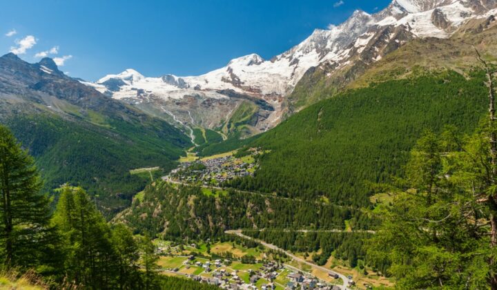
    • Your Tour de Monte Rosa self-guided hiking tour starts in the charming village of Saas Grund in Switzerland, just next to the well-known ski resort of Saas Fee. Settle into your accommodation, have dinner, and get some rest—tomorrow the hiking begins!

      Meals: Dinner
      Accommodation: Hotel, luggage access

      Panoramic views of Saas Grund, surrounded by the Swiss Alps.
    • Take a short bus ride to Mattmark, where you’ll start your hiking off gently, following the side of Lake Mattmark. Warm up before coming to the first challenging col of the trip—Monte Moro, standing at 9,360 ft (2,853 m). Enjoy spectacular views of the Weissmies (13,200 ft / 4,023 m) and the Rimpfischhorn (13,773 ft / 4,198 m) peaks. Upon arrival at the pass, you’ll be greeted by Monte Rosa itself! You then have a steep descent up the boulder fields, until you arrive at the village of Macugnaga. This is where you’ll stay the night.

      Meals: Breakfast and dinner
      Accommodation: Hotel, no luggage access
      Hiking: 6-7 hours
      Distance: 15 km / 9 miles
      Elevation: +750 m (2,460 ft) / -1,600 m (5,250 ft)

      The Italian town of Macugnaga with a stone bell tower and a loft peak in the distance.
    • Today is one of the longest climbs of the tour, but the rewards are immense. Follow the torrent of Anya towards the lake at Quarazza. Afterwards, climb steadily through spruce forests to Alpe Plana, with views of impressive waterfalls behind you. By passing over the Colle del Turlo, you’ll enjoy views of the dome of the Weissmies. From here, begin a long and steady descent to your overnight stop at Rifugio Pastore.

      Meals: Breakfast and dinner
      Accommodation: Rifugio Pastore, no luggage access
      Hiking: 8 hours
      Distance: 23 km / 14 miles
      Elevation: +1,510 m (4,955 ft) / -1,300 m (4,265 ft)

      Rifugio Pastore
    • Starting from the refuge, climb to the Vallon delle Pisse. Today’s route follows the waterfall underneath the glacier of the Piramide Vincent, one of the smaller peaks of the Monte Rosa Massif. After passing the cable car station at Alpe la Balma, you’ll take on a steep and rugged trail over the Bocchetta delle Pisse, followed by a descent to Alpe Pianlunga. Once you’ve managed to ascend another winding trail through the Valle d’Olen, go back down to your next refuge at Lake Gabiet, your accommodation for the night.

      Meals: Breakfast and dinner
      Accommodation: Rifugio Gabiet, no luggage access
      Hiking: 7-8 hours
      Distance: 15 km (9 miles)
      Elevation: +1,800 m (5,905 ft) / -650 m (2,135 ft)

      Remote high-mountain rifugio Gabiet in the Italian Alps, surrounded by peaks and grasslands.
    • Your hiking today starts off gently. Cross the Colle d’Olen, and then descend through the larch forests to the Rifugio del Lys. A lovely trail through forests and meadows brings you into Gressoney Stafal. Then you’ll head up to Alpe Sitten and walk a good path to your only pass of the day: Colle di Bettaforca. Following a more challenging section, take an easy trail down to the charming hamlet of Resy, spending the night high above the Ayas Valley.

      Meals: Breakfast and dinner
      Accommodation: Rifugio, no luggage access
      Hiking: 6-7 hours
      Distance: 16 km (10 miles)
      Elevation: +970 m (3,180 ft) / -1,200 m (3,935 ft)

      Alpine hamlet of Resy, scenicly located near lofty peaks, one of the stops during the Tour de Monte Rosa Trek.
    • Begin your day with a short descent towards the meadows of Alpe Varda and Alpe Mase—it’s one of the trail’s highlights. Climb steadily to the Colle Superieur delle Cime Blanche (2,982 m / 9,783 ft), with the Breithorn above us. From this vantage point, enjoy your first unforgettable views of the world-famous Matterhorn (14,692 ft / 4,478 m). After descending through glacial moraine, tackle a steep final climb to the highest point of the trip, and your base for the night—refuge at Colle del Teodulo (10,883 ft / 3,317 m).

      Meals: Breakfast and dinner
      Accommodation: Rifugio at Colle del Teodulo, no luggage access
      Hiking: 7-8 hours
      Distance: 18 km (11 miles)
      Elevation: +1,550 m (5,085 ft) / -300 m (985 ft)

      Hiking in the Swiss Alps with views of Matterhorn.
    • Today an IFMGA-qualified guide will meet you, as you’ll have to descend the Theodule glacier (yes, Theodule—you’re now back in the German-speaking area)! You’ll be roped up, but no other specialist equipment is needed other than your biking boots and poles. The angle of the glacier is relatively easy, and the views fantastic—Matterhorn dominates the skyline, though you can also see Alphubel, Dom, Obergabelhorn, Zinalrothorn, and Weisshorn, on both sides of the Mattertal. At Gandegg, leave the ice of the glacier behind, and traverse the glacier moraine all the way down to the world-famous mountaineering town of Zermatt.

      Meals: Breakfast and dinner
      Accommodation: Hotel, luggage access
      Hiking: 4-5 hours
      Distance: 16 km (10 miles)
      Elevation: +460 m (1,510 ft) / -2,070 m (6,970 ft)

      View of the Swiss resort town of Zermatt, one of the stops during the Tour of Monte Rosa, and the towering Matterhorn during summer.
    • Leaving Zermatt behind, follow the Mattertal towards the Rhone Valley, strolling through meadows and larch forests. After Täsch, enter the village of Randa, and start a steady climb on a steep zig-zag trail. Pass under the rugged peaks of the Täschorn and the Dom, before reaching your base for the night: Europahütte, a relatively new hut boasting views of the Weisshorn. The alternative route of getting from Zermartt to Europahütte is along Europaweg, arguably the most scenic two-day hiking trail in the Alps—featuring the longest pedestrian bridge in the world, 500 m (1,640 ft) long. The most suitable route for you to take will be decided upon booking, just as your personal self-guided itinerary is finalized with your guiding service.

      Meals: Breakfast and dinner
      Accommodation: Rifugio, no luggage access
      Hiking: 4-5 hours
      Distance: 16 km (10 miles)
      Elevation: +890 m (2,920 ft) / -300 m (985 ft)

      Beautiful Alpine scenery as seen during the Europaweg section of the Tour de Monte Rosa.
    • Today’s hike takes you across boulder fields, with rugged cliffs towering above, and the Breithorn and Matterhorn behind you. You will enjoy incredible views as you tackle the cables and bridges on this exciting trail. Leaving behind the Riedgletscher, descend steeply and drop down through the woods to your overnight stop at the village of Grächen.

      Meals: Breakfast and dinner
      Accommodation: Hotel, no luggage access
      Hiking: 6-7 hours
      Distance: 17 km (10.5 miles)
      Elevation: +600 m (1,970 ft) / -1,180 m (3,870 ft)

      Idyllic Swiss Alpine village of Grächen, surrounded by Alpine ridges and meadows.
    • On your final hiking day, take the Hohenweg path to Hannigalp, high above the Saastal. It’s a lovely trail, lower and greener than those covered in the previous days, but still with exposed sections that demand your full attention. Directly ahead are views of the snow-topped Weissmies and the Lagginhorn. Reaching Saas Grund marks the official end of your Tour de Monte Rosa self-guided hike! Get comfy in your hotel and take a well-deserved rest! Head to your final Monte Rosa dinner.

      Meals: Breakfast and dinner
      Accommodation: Hotel, luggage access
      Hiking: 7-8 hours
      Distance: 21 km (13 miles)
      Elevation: +1,220 m (4,000 ft) / -1,270 m (4,165 ft)

      Hiking path along the final section of the Tour de Monte Rosa, surrounded by lofty peaks.
    • Your self-guided tour comes to an end after a hearty breakfast. Head back home or continue touring this marvel of an area on your own!

      Meals: Breakfast

      Saas Grund, village in Switzerland
Saved to bucket list
Removed from bucket list

Choose a currency

  • USD - $
    US Dollar
  • EUR - €
    Euro
  • AUD - AU$
    Australian Dollar
  • CAD - CA$
    Canadian Dollar
  • GBP - £
    British Pound Sterling
  • CHF - CHF
    Swiss Franc
  • JPY - ¥
    Japanese Yen
  • SGD - S$
    Singapore Dollar
  • HKD - HK$
    Hong Kong Dollar
  • DKK - Dkr
    Danish Krone
  • NOK - Nkr
    Norwegian Krone
  • NZD - NZ$
    New Zealand Dollar