If you want 360º views of the North and South Rim and the fastest way to get to the canyon interior, check out the South Kaibab Trail to Cedar Ridge. This trail turbocharges you through much of the canyon’s geology in less than a mile. Painted layers of towering cliffs loom all around you. One of the finest trails in the park, the South Kaibab Trail is a wide, well-maintained, and signed path that leads from the rim all the way to the Colorado River. I like that it feels wilder than the Bright Angel Trail with fewer crowds.
A relatively short trail with rewarding views
This is a trail I like to start early (there’s even a free 4 am shuttle bus here during the summer). Bring one gallon of water per person and sun protection. Unlike the Bright Angel Trail, there are no drinking fountains here. Be sure to check temperature predictions for the day. Like all Grand Canyon hikes, the difficulty can be deceptive because the hardest climb happens at the end of your hike on the return.
Another warning: the trail is used by mules that resupply Phantom Ranch below. For your safety and that of the animals, yield to them. For the prepared hiker, the South Kaibab Trail can be the best part of your Grand Canyon trip and this is a great option for a guided day hike.

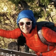
Starting at the South Kaibab Trailhead
The bus drops you off at the South Kaibab Trailhead, which has pit toilets, water, and picnic tables. The trail descends on red rock gravel here, reminiscent of hiking in Colorado. Wooden logs give the effect of “steps” as you descend.
This trail doesn’t mess around: you begin with tight switchbacks down through the youngest exposed rock layer in the park, the grey Kaibab Limestone. If you’re visiting in spring or late fall, check with a ranger for conditions. I’ve been here in late March and still found ice.
After half a mile, the trail levels out. Continue descending for another mile to the fittingly named Ooh-Ah point. Here, you’ll get your first panoramic view from the rim. You can see where the South Kaibab Trail continues below you as it curls around O’Neill Butte to the northwest.
I like how when you look across the North Rim, you can see so many terraces of different colors of rock layers. If you got a late start or are feeling this heat, this is a great turn-around point for a 1.8-mile round-trip (you’ve got about 1000 feet of climbing to get back to the top).

Continue on for the best views
I think the views get better and the crowds get thinner when you continue onto Cedar Ridge. The trail becomes exciting again with steeper switchbacks. If you’re concerned about heights or hiking with someone who is, don’t look to your left at the steep drop-off to Lime Creek. I recommend trekking poles for the descent.
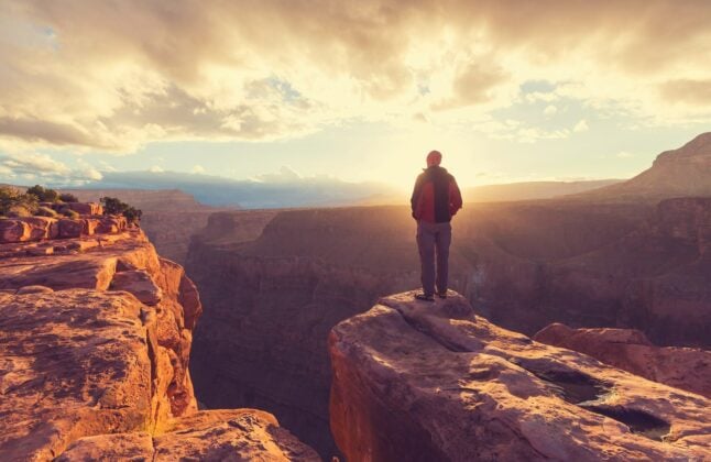
Cedar Ridge is a relatively flat area — which is why it has some of the best 360º views in the park. There are also a few cedar trees for moderate shade, plus a pit toilet. Can you see Brahma and Zoraster Temples? These rounded towers on the North Rim lie just east of where the South Kaibab Trail crosses the Colorado River.

I’ve heard Cedar Ridge referred to as a “humbling spot.” It gives you the kinds of views that make you realize how big the canyon really is, how much more of it there is to see, and how small we are as humans. It’s a place for contemplating the beauty and vastness of the natural world. Speaking of humbling, save plenty of time for the climb back to the rim. Expect it to take twice as long to ascend as it did to get down here.